Mount Elijah
At a glance
Mount Elijah is a summit in southern Oregon, lying within Oregon Caves National Monument and Preserve and the Wild Rivers Ranger District of the Rogue River-Siskiyou National Forests. The nearest town is Williams, about 10 miles away. Close by, the Sturgis Fork and Lake Mountain/Bigelow Lakes Trail hikes both start within a mile, and Elk Creek is just over a mile off. For an overnight stay, Grayback campground sits about 6 miles away, with Grayback Creek nearby for canoeing.
- summit
- 6,392 ft
- ways up
- 2
Where it is: Wild Rivers Ranger District · Oregon Caves National Monument and Preserve
Near: Grants Pass
Been here? Tell people how it was.
- Lake Mountain/Bigelow Lakes TrailModerateabout 1,761 ft of climbing3.1 mi round trip
- Lake MountainModerateabout 1,936 ft of climbing5.2 mi round trip
Compare the routes Lake Mountain/Bigelow Lakes Trail Lake Mountain Climbing About 1,761 ft About 1,936 ft Round trip 3.1 mi 5.2 mi Difficulty Moderate Moderate Terrain Hike Hike Season — Year-round Map © Mapbox © OpenStreetMap contributors  Preston PeakSummitPhoto: U.S. Forest Service- Pacific Northwest Region, Public domain (via Wikimedia Commons)~36 min drive
 Bear MountainSummitPhoto: Miguel Vieira from Walnut Creek, CA, USA, CC BY 2.0 (via Wikimedia Commons)~43 min drive
 Roxy Ann PeakSummitPhoto: ZabMilenko at English Wikipedia, CC BY-SA 3.0 (via Wikimedia Commons)~1h 1m drive
 Mount EmilySummitPhoto: Visitor7, CC BY-SA 3.0 (via Wikimedia Commons)~1h 9m drive
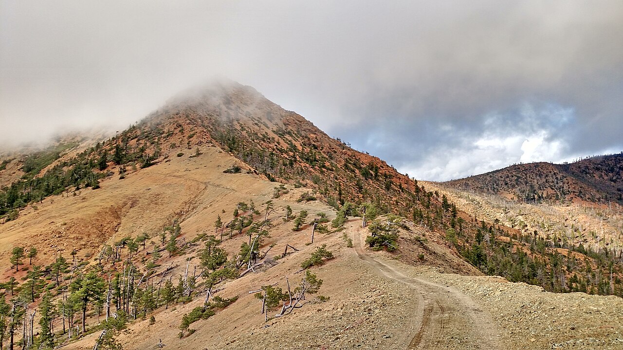 Pearsoll PeakSummitPhoto: Forest Service, Public domain (via Wikimedia Commons)~49 min drive
 Mount AshlandSummitPhoto: Alex Lockhart, Public domain (via Wikimedia Commons)~58 min drive
 Boccard PointSummitPhoto: Bureau of Land Management, Public domain (via Wikimedia Commons)~1h 18m drive
- Kerby PeakSummit~18 min drive
- Lower Devils PeakSummit~29 min drive
- Bolt MountainSummit~34 min drive
Conditions and forecast
Caution todayAgency alerts are in effect for this areaUSFS · checked 11 h agoDaily highs and lows, wind and the chance of precipitation at the summit and route start for the next 7 days, from the Open-Meteo model.
Questions about Mount Elijah
How tall is Mount Elijah?
6,392 ft (1,948 m).
How many routes go to the summit of Mount Elijah?
2: Lake Mountain/Bigelow Lakes Trail and Lake Mountain.
What is the shortest route up Mount Elijah?
Lake Mountain/Bigelow Lakes Trail, about 3.1 mi round trip.
When is the best time to climb Mount Elijah?
Year-round.

Ask about this place
Questions about Mount Elijah: conditions, access, timing. Answers say when something isn't known.
