Onion Creek Campground
Campground
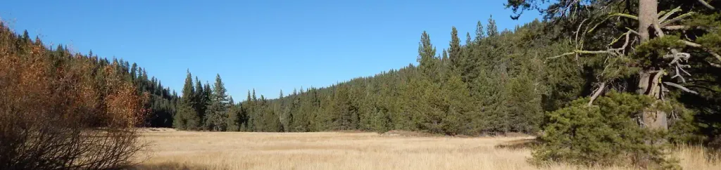
Campground · 3.7 mi from the trail
 Photo: Tim Berger, CC BY 2.0 (via Wikimedia Commons)
Alert in the area
The Forest Service lists an alert for Tahoe National Forest.
Camping and Campfire Restrictions-Truckee and Sierraville Districts
Agency alert covering Tahoe National Forest · Order 17-25-05 · USFS · Tahoe National Forest
As of · Source: USFS · Tahoe National Forest. Agencies don't list every closure — check before you go.
Anderson Peak is a summit of about 8,687 feet in Placer County, California, within the Truckee Ranger District of Tahoe National Forest. The nearest town is Soda Springs, about 6 miles away, and the Forest Service manages the surrounding land. Fire rules are worth checking before a visit. The Cold Stream and Coldstream Trail hikes both start about a mile away. The North Fork American River offers paddling within 4 miles, and Goose Meadow campground sits about 4.6 miles off.
Onion Creek Campground
Campground
Gold Coast Lodge
Restaurant
Watson Cabin
Museum
Places © OpenStreetMap contributors
More in Sunnyside-Tahoe CityDaily highs and lows, wind and the chance of precipitation at the summit and route start for the next 7 days, from the Open-Meteo model.
Elevation from USGS 3D Elevation Program terrain data (about 10 m resolution).
8,687 ft (2,648 m).
One: Pacific Crest National Scenic Trail #2000.

 Cold StreamHikingPhoto: Tim Berger, CC BY 2.0 (via Wikimedia Commons)1.1 miColdstream TrailHikingPhoto: Tim Berger, CC BY 2.0 (via Wikimedia Commons)1.1 mi
 North Fork American RiverCanoeingPhoto: Moiseiko, CC BY-SA 3.0 (via Wikimedia Commons)3.6 mi
 Goose MeadowsCampingPhoto: Recreation.gov (RIDB) / public domain4.7 mi
Source: Roamze catalog (indexable pages within 10 miles, PostGIS distance)
 Tinker KnobSummit · ~2 min drivePhoto: Tim Berger, CC BY 2.0 (via Wikimedia Commons)Donner PeakSummit · ~6 min drivePhoto: Ken Lund, CC BY-SA 2.0 (via Wikimedia Commons)
 Granite ChiefSummit · ~7 min drivePhoto: Tim Berger from Fair Oaks, CA, CC BY 2.0 (via Wikimedia Commons)
 Castle PeakSummit · ~14 min drivePhoto: MiguelVieira, CC BY 2.0 (via Wikimedia Commons)
 Rose Knob PeakSummit · ~31 min drivePhoto: Ken Lund, CC BY-SA 2.5 (via Wikimedia Commons)
 Relay PeakSummit · ~33 min drivePhoto: Mitch Barrie, CC BY-SA 2.0 (via Wikimedia Commons)
 McConnell PeakSummit · ~37 min drivePhoto: photo by Travis Higdon, Public domain (via Wikimedia Commons)
 Slide MountainSummit · ~38 min drivePhoto: Rick Cooper, CC BY 2.0 (via Wikimedia Commons)
 Maggies PeaksSummit · ~42 min drivePhoto: Phreakdigital (talk · contribs), Public domain (via Wikimedia Commons)
 Mount TallacSummit · ~46 min drivePhoto: Rabit 115 at English Wikipedia, Public domain (via Wikimedia Commons)
Also worth it near here
Cold StreamHiking · ~2 min drivePhoto: Tim Berger, CC BY 2.0 (via Wikimedia Commons)North Fork American RiverCanoeing · ~6 min drivePhoto: Moiseiko, CC BY-SA 3.0 (via Wikimedia Commons)