Mount Rose (nv)
Campground
Campground · 2.7 mi from the trail
 Photo: Mitch Barrie, CC BY-SA 2.0 (via Wikimedia Commons)
Closure in the area
There's a closure order in Humboldt-Toiyabe National Forest. It doesn't name Relay Peak, so check the source for the area it covers.
Elephant Fire Closure
Agency closure covering Humboldt-Toiyabe National Forest · Order 04-17-26-01-04 · USFS · Humboldt-Toiyabe National Forest
Floriston Fire Closure
Agency alert covering Carson Ranger District · Order 17-26-24 · USFS · Carson Ranger District
Power line construction along SR 88, Alpine County, California (Carson Ranger District)
Agency alert covering Carson Ranger District · USFS · Carson Ranger District
Over-Snow Vehicle Closure (Carson Ranger District)
Agency alert covering Carson Ranger District · Order 04-17-25-12 · USFS · Carson Ranger District
Area, Road, and Trail Closures (Spring Mountains National Recreation Area)
Agency alert covering Humboldt-Toiyabe National Forest · Order 04-17-25-04 · USFS · Humboldt-Toiyabe National Forest
As of · Source: USFS · Humboldt-Toiyabe National Forest. Agencies don't list every closure — check before you go.
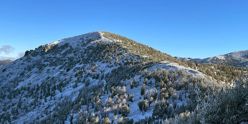
Relay Peak is a summit of about 10,323 feet in Washoe County, Nevada, on the Carson Ranger District of the Humboldt-Toiyabe National Forest. The Forest Service manages the land, and the nearest town is Incline Village, about 3.4 miles away. The Tahoe Rim Trail passes just 0.4 miles from the peak, and the TRT Tahoe Meadows to Spooner Summit route and Mt Houghton are each about a mile away. For an overnight base, Mt. Rose Campground sits roughly 2.7 miles off.
Mount Rose (nv)
Campground
Fox Cultural Hall
Museum
Places © OpenStreetMap contributors, Places © Overture Maps Foundation
More in Sunnyside-Tahoe CityDaily highs and lows, wind and the chance of precipitation at the summit and route start for the next 7 days, from the Open-Meteo model.
Elevation from USGS 3D Elevation Program terrain data (about 10 m resolution).
| Tahoe Rim Trail | Tahoe Rim Trail | |
|---|---|---|
| Starts at | TAHOE MEADOWS TRT TRAILHEAD | — |
| Climbing | About 1,504 ft | About 2,313 ft |
| Round trip | 8.6 mi | 20.2 mi |
| Difficulty | Hard | Hard |
| Terrain | Hike | Hike |
| Season | — | Year-round |
10,323 ft (3,146 m).
2: Tahoe Rim Trail and Tahoe Rim Trail.
Tahoe Rim Trail, about 8.6 mi round trip.
Tahoe Rim Trail starts at TAHOE MEADOWS TRT TRAILHEAD (about 8,884 ft).
Year-round.

 Mt HoughtonHikingPhoto: Mitch Barrie — Wikimedia Commons (CC BY-SA 4.0)1 mi
Source: Roamze catalog (indexable pages within 10 miles, PostGIS distance)
 Rose Knob PeakSummit · ~3 min drivePhoto: Ken Lund, CC BY-SA 2.5 (via Wikimedia Commons)
 Slide MountainSummit · ~6 min drivePhoto: Rick Cooper, CC BY 2.0 (via Wikimedia Commons)
 Tinker KnobSummit · ~32 min drivePhoto: Tim Berger, CC BY 2.0 (via Wikimedia Commons)
 Peavine PeakSummit · ~32 min drivePhoto: Ken Lund from Reno, Nevada, USA, CC BY-SA 2.0 (via Wikimedia Commons)
 Anderson PeakSummit · ~33 min drivePhoto: Tim Berger, CC BY 2.0 (via Wikimedia Commons)
 Donner PeakSummit · ~34 min drivePhoto: Ken Lund, CC BY-SA 2.0 (via Wikimedia Commons)
 Granite ChiefSummit · ~34 min drivePhoto: Tim Berger from Fair Oaks, CA, CC BY 2.0 (via Wikimedia Commons)
 Castle PeakSummit · ~38 min drivePhoto: MiguelVieira, CC BY 2.0 (via Wikimedia Commons)
 Maggies PeaksSummit · ~48 min drivePhoto: Phreakdigital (talk · contribs), Public domain (via Wikimedia Commons)
 Mount TallacSummit · ~50 min drivePhoto: Rabit 115 at English Wikipedia, Public domain (via Wikimedia Commons)

