Mount Rose (nv)
Campground
Campground · 0.6 mi from the trail
Closure in the area
There's a closure order in Humboldt-Toiyabe National Forest. It doesn't name Tamarack Lake Trail, so check the source for the area it covers.
Elephant Fire Closure
Agency closure covering Humboldt-Toiyabe National Forest · Order 04-17-26-01-04 · USFS · Humboldt-Toiyabe National Forest
Floriston Fire Closure
Agency alert covering Carson Ranger District · Order 17-26-24 · USFS · Carson Ranger District
Power line construction along SR 88, Alpine County, California (Carson Ranger District)
Agency alert covering Carson Ranger District · USFS · Carson Ranger District
Over-Snow Vehicle Closure (Carson Ranger District)
Agency alert covering Carson Ranger District · Order 04-17-25-12 · USFS · Carson Ranger District
Area, Road, and Trail Closures (Spring Mountains National Recreation Area)
Agency alert covering Humboldt-Toiyabe National Forest · Order 04-17-25-04 · USFS · Humboldt-Toiyabe National Forest
As of · Source: USFS · Humboldt-Toiyabe National Forest. Agencies don't list every closure — check before you go.
Tamarack Lake Trail is a short, easy mountain biking route in the Carson Ranger District of the Humboldt-Toiyabe National Forest in Nevada, managed by the Forest Service. The trail is about 1.4 miles long and covers roughly 2.8 miles round trip, with a one-way elevation gain of 175 feet. The climb starts at about 8,916 feet and reaches a high point of 9,073 feet, and the steepest section comes early on, around 0.16 miles from the start, with a grade of about 16%. The trail sits close to several other destinations. The Tahoe Rim Trail passes about 0.4 miles away, and the Tahoe Meadows Interpretive Trail is about half a mile off. Mt. Rose Campground is about 0.6 miles away, and the Upper Meadow Loop lies about a mile away.
Mount Rose (nv)
Campground
Fox Cultural Hall
Museum
Places © OpenStreetMap contributors, Places © Overture Maps Foundation
More in Sunnyside-Tahoe CityNot on Roamze yet. Their page has how to reach them.
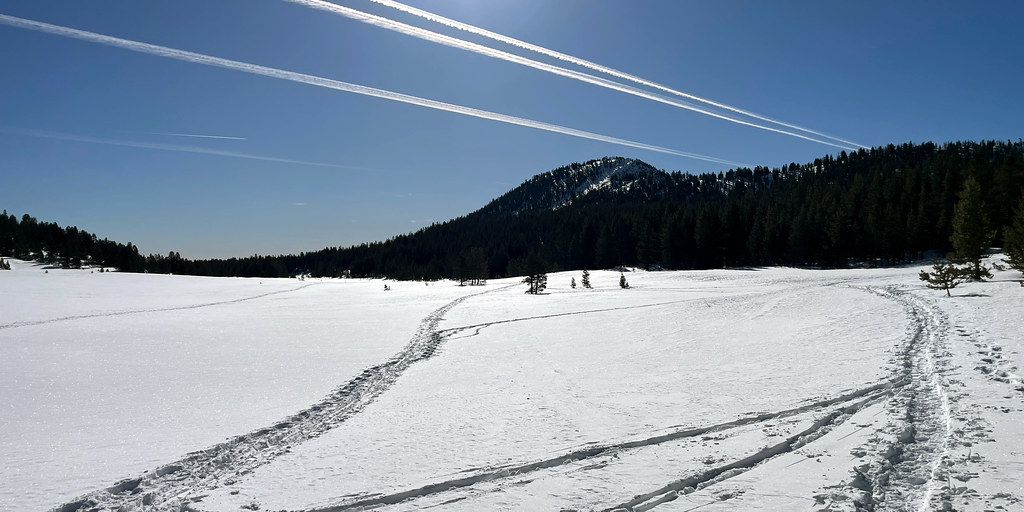 Tahoe Meadows Interpretive TraHikingPhoto: simonov, CC BY-SA 2.0 (via Flickr)0.5 miUpper Meadow LoopHikingPhoto: simonov, CC BY-SA 2.0 (via Flickr)1 mi
Source: Roamze catalog (indexable pages within 10 miles, PostGIS distance)
 Tahoe Meadows Interpretive TraMountain biking · ~1 min drivePhoto: Famartin, CC BY-SA 4.0 (via Wikimedia Commons)
 Tahoe Rim TrailMountain biking · ~10 min drivePhoto: AT2663, CC BY-SA 3.0 (via Wikimedia Commons)Tahoe Rim TrailMountain biking · ~10 min drivePhoto: AT2663, CC BY-SA 3.0 (via Wikimedia Commons)Tahoe Rim TrailMountain biking · ~10 min drivePhoto: AT2663, CC BY-SA 3.0 (via Wikimedia Commons)Lower Meadow LoopMountain biking · ~2 min drivePhoto: Famartin, CC BY-SA 4.0 (via Wikimedia Commons)Tahoe Rim TrailMountain biking · ~11 min drivePhoto: AT2663, CC BY-SA 3.0 (via Wikimedia Commons)
 Ophir CreekMountain biking · ~4 min drivePhoto: Ken Lund from Reno, Nevada, USA, CC BY-SA 2.0 (via Wikimedia Commons)Tahoe Rim TrailMountain biking · ~11 min drivePhoto: AT2663, CC BY-SA 3.0 (via Wikimedia Commons)
Map and trail data © OpenStreetMap contributors


