Mt. Rose Campground
Campground
Campground · 0.6 mi from the trail
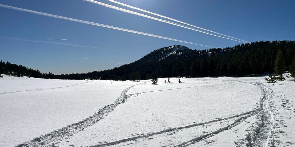 Photo: simonov, CC BY-SA 2.0 (via Flickr)
Closure in the area
There's a closure order in Humboldt-Toiyabe National Forest. It doesn't name Tahoe Meadows Interpretive Tra, so check the source for the area it covers.
Elephant Fire Closure
Agency closure covering Humboldt-Toiyabe National Forest · Order 04-17-26-01-04 · USFS · Humboldt-Toiyabe National Forest
Floriston Fire Closure
Agency alert covering Carson Ranger District · Order 17-26-24 · USFS · Carson Ranger District
Power line construction along SR 88, Alpine County, California (Carson Ranger District)
Agency alert covering Carson Ranger District · USFS · Carson Ranger District
Over-Snow Vehicle Closure (Carson Ranger District)
Agency alert covering Carson Ranger District · Order 04-17-25-12 · USFS · Carson Ranger District
Area, Road, and Trail Closures (Spring Mountains National Recreation Area)
Agency alert covering Humboldt-Toiyabe National Forest · Order 04-17-25-04 · USFS · Humboldt-Toiyabe National Forest
As of · Source: USFS · Humboldt-Toiyabe National Forest. Agencies don't list every closure — check before you go.
The Tahoe Meadows Interpretive Trail is an easy, out-and-back hike of about 2.3 miles in Nevada's Carson Ranger District of the Humboldt-Toiyabe National Forest. The trail rises about 60 feet from a low point of 8,675 feet to a high of 8,730 feet, so it's a short, low-elevation outing that pairs well with time on the surrounding trails. The route is on natural surface and is open to bikes, which makes it a practical choice for riders as well as hikers. The trailhead is called Tahoe Meadows Trt Trailhead, and the trail is open from June 1 to October 15. The Tahoe Rim Trail passes just 0.2 miles away, and the Tamarack Lake Trail and Upper Meadow Loop mountain biking routes sit within about half a mile. Mt. Rose Campground is also about 0.6 miles off, so it's easy to make an overnight of the trip.
Mt. Rose Campground
Campground
Fox Cultural Hall
Museum
Places © OpenStreetMap contributors, Places © Overture Maps Foundation
More in Sunnyside-Tahoe CityNot on Roamze yet. Their page has how to reach them.
Source: Roamze catalog (indexable pages within 10 miles, PostGIS distance)
Upper Meadow LoopHiking · ~1 min drivePhoto: simonov, CC BY-SA 2.0 (via Flickr) Gray Lake Trail (Mt. Rose)Hiking · ~2 min drivePhoto: simonov, CC BY-SA 2.0 (via Flickr)
 Incline Flume TrailHiking · ~4 min drivePhoto: Ken Lund from Reno, Nevada, USA, CC BY-SA 2.0 (via Wikimedia Commons)
 Tamarack Lake TrailHiking · ~1 min drivePhoto: simonov — CC BY-SA 2.0 (via Flickr)Tahoe Rim Trail ConnectorHiking · ~1 min drivePhoto: simonov, CC BY-SA 2.0 (via Flickr)
 Tyrolian DownhillHiking · ~3 min drivePhoto: simonov, CC BY-SA 2.0 (via Flickr)
 JonesHiking · ~7 min drivePhoto: simonov, CC BY-SA 2.0 (via Flickr)
 Lower Meadow LoopHiking · ~1 min drivePhoto: Ken Lund from Reno, Nevada, USA, CC BY-SA 2.0 (via Wikimedia Commons)
 Allison RidgeHiking · ~5 min drivePhoto: inkknife_2000 (7.5 million views +), CC BY-SA 2.0 (via Wikimedia Commons)
Also worth it near here
 Tahoe Meadows Interpretive TraMountain biking · Next doorPhoto: Famartin, CC BY-SA 4.0 (via Wikimedia Commons)
 Slide MountainSummit · ~2 min drivePhoto: Rick Cooper, CC BY 2.0 (via Wikimedia Commons)
 Mount Rose Ski TahoeDownhill skiing · ~3 min drivePhoto: Beesmill, CC BY-SA 4.0 (via Wikimedia Commons)
