South Trail Creek
At a glance
South Trail Creek is an easy hike of about 2.2 miles in the Sulphur Ranger District of the Arapaho and Roosevelt National Forests in Colorado, managed by the Forest Service. The trail is an out-and-back with a one-way climb of about 296 feet, from a low point of roughly 8,913 feet to a high of about 9,205 feet. Summer is the most comfortable time to go. Typical averages from a nearby weather station at about 9,000 feet show July highs around 73°F with lows near 40°F, while winter highs stay in the low 30s. The trail is on natural surface and allows both horses and bikes. Trail Creek, a mountain biking route, lies about 0.3 miles away. KAUFFMAN CREEK and Bill Miller are hikes within about 2 miles. Denver Creek Campground is about 2.2 miles off.
- round trip
- 2.2 mi
- climb
- 296 ft
- high point
- 9,205 ft
- route
- Out and back
- best months
- Late May–late Sep
Where it is: Sulphur Ranger District · Arapaho and Roosevelt National Forests
Near: Estes Park
Best weeks to go
Late May to late September is usually best for hiking here.
Typical highs of 61–73°F and lows of 30°F or warmer in those weeks.
Typical weather: NOAA 1991–2020 normals at Gould 4se Sfsp, CO, 16 mi away. Not a forecast.
Typical weather by monthBest time to visit South Trail Creek
Best months: June–September. Best months are the ones mostly made of the best weeks for hiking: typical temperatures in its comfortable range, few snowy days and not usually wet, judged with the same limits as our good-day forecasts.
Jan
29°
3°
11 wet
Feb
30°
5°
11 wet
Mar
38°
12°
10 wet
Apr
45°
20°
10 wet
May
55°
27°
9 wet
Jun
67°
33°
8 wet
Jul
73°
40°
10 wet
Aug
72°
38°
11 wet
Sep
64°
31°
9 wet
Oct
51°
22°
8 wet
Nov
38°
12°
10 wet
Dec
30°
4°
12 wet
Typical high / low (°F) and days with rain or snow, 1991–2020. Measured at Gould 4se Sfsp, CO, 16.4 mi away at 9,000 ft. This station doesn't record snowfall. Source: NOAA NCEI U.S. Climate Normals 1991–2020.
Been here? Tell people how it was.
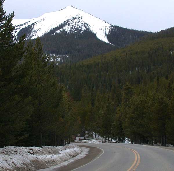
 Trail CreekMountain bikingPhoto: cogdogblog, CC BY 2.0 (via Wikimedia Commons)0.3 mi
- KAUFFMAN CREEKHiking1.5 mi
- Bill MillerHiking1.9 mi
- Buffalo CreekHiking1.9 mi
- Denver Creek CampgroundCamping2.2 mi
- Sawmill Gulch CampgroundCamping4.4 mi
 Willow CreekCanoeingPhoto: Jeffrey Beall, CC BY 4.0 (via Wikimedia Commons)5 mi
- East Fork Troublesome CreekCanoeing6.3 mi
 ParkviewHikingPhoto: cogdogblog, CC BY 2.0 (via Wikimedia Commons)~8 min drive
- Elk MountainHiking~10 min drive
- Elk MountainHiking~4 min drive
- LITTLE GRAVEL MOUNTAIN SPURHiking~4 min drive
- Willow Pass TrailHikingPhoto: cogdogblog, CC BY 2.0 (via Wikimedia Commons)~8 min drive
- PARKVIEW CREEKHikingPhoto: cogdogblog, CC BY 2.0 (via Wikimedia Commons)~9 min drive
- Paradise CreekHiking~7 min drive
- KAUFFMAN CREEKHiking~3 min drive
 Beaver Line TrailHikingPhoto: Maria Vorontsova, Public Domain Dedication (CC0) (via Flickr)~15 min drive
- Trail CreekHiking~1 min drive
Conditions and forecast
Caution todayAgency alerts are in effect for this areaUSFS · checked 12 min agoDaily highs and lows, wind and the chance of precipitation at Start for the next 7 days, from the Open-Meteo model.
Ask about this place
Questions about South Trail Creek: conditions, access, timing. Answers say when something isn't known.
Local outfitters
- Rancho Del Rio38 mi away
- Camp Always Choose Adventures43 mi away
Not on Roamze yet. Their page has how to reach them.
