Trail Creek
- 7.4 mi
- round trip
- 775 ft
- climb
- 9,325 ft
- high point
- Out and back
- route
- Jun, Sep
- best months
Is Trail Creek open right now?
Alert in the area
The Forest Service lists 3 alerts for Arapaho and Roosevelt National Forests.
Fire Restrictions
Agency alert covering Arapaho and Roosevelt National Forests · USFS · Arapaho and Roosevelt National Forests
Fire Restrictions
Agency alert covering Sulphur Ranger District · USFS · Sulphur Ranger District
Permanent Recreational Shooting Order
Agency alert covering Sulphur Ranger District · Order 02-10-00-25-02 · USFS · Sulphur Ranger District
As of · Source: USFS · Arapaho and Roosevelt National Forests. Agencies don't list every closure — check before you go.
Trail Creek is a 7.6-mile out-and-back trail located in Colorado near Colorado, managed by the Arapaho-Roosevelt National Forest, Clear Creek Ranger District. This moderate-distance hike offers a classic out-and-back route suitable for hikers seeking a half-day adventure in the national forest. The trail follows Trail Creek through the managed lands of the Clear Creek Ranger District, providing access to the creek environment and surrounding forest terrain. The out-and-back format means hikers can turn around at any point, making the experience flexible for different fitness levels and time constraints. The Arapaho-Roosevelt National Forest encompasses diverse landscapes across north-central Colorado, and Trail Creek represents one of many recreational opportunities within the Clear Creek drainage area. This section of the forest is accessible to visitors seeking creek-side hiking without significant technical challenges. Before heading out, contact the Clear Creek Ranger District for current trail conditions and any seasonal closures. The national forest manages this area for both recreation and resource conservation, so please follow Leave No Trace principles and all posted regulations.
Local outfitters
- Rancho Del Rio38 mi away
- Camp Always Choose Adventures43 mi away
Not on Roamze yet. Their page has how to reach them.
- South Trail CreekHiking0.8 mi
- KAUFFMAN CREEKHiking0.9 mi
- LITTLE GRAVEL MOUNTAIN SPURHiking1.7 mi
- Denver Creek CampgroundCamping1.9 mi
- Buffalo CreekHiking2.2 mi
- Sawmill Gulch CampgroundCamping4 mi
 Willow CreekCanoeingPhoto: Jeffrey Beall, CC BY 4.0 (via Wikimedia Commons)4.3 mi
- East Fork Troublesome CreekCanoeing7 mi
Source: Roamze catalog (indexable pages within 10 miles, PostGIS distance)
 ParkviewHiking · ~8 min drivePhoto: cogdogblog, CC BY 2.0 (via Wikimedia Commons)
- PARKVIEW CREEKHiking · ~9 min drivePhoto: cogdogblog, CC BY 2.0 (via Wikimedia Commons)
 Pony Park TrailHiking · ~14 min drivePhoto: Thomas — CC BY-SA 2.0 (via Flickr)
- LITTLE GRAVEL MOUNTAIN SPURHiking · ~3 min drive
- Willow Pass TrailHiking · ~8 min drivePhoto: cogdogblog, CC BY 2.0 (via Wikimedia Commons)
- Elk MountainHiking · ~11 min drive
- Elk MountainHiking · ~5 min drive
- KAUFFMAN CREEKHiking · ~2 min drive
- Gilsonite TrailHiking · ~11 min drivePhoto: Thomas — CC BY-SA 2.0 (via Flickr)
- Buffalo CreekHiking · ~4 min drive
Also worth it near here
 Trail CreekMountain biking · ~2 min drivePhoto: cogdogblog, CC BY 2.0 (via Wikimedia Commons)
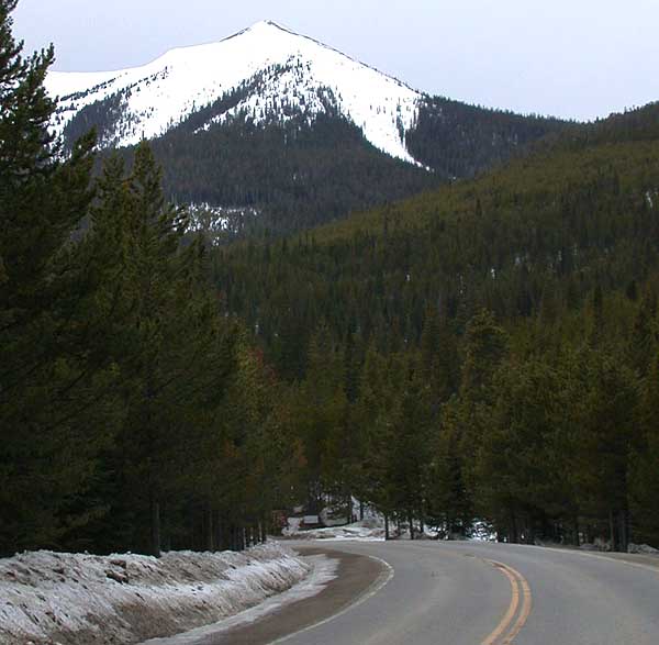 Parkview MountainSummit · ~7 min drivePhoto: Matthew Trump, CC BY-SA 3.0 (via Wikimedia Commons)
- Willow CreekCanoeing · ~7 min drivePhoto: Jeffrey Beall, CC BY 4.0 (via Wikimedia Commons)
 River Run LoopCross-country skiing · ~20 min drivePhoto: Don Graham from Redlands, CA, USA - God bless it!, CC BY-SA 2.0 (via Wikimedia Commons)
Best time to visit Trail Creek
Best months: June and September. Best months have typical highs of 55–85 °F, lows of 30 °F or warmer (32 °F where the station doesn't record snow), at most one snowy day and no more than 12 wet days.
Jan
30° / 4°
14 wet · 14 snow
Feb
34° / 6°
13 wet · 12 snow
Mar
42° / 14°
12 wet · 9 snow
Apr
49° / 20°
11 wet · 6 snow
May
59° / 28°
12 wet · 2 snow
Jun
71° / 34°
11 wet
Jul
76° / 40°
14 wet
Aug
73° / 38°
15 wet
Sep
68° / 32°
12 wet · 1 snow
Oct
55° / 23°
10 wet · 4 snow
Nov
40° / 13°
11 wet · 9 snow
Dec
30° / 5°
14 wet · 13 snow
Typical high / low (°F) and days with rain or snow, 1991–2020. Measured at Grand Lake 1 Nw, CO, 13.4 mi away at 8,720 ft. The station sits about 600 ft lower than this place, so expect it a little cooler here. Source: NOAA NCEI U.S. Climate Normals 1991–2020.
