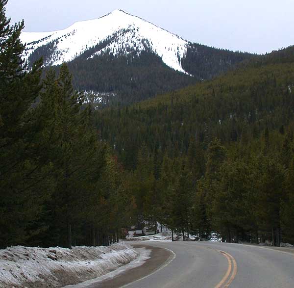
Little Gravel Mountain Spur
- 11.9 mi
- round trip
- 3,568 ft
- climb
- 10,840 ft
- high point
- Out and back
- route
Caution today
Agency alerts are in effect for this area; weather is good · USFS, OpenWeather · checked 7 h ago
Is LITTLE GRAVEL MOUNTAIN SPUR open right now?
Alert in the area
The Forest Service lists 3 alerts for Arapaho and Roosevelt National Forests.
Fire Restrictions
Agency alert covering Arapaho and Roosevelt National Forests · USFS · Arapaho and Roosevelt National Forests
Fire Restrictions
Agency alert covering Sulphur Ranger District · USFS · Sulphur Ranger District
Permanent Recreational Shooting Order
Agency alert covering Sulphur Ranger District · Order 02-10-00-25-02 · USFS · Sulphur Ranger District
As of · Source: USFS · Arapaho and Roosevelt National Forests. Agencies don't list every closure — check before you go.
Little Gravel Mountain Spur is an out-and-back hike in the Sulphur Ranger District of the Arapaho and Roosevelt National Forests in Colorado, managed by the Forest Service. The route is about 24 miles long, with a total elevation gain of 3,568 feet, and it is rated expert. The high point is 10,840 feet, and the climb is rolling, with the steepest stretch at about 9.4 miles in, where the grade reaches 16%. The trip starts at roughly 9,180 feet and ends at about 9,093 feet, so the total gain and loss are each about 3,568 feet. The estimated time is about 9.5 hours. Kauffman Creek is about 0.7 miles away, and Denver Creek Campground is about 0.8 miles away. Trail Creek and Buffalo Creek are both within about 2.2 miles.
Local outfitters
- Rancho Del Rio38 mi away
- Camp Always Choose Adventures41 mi away
Not on Roamze yet. Their page has how to reach them.
- KAUFFMAN CREEKHiking0.7 mi
- Denver Creek CampgroundCamping0.8 mi
- Trail CreekHiking1.7 mi
- Buffalo CreekHiking2.2 mi
- Sawmill Gulch CampgroundCamping2.4 mi
 Willow CreekCanoeingPhoto: Jeffrey Beall, CC BY 4.0 (via Wikimedia Commons)2.8 mi
- East Fork Troublesome CreekCanoeing7.3 mi
- Bull Mountain CampgroundCamping9.6 mi
Source: Roamze catalog (indexable pages within 10 miles, PostGIS distance)
- Elk MountainHiking · ~10 min drive
 Gilsonite TrailHiking · ~10 min drivePhoto: Thomas — CC BY-SA 2.0 (via Flickr)
- Pony Park TrailHiking · ~13 min drivePhoto: Thomas — CC BY-SA 2.0 (via Flickr)
- KAUFFMAN CREEKHiking · ~1 min drive
 PARKVIEW CREEKHiking · ~12 min drivePhoto: cogdogblog, CC BY 2.0 (via Wikimedia Commons)
- Willow Pass TrailHiking · ~11 min drivePhoto: cogdogblog, CC BY 2.0 (via Wikimedia Commons)
- Bill MillerHiking · ~4 min drive
- Trail CreekHiking · ~3 min drive
- ParkviewHiking · ~11 min drivePhoto: cogdogblog, CC BY 2.0 (via Wikimedia Commons)
- Elk MountainHiking · ~7 min drive