Beaver Line Trail
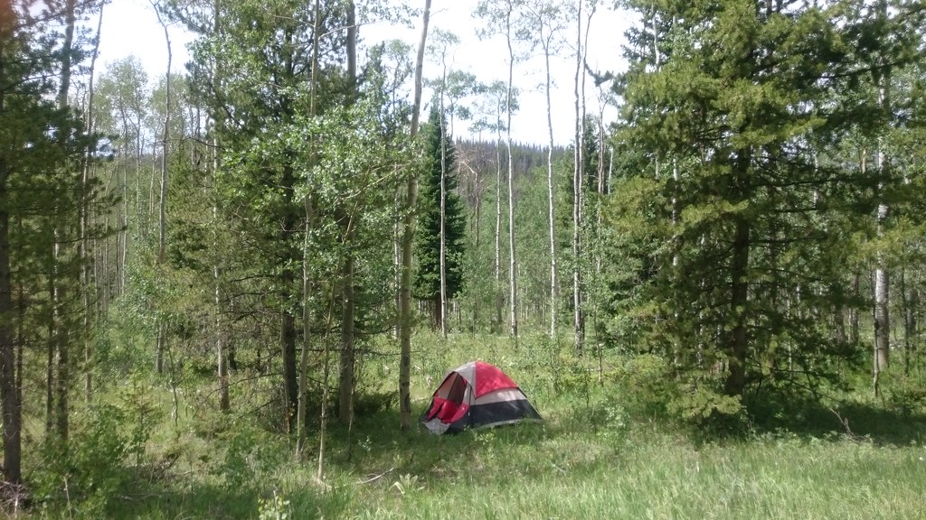
 Photo: Maria Vorontsova, Public Domain Dedication (CC0) (via Flickr)
- 2.5 mi
- distance
- 600 ft
- climb
- Easy
- difficulty
- Jun–Jul, Sep
- best months
Caution today
Agency alerts are in effect for this area; weather is good · USFS, OpenWeather · checked just now
Is Beaver Line Trail open right now?
Alert in the area
The Forest Service lists 3 alerts for Arapaho and Roosevelt National Forests.
Fire Restrictions
Agency alert covering Arapaho and Roosevelt National Forests · USFS · Arapaho and Roosevelt National Forests
Fire Restrictions
Agency alert covering Sulphur Ranger District · USFS · Sulphur Ranger District
Permanent Recreational Shooting Order
Agency alert covering Sulphur Ranger District · Order 02-10-00-25-02 · USFS · Sulphur Ranger District
As of · Source: USFS · Arapaho and Roosevelt National Forests. Agencies don't list every closure — check before you go.
The Beaver Line Trail is a 2.5-mile hike in the Sulphur Ranger District of the Arapaho and Roosevelt National Forests in Colorado, managed by the Forest Service. It is an easy route with a total elevation gain of about 600 feet, and it takes roughly an hour to complete. Summer is the most comfortable time to go. Typical averages from a nearby weather station at Grand Lake show July highs around 75°F with lows near 44°F, while winter highs stay in the 20s. The Trail Creek Spur Trail starts just 0.1 mile away, and Bull Mountain Campground is about 3 miles off. Stillwater Campground and the Colorado River, both within about 5 miles, round out the options for an overnight stay or a longer outing.
Local outfitters
- Camp Always Choose Adventures35 mi away
- Wildcat Mountaineering36 mi away
Not on Roamze yet. Their page has how to reach them.
 Trail Creek Spur TrailHikingPhoto: Maria Vorontsova, Public Domain Dedication (CC0) (via Flickr)0.1 mi
- TRAIL CREEK SPURHikingPhoto: Maria Vorontsova, Public Domain Dedication (CC0) (via Flickr)0.2 mi
- Bull Mountain CampgroundCamping3.2 mi
 Willow CreekCanoeingPhoto: Jeffrey Beall, CC BY 4.0 (via Wikimedia Commons)3.9 mi
- Stillwater CampgroundCamping4.7 mi
- Colorado RiverCanoeing6.6 mi
- Grand LakeRock climbing7.4 mi
- Windy GapRock climbing8.2 mi
Source: Roamze catalog (indexable pages within 10 miles, PostGIS distance)
- TRAIL CREEK SPURHiking · Next doorPhoto: Maria Vorontsova, Public Domain Dedication (CC0) (via Flickr)
 Blizzard Pass TrailHiking · ~6 min drivePhoto: Thomas — CC BY-SA 2.0 (via Flickr)
- Blue RidgeHiking · ~9 min drive
- LITTLE GRAVEL MOUNTAIN SPURHiking · ~11 min drive
- Bull Mountain TrailHiking · ~2 min drivePhoto: Thomas — CC BY-SA 2.0 (via Flickr)
- Pony Park TrailHiking · ~9 min drivePhoto: Thomas — CC BY-SA 2.0 (via Flickr)
- NORTH SUPPLY LOOPHiking · ~9 min drive
- Spruce ‘Em Up Jack TrailHiking · ~3 min drivePhoto: Maria Vorontsova, Public Domain Dedication (CC0) (via Flickr)
- Shadow Mountain Lookout trailHiking · ~11 min drivePhoto: Thomas — CC BY-SA 2.0 (via Flickr)
- Little Gravel Mountain Spur TrailHiking · ~7 min drive
Also worth it near here
 Stillwater PassMountain biking · ~6 min drivePhoto: inkknife_2000 (7.5 million views +), CC BY-SA 2.0 (via Wikimedia Commons)
- Willow CreekCanoeing · ~7 min drivePhoto: Jeffrey Beall, CC BY 4.0 (via Wikimedia Commons)
 River Run LoopCross-country skiing · ~8 min drivePhoto: Don Graham from Redlands, CA, USA - God bless it!, CC BY-SA 2.0 (via Wikimedia Commons)
- Stillwater Boating SiteBoat launch · ~8 min drive
Best time to visit Beaver Line Trail
Best months: June–July and September. Best months have typical highs of 55–85 °F, lows of 30 °F or warmer (32 °F where the station doesn't record snow), at most one snowy day and no more than 12 wet days.
Jan
26° / 3°
11 wet
Feb
30° / 4°
10 wet
Mar
40° / 13°
9 wet
Apr
48° / 23°
10 wet
May
59° / 31°
11 wet
Jun
70° / 38°
10 wet
Jul
75° / 44°
12 wet
Aug
73° / 43°
13 wet
Sep
67° / 36°
10 wet
Oct
55° / 27°
8 wet
Nov
40° / 18°
8 wet
Dec
28° / 8°
10 wet
Typical high / low (°F) and days with rain or snow, 1991–2020. Measured at Grand Lake 6 Ssw, CO, 5.3 mi away at 8,288 ft. We don't have this place's elevation, so higher spots nearby can run cooler. This station doesn't record snowfall. Source: NOAA NCEI U.S. Climate Normals 1991–2020.
Map and trail data © OpenStreetMap contributors
