Kauffman Creek
- 10.5 mi
- round trip
- 3,438 ft
- climb
- 10,162 ft
- high point
- Out and back
- route
- Jun, Sep
- best months
Caution today
Agency alerts are in effect for this area; weather is good · USFS, OpenWeather · checked 1 h ago
Is KAUFFMAN CREEK open right now?
Alert in the area
The Forest Service lists 3 alerts for Arapaho and Roosevelt National Forests.
Fire Restrictions
Agency alert covering Arapaho and Roosevelt National Forests · USFS · Arapaho and Roosevelt National Forests
Fire Restrictions
Agency alert covering Sulphur Ranger District · USFS · Sulphur Ranger District
Permanent Recreational Shooting Order
Agency alert covering Sulphur Ranger District · Order 02-10-00-25-02 · USFS · Sulphur Ranger District
As of · Source: USFS · Arapaho and Roosevelt National Forests. Agencies don't list every closure — check before you go.
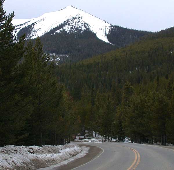
Kauffman Creek is a long, steep out-and-back hike in Colorado's Arapaho and Roosevelt National Forests, within the Sulphur Ranger District. The Forest Service manages the land, and the route is rated expert. It starts at 8,745 feet and climbs to 10,162 feet, with a total round-trip gain and loss of about 3,400 feet. The route is roughly 21 miles long and takes about nine hours to complete. The most comfortable stretch for a visit runs from June through September. Typical averages from a nearby weather station at Grand Lake, which sits well below the trail's high point, show July highs around 76°F and lows near 40°F. That station's figures are not adjusted for elevation, so temperatures on the trail run cooler. Denver Creek Campground lies about a mile away, and Sawmill Gulch Campground is about 3 miles off. Little Gravel Mountain Spur and Trail Creek are both under a mile from the trailhead.
Local outfitters
- Rancho Del Rio38 mi away
- Camp Always Choose Adventures42 mi away
Not on Roamze yet. Their page has how to reach them.
- LITTLE GRAVEL MOUNTAIN SPURHiking0.7 mi
- Trail CreekHiking0.9 mi
- Denver Creek CampgroundCamping1.1 mi
- South Trail CreekHiking1.5 mi
- Sawmill Gulch CampgroundCamping3.1 mi
 Willow CreekCanoeingPhoto: Jeffrey Beall, CC BY 4.0 (via Wikimedia Commons)3.4 mi
- East Fork Troublesome CreekCanoeing7.1 mi
- Colorado RiverCanoeing9.8 mi
Source: Roamze catalog (indexable pages within 10 miles, PostGIS distance)
 Willow Pass TrailHiking · ~10 min drivePhoto: cogdogblog, CC BY 2.0 (via Wikimedia Commons)
- Elk MountainHiking · ~10 min drive
 Pony Park TrailHiking · ~14 min drivePhoto: Thomas — CC BY-SA 2.0 (via Flickr)
- LITTLE GRAVEL MOUNTAIN SPURHiking · ~1 min drive
- ParkviewHiking · ~10 min drivePhoto: cogdogblog, CC BY 2.0 (via Wikimedia Commons)
- PARKVIEW CREEKHiking · ~11 min drivePhoto: cogdogblog, CC BY 2.0 (via Wikimedia Commons)
- Elk MountainHiking · ~6 min drive
- Gilsonite TrailHiking · ~10 min drivePhoto: Thomas — CC BY-SA 2.0 (via Flickr)
- Trail CreekHiking · ~2 min drive
- KAUFFMAN CREEK SPURHiking · ~7 min drive
Best time to visit KAUFFMAN CREEK
Best months: June and September. Best months have typical highs of 55–85 °F, lows of 30 °F or warmer (32 °F where the station doesn't record snow), at most one snowy day and no more than 12 wet days.
Jan
30° / 4°
14 wet · 14 snow
Feb
34° / 6°
13 wet · 12 snow
Mar
42° / 14°
12 wet · 9 snow
Apr
49° / 20°
11 wet · 6 snow
May
59° / 28°
12 wet · 2 snow
Jun
71° / 34°
11 wet
Jul
76° / 40°
14 wet
Aug
73° / 38°
15 wet
Sep
68° / 32°
12 wet · 1 snow
Oct
55° / 23°
10 wet · 4 snow
Nov
40° / 13°
11 wet · 9 snow
Dec
30° / 5°
14 wet · 13 snow
Typical high / low (°F) and days with rain or snow, 1991–2020. Measured at Grand Lake 1 Nw, CO, 12.9 mi away at 8,720 ft. The station sits about 1,400 ft lower than this place, so expect it a little cooler here. Source: NOAA NCEI U.S. Climate Normals 1991–2020.