Buffalo Creek
- 11.1 mi
- round trip
- 951 ft
- climb
- 9,819 ft
- high point
- Out and back
- route
- Jun, Sep
- best months
Is Buffalo Creek open right now?
Alert in the area
The Forest Service lists 3 alerts for Arapaho and Roosevelt National Forests.
Fire Restrictions
Agency alert covering Arapaho and Roosevelt National Forests · USFS · Arapaho and Roosevelt National Forests
Fire Restrictions
Agency alert covering Sulphur Ranger District · USFS · Sulphur Ranger District
Permanent Recreational Shooting Order
Agency alert covering Sulphur Ranger District · Order 02-10-00-25-02 · USFS · Sulphur Ranger District
As of · Source: USFS · Arapaho and Roosevelt National Forests. Agencies don't list every closure — check before you go.
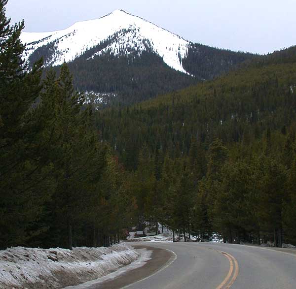
Buffalo Creek is an 11.12-mile out-and-back trail in Colorado managed by Arapaho and Roosevelt National Forests. The trail gains 951 feet of elevation over its round-trip distance, reaching a maximum elevation of 9,819 feet.
Local outfitters
- Rancho Del Rio36 mi away
- Camp Always Choose Adventures42 mi away
Not on Roamze yet. Their page has how to reach them.
- Bill MillerHiking0.1 mi
- Denver Creek CampgroundCamping1.6 mi
 South Trail CreekMountain bikingPhoto: cogdogblog, CC BY 2.0 (via Wikimedia Commons)1.8 mi
 Trail CreekMountain bikingPhoto: cogdogblog, CC BY 2.0 (via Wikimedia Commons)1.9 mi
- KAUFFMAN CREEKHiking2 mi
- Sawmill Gulch CampgroundCamping3.4 mi
 Willow CreekCanoeingPhoto: Jeffrey Beall, CC BY 4.0 (via Wikimedia Commons)4.7 mi
- East Fork Troublesome CreekCanoeing5.1 mi
Source: Roamze catalog (indexable pages within 10 miles, PostGIS distance)
- Elk MountainHiking · ~7 min drive
 ParkviewHiking · ~11 min drivePhoto: cogdogblog, CC BY 2.0 (via Wikimedia Commons)
- Elk MountainHiking · ~4 min drive
- LITTLE GRAVEL MOUNTAIN SPURHiking · ~4 min drive
- PARKVIEW CREEKHiking · ~12 min drivePhoto: cogdogblog, CC BY 2.0 (via Wikimedia Commons)
- Willow Pass TrailHiking · ~12 min drivePhoto: cogdogblog, CC BY 2.0 (via Wikimedia Commons)
- Paradise CreekHiking · ~5 min drive
- KAUFFMAN CREEKHiking · ~3 min drive
- Trail CreekHiking · ~4 min drive
 Gilsonite TrailHiking · ~14 min drivePhoto: Thomas — CC BY-SA 2.0 (via Flickr)
Best time to visit Buffalo Creek
Best months: June and September. Best months have typical highs of 55–85 °F, lows of 30 °F or warmer (32 °F where the station doesn't record snow), at most one snowy day and no more than 12 wet days.
Jan
30° / 4°
14 wet · 14 snow
Feb
34° / 6°
13 wet · 12 snow
Mar
42° / 14°
12 wet · 9 snow
Apr
49° / 20°
11 wet · 6 snow
May
59° / 28°
12 wet · 2 snow
Jun
71° / 34°
11 wet
Jul
76° / 40°
14 wet
Aug
73° / 38°
15 wet
Sep
68° / 32°
12 wet · 1 snow
Oct
55° / 23°
10 wet · 4 snow
Nov
40° / 13°
11 wet · 9 snow
Dec
30° / 5°
14 wet · 13 snow
Typical high / low (°F) and days with rain or snow, 1991–2020. Measured at Grand Lake 1 Nw, CO, 14.7 mi away at 8,720 ft. The station sits about 1,100 ft lower than this place, so expect it a little cooler here. Source: NOAA NCEI U.S. Climate Normals 1991–2020.