Elk Mountain
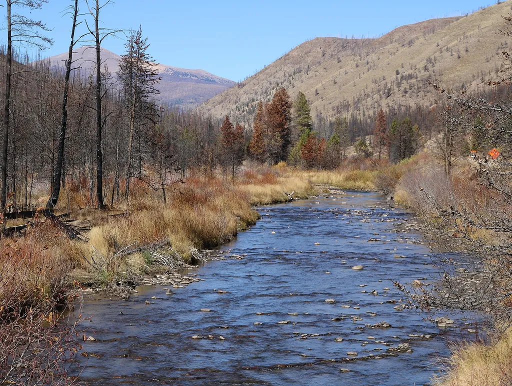 Photo: Jeffrey Beall — Wikimedia Commons (CC BY 4.0)
- 11.9 mi
- round trip
- 311 ft
- climb
- 10,757 ft
- high point
- Out and back
- route
Is Elk Mountain open right now?
Alert in the area
The Forest Service lists 3 alerts for Arapaho and Roosevelt National Forests.
Fire Restrictions
Agency alert covering Arapaho and Roosevelt National Forests · USFS · Arapaho and Roosevelt National Forests
Fire Restrictions
Agency alert covering Sulphur Ranger District · USFS · Sulphur Ranger District
Permanent Recreational Shooting Order
Agency alert covering Sulphur Ranger District · Order 02-10-00-25-02 · USFS · Sulphur Ranger District
As of · Source: USFS · Arapaho and Roosevelt National Forests. Agencies don't list every closure — check before you go.
Elk Mountain is an out-and-back hike on the Forest Service's Arapaho and Roosevelt National Forests, within the Sulphur Ranger District in Colorado. It is a hard hike of about 12 miles round trip, with a total climb of about 310 feet from the low point at 9,126 feet to the high at 10,757 feet. The trail is natural-surface, and horses and bikes are both allowed. The trail is a long, steady climb. Riders and equestrians will find the route open to them, and the natural surface makes it a straightforward ride or ride. The climb is one way, so plan on about 310 feet of elevation gain for the ascent, with the full trip covering twice that. Wheatley Creek Cut Off and Wheatley Creek lie within a few miles, and Drowsy Water is close by as well. For overnight stays, Sawmill Gulch Campground is about 4.9 miles away.
Local outfitters
- Rancho Del Rio33 mi away
- Camp Always Choose Adventures41 mi away
Not on Roamze yet. Their page has how to reach them.
Keep exploring — more trails worth the drive
 Photo: Maria Vorontsova, Public Domain Dedication (CC0) (via Flickr)
Beaver Line Trail
~17 min drive
2.51-mile trail in Colorado with 600 ft of elevation gain.
 Photo: cogdogblog, CC BY 2.0 (via Wikimedia Commons)
PARKVIEW CREEK
~19 min drive
14.4-mile out-and-back trail at 9,839 ft elevation in Colorado
HIKE
Drowsy Water
~5 min drive
4.78-mile out-and-back trail in Colorado managed by Arapaho and Roosevelt National Forests.
HIKE
LITTLE GRAVEL MOUNTAIN SPUR
~10 min drive
23.78-mile out-and-back trail in Colorado with 3,568 ft gain/loss.
 Photo: Maria Vorontsova, Public Domain Dedication (CC0) (via Flickr)
Trail Creek Spur Trail
~17 min drive
0.76-mile out-and-back trail in Colorado with 244 ft elevation gain
HIKE
Wheatley Creek
~5 min drive
13.72-mile out-and-back trail in Colorado's Medicine Bow-Routt National Forest with 743 ft elevation gain.
HIKE
Bill Miller
~7 min drive
3.69-mile out-and-back trail in Colorado with 524 ft elevation gain.
HIKE
KAUFFMAN CREEK
~10 min drive
21.08-mile out-and-back trail in Colorado with 3,438 ft elevation gain and loss.
Photo: Maria Vorontsova, Public Domain Dedication (CC0) (via Flickr)TRAIL CREEK SPUR
~18 min drive
1.26-mile out-and-back trail in Colorado with 491 ft gain/loss.
HIKE
Buffalo Creek
~7 min drive
11.12-mile out-and-back trail in Colorado with 951 ft elevation gain.
Also worth it near here


Route details
- Distance
- 11.9 mi round trip
- Climbing
- About 311 ft
- Starts at
- ELK MOUNTAIN (about 10,651 ft)
- Summit
- 10,746 ft
- Difficulty
- Hard
Getting there
Park at ELK MOUNTAIN.
Questions about this route
How long is the Elk Mountain on Searight Mountain?
About 11.9 mi round trip from ELK MOUNTAIN (about 10,651 ft).
How much elevation gain is on the Elk Mountain?
About 311 ft of climbing round trip.
How hard is the Elk Mountain?
It is rated hard.
Where does the Elk Mountain start?
ELK MOUNTAIN (about 10,651 ft).
Conditions and forecast on Searight Mountain
Daily highs and lows, wind and the chance of precipitation at the summit and route start for the next 7 days, from the Open-Meteo model.
