Powell Point
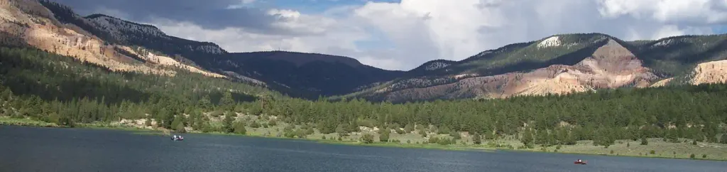
 Photo: A. E. Crane, U.S. Department of Transportation, Public domain (via Wikimedia Commons)
- 10,214 ft
- summit
- 1
- way up
- Forest Service
- managed by
Is Powell Point open right now?
Alert in the area
The Forest Service lists 3 alerts for Dixie National Forest.
Duck Creek OHV Trail Closure
Agency alert covering Dixie National Forest · Order 0407-26-11 · USFS · Dixie National Forest
Pine Valley Ranger District Area and Trail and Road Closure
Agency alert covering Dixie National Forest · Order 0407-26-01 · USFS · Dixie National Forest
Cedar City Temporary Road Closure Webster Flat Road (Order 0407-25-02)
Agency alert covering Dixie National Forest · Order 0407-25-02 · USFS · Dixie National Forest
As of · Source: USFS · Dixie National Forest. Agencies don't list every closure — check before you go.
Powell Point is a summit of about 10,214 feet in Garfield County, Utah, within the Escalante Ranger District of Dixie National Forest. The Forest Service manages the land, and the nearest town is Henrieville, about 10 miles away. The summit sits at roughly 10,200 feet, and the Powell Point Trail starts about half a mile from it. That makes the trail the natural way to approach the peak. Other nearby options include the Under the Point Trail, about 1.6 miles away, and Henderson Canyon Trail at about 2.5 miles. Climbers can head to Jungle Grotto, about 2.6 miles off, and Pine Lake Campground offers a place to stay about 5 miles away.
Conditions and forecast
Daily highs and lows, wind and the chance of precipitation at the summit and route start for the next 7 days, from the Open-Meteo model.
- Summit elevation
- 10,214 ft
- Land manager
- Forest Service
Elevation from USGS 3D Elevation Program terrain data (about 10 m resolution).
Map © Mapbox © OpenStreetMap contributors Questions about Powell Point
How tall is Powell Point?
10,214 ft (3,113 m).
How many routes go to the summit of Powell Point?
One: Powell Point Trail.
When is the best time to climb Powell Point?
May 1 – October 31.
 The Cathedral7,823 ft · Utah2 routes15 mi awayPhoto: George A. Grant, Public domain (via Wikimedia Commons)
- Adams Head10,428 ft · Utah1 route24 mi away
- No Mans Mesa6,216 ft · Utah2 routes30 mi away
- Trail Point10,876 ft · Utah1 route35 mi away
- Long Neck7,333 ft · Utah1 route35 mi away
- Bowns Point10,943 ft · Utah2 routes39 mi away
- Powell Point TrailHiking0.5 mi
- Under the Point TrailHiking1.6 mi
- Henderson Canyon TrailHiking2.5 mi
- Jungle GrottoRock climbing2.6 mi
 North BoulderRock climbingPhoto: Wojtek Szkutnik, CC BY 3.0 (via Wikimedia Commons)2.6 mi
- Water Canyon TrailHiking2.6 mi
- Upper JungleRock climbing4.6 mi
 Pine Lake CampgroundCampingPhoto: Recreation.gov (RIDB) / public domain4.9 mi
Source: Roamze catalog (indexable pages within 10 miles, PostGIS distance)
 Sinking ShipSummit · ~21 min drivePhoto: Christopher Michel, CC BY 2.0 (via Wikimedia Commons)
 Flake MountainSummit · ~23 min drivePhoto: An Errant Knight, CC BY-SA 4.0 (via Wikimedia Commons)
 Boat MesaSummit · ~24 min drivePhoto: Chris Light, CC BY-SA 4.0 (via Wikimedia Commons)
 Mormon TempleSummit · ~24 min drivePhoto: George A. Grant, Public domain (via Wikimedia Commons)
- The CathedralSummit · ~26 min drivePhoto: George A. Grant, Public domain (via Wikimedia Commons)
 Anderson MountainSummit · ~1h 22m drivePhoto: YubYub41, CC BY-SA 3.0 (via Wikimedia Commons)
 Coyote ButtesSummit · ~1h 26m drivePhoto: Bureau of Land Management, Public domain (via Wikimedia Commons)
- The BluesSummit · ~3 min drive
- Adams HeadSummit · ~41 min drive
- Cottonwood PeakSummit · ~45 min drive
