Flake Mountain
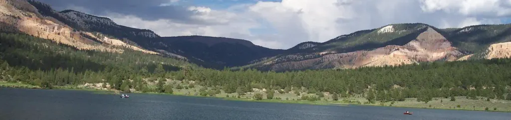
 Photo: An Errant Knight, CC BY-SA 4.0 (via Wikimedia Commons)
- 8,316 ft
- summit
- Forest Service
- managed by
- Jun–Sep
- best months
Is Flake Mountain open right now?
Alert in the area
The Forest Service lists 3 alerts for Dixie National Forest.
Duck Creek OHV Trail Closure
Agency alert covering Dixie National Forest · Order 0407-26-11 · USFS · Dixie National Forest
Pine Valley Ranger District Area and Trail and Road Closure
Agency alert covering Dixie National Forest · Order 0407-26-01 · USFS · Dixie National Forest
Cedar City Temporary Road Closure Webster Flat Road (Order 0407-25-02)
Agency alert covering Dixie National Forest · Order 0407-25-02 · USFS · Dixie National Forest
As of · Source: USFS · Dixie National Forest. Agencies don't list every closure — check before you go.
Flake Mountain is a summit of 8,316 feet in the Powell Ranger District of Dixie National Forest in southern Utah, about 6 miles from Bryce Canyon City. The Forest Service manages the land. Summer is the most comfortable time to visit. Typical averages from a nearby weather station at Bryce Canyon put July highs around 81°F with lows near 45°F, while winter highs stay in the mid-30s. That station sits about 730 feet below the summit, so temperatures on top run cooler. Several trails lie within a short drive. North Main Street is about 5 miles away, and the Pines Horse Trail and Great Western Trail are each within about 6 miles. For an overnight stay, Pine Lake Campground is roughly 10 miles off.
Conditions and forecast
Daily highs and lows, wind and the chance of precipitation at the summit for the next 7 days, from the Open-Meteo model.
- Summit elevation
- 8,316 ft
- Land manager
- Forest Service
Elevation from USGS 3D Elevation Program terrain data (about 10 m resolution).
We don't know of a mapped trail or route to the summit of Flake Mountain. Plan the approach with local maps, a guidebook or a local guide, and check conditions before you go.
Questions about Flake Mountain
How tall is Flake Mountain?
8,316 ft (2,535 m).
Is there a trail to the top of Flake Mountain?
We don't know of a mapped trail or route to the summit. Plan the approach with local maps, a guidebook or a local guide.
 The Cathedral7,823 ft · Utah2 routes10 mi awayPhoto: George A. Grant, Public domain (via Wikimedia Commons)
- Adams Head10,428 ft · Utah1 route13 mi away
 Powell Point10,214 ft · Utah1 route13 mi awayPhoto: A. E. Crane, U.S. Department of Transportation, Public domain (via Wikimedia Commons)
- Horse Valley Peak10,573 ft · Utah1 route32 mi away
- No Mans Mesa6,216 ft · Utah2 routes36 mi away
- Valentine Peak8,043 ft · Utah1 route36 mi away
- North Main StreetHiking5.1 mi
- PINES HORSE TRAILHiking5.7 mi
- Great Western TrailHiking6.3 mi
 OLD BRYCE TOWN LOOP SNOW TRAILHikingPhoto: Roger Sylvia, CC BY-SA 3.0 (via Wikimedia Commons)6.7 mi
- East Fork Sevier RiverCanoeing8.9 mi
- North Campground (UT)Camping9 mi
- Sunset Campground (UT)Camping9 mi
 Pine Lake CampgroundCampingPhoto: Recreation.gov (RIDB) / public domain9.6 mi
Source: Roamze catalog (indexable pages within 10 miles, PostGIS distance)
 Boat MesaSummit · ~14 min drivePhoto: Chris Light, CC BY-SA 4.0 (via Wikimedia Commons)
 Sinking ShipSummit · ~14 min drivePhoto: Christopher Michel, CC BY 2.0 (via Wikimedia Commons)
 Mormon TempleSummit · ~16 min drivePhoto: George A. Grant, Public domain (via Wikimedia Commons)
- The CathedralSummit · ~18 min drivePhoto: George A. Grant, Public domain (via Wikimedia Commons)
- Powell PointSummit · ~23 min drivePhoto: A. E. Crane, U.S. Department of Transportation, Public domain (via Wikimedia Commons)
 Anderson MountainSummit · ~60 min drivePhoto: YubYub41, CC BY-SA 3.0 (via Wikimedia Commons)
 P HillSummit · ~1h 6m drivePhoto: An Errant Knight, CC BY-SA 4.0 (via Wikimedia Commons)
 Brian HeadSummit · ~1h 7m drivePhoto: brewbooks from near Seattle, USA, CC BY-SA 2.0 (via Wikimedia Commons)
 Delano PeakSummit · ~1h 15m drivePhoto: ALK at English Wikipedia, CC BY-SA 3.0 (via Wikimedia Commons)
 Mount BelknapSummit · ~1h 22m drivePhoto: Intermountain Forest Service, USDA Region 4 Photography, Public domain (via Wikimedia Commons)
Also worth it near here
 Bryce Canyon Pines RV ParkCamping · ~10 min drivePhoto: Olivier Bruchez — CC BY-SA 2.0 (via Flickr)
 Ruby Rim LoopHiking · ~11 min drivePhoto: Roger Sylvia, CC BY-SA 3.0 (via Wikimedia Commons)
- Rubys Inn 3 Snow TrailCross-country skiing · ~12 min drive
 Ruby Rim a LoopMountain biking · ~12 min drivePhoto: brewbooks from near Seattle, USA, CC BY-SA 2.0 (via Wikimedia Commons)
Best time to visit Flake Mountain
Best months: June–September. Best months have typical highs of 55–85 °F, lows of 30 °F or warmer (32 °F where the station doesn't record snow), at most one snowy day and no more than 12 wet days.
Jan
36° / 6°
6 wet
Feb
38° / 10°
7 wet
Mar
45° / 18°
7 wet
Apr
54° / 24°
6 wet
May
64° / 31°
6 wet
Jun
76° / 37°
4 wet
Jul
81° / 45°
9 wet
Aug
79° / 45°
11 wet
Sep
71° / 37°
7 wet
Oct
59° / 26°
5 wet
Nov
46° / 15°
5 wet
Dec
35° / 6°
6 wet
Typical high / low (°F) and days with rain or snow, 1991–2020. Measured at Bryce Canyon Ap, UT, 3.9 mi away at 7,586 ft. The station sits about 700 ft lower than this place, so expect it a little cooler here. This station doesn't record snowfall. Source: NOAA NCEI U.S. Climate Normals 1991–2020.
