The Blues
About
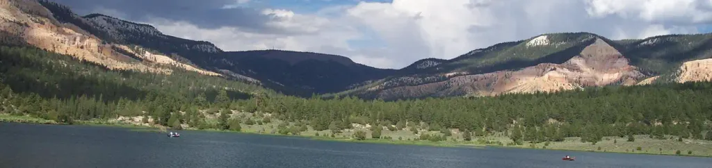
The Blues is a summit of about 8,085 feet in Garfield County, Utah, on National Public Lands managed by the Bureau of Land Management. The nearest town is Henrieville, about 9.5 miles away. Summer is the most comfortable time to visit. Typical July averages from a nearby weather station at Bryce Canyon National Park headquarters, which sits at a similar elevation, run around 80°F for highs and 52°F for lows. Winter highs there average in the upper 30s. Several trails start within a few miles, including Powell Point Trail at about 2 miles and Water Canyon Trail at about 3 miles. Climbers can head to Jungle Grotto, about 4.4 miles out. Pine Lake Campground, roughly 6.7 miles away, is the closest place to camp.
Summit Facts
Summit elevation
8,085 ft
Land manager
Bureau of Land Management
Elevation from USGS 3D Elevation Program terrain data (about 10 m resolution).
Location
The Blues
Utah
Name and location: U.S. Geological Survey, Geographic Names Information System (GNIS). Elevation: USGS 3D Elevation Program. View the GNIS record.
Facts about this place
When to go
Best time to go: May–Sep. The mildest months here, with typical highs of 63–80°F and lows of 37–52°F.
Typical monthly averages (not a forecast) from the Bryce Canyon Np Hqrs, UT weather station, 16 mi away. High / low in °F.
- Jan37° high17° low
- Feb39° high18° low
- Mar46° high23° low
- Apr54° high29° low
- May63° high37° low
- Jun75° high45° low
- Jul80° high52° low
- Aug77° high50° low
- Sep70° high42° low
- Oct58° high32° low
- Nov46° high23° low
- Dec37° high17° low
Where it is
- National Public Lands · Bureau of Land Management
- Nearest town
- Henrieville, Utah · 9.5 mi
- Managed by
- Bureau of Land Management
Nearby
- Powell Point TrailHiking2.1 mi
- Water Canyon TrailHiking3.2 mi
- Under the Point TrailHiking3.4 mi
- Henderson Canyon TrailHiking3.8 mi
- Jungle GrottoRock climbing4.4 mi
 North BoulderRock climbingPhoto: Wojtek Szkutnik, CC BY 3.0 (via Wikimedia Commons)4.4 mi
- Upper JungleRock climbing5.9 mi
 Pine Lake CampgroundCampingPhoto: Recreation.gov (RIDB) / public domain6.7 mi
Source: Roamze catalog (indexable pages within 10 miles, PostGIS distance)
Best time to visit The Blues
Best months: May–October. Best months have typical highs of 55–85 °F, lows of 30 °F or warmer (32 °F where the station doesn't record snow), at most one snowy day and no more than 12 wet days.
Jan
37° / 17°
6 wet
Feb
39° / 18°
7 wet
Mar
46° / 23°
7 wet
Apr
54° / 29°
6 wet
May
63° / 37°
5 wet
Jun
75° / 45°
4 wet
Jul
80° / 52°
8 wet
Aug
77° / 50°
10 wet
Sep
70° / 42°
7 wet
Oct
58° / 32°
5 wet
Nov
46° / 23°
5 wet
Dec
37° / 17°
6 wet
Typical high / low (°F) and days with rain or snow, 1991–2020. Measured at Bryce Canyon Np Hqrs, UT, 15.8 mi away at 7,890 ft. This station doesn't record snowfall. Source: NOAA NCEI U.S. Climate Normals 1991–2020.
