Coyote Buttes
 Photo: Bureau of Land Management, Public domain (via Wikimedia Commons)
- 6,349 ft
- summit
- Bureau of Land Management
- managed by
- May, Sep
- best months
Coyote Buttes is a summit of 6,349 feet in Arizona's Paria Canyon-Vermilion Cliffs Wilderness, within the Arizona Strip Field Office of the Bureau of Land Management. The nearest town is Big Water, Utah, about 21 miles away. Spring and fall are the most comfortable times to visit. Typical averages from a nearby weather station at Kodachrome Basin Park put May highs around 74°F and October highs near 68°F, while July averages about 91°F and January highs sit around 45°F. The Notch Trail lies about 1.5 miles away, and The Maze Trail and Top Rock Loop are each roughly 1.8 miles off. Stateline Campground, about 2.7 miles away, is the closest place to camp.
Conditions and forecast
Daily highs and lows, wind and the chance of precipitation at the summit for the next 7 days, from the Open-Meteo model.
- Summit elevation
- 6,349 ft
- Land manager
- Bureau of Land Management
Elevation from USGS 3D Elevation Program terrain data (about 10 m resolution).
We don't know of a mapped trail or route to the summit of Coyote Buttes. Plan the approach with local maps, a guidebook or a local guide, and check conditions before you go.
Questions about Coyote Buttes
How tall is Coyote Buttes?
6,349 ft (1,935 m).
Is there a trail to the top of Coyote Buttes?
We don't know of a mapped trail or route to the summit. Plan the approach with local maps, a guidebook or a local guide.
- Top Rock5,556 ft · Arizona1 route1.5 mi away
- Buckskin Mountains6,386 ft · Arizona2 routes8.6 mi away
- No Mans Mesa6,216 ft · Utah2 routes20 mi away
- Stud Horse Point4,601 ft · Utah1 route23 mi away
- Savage Point5,957 ft · Utah2 routes27 mi away
 The Cathedral7,823 ft · Utah2 routes45 mi awayPhoto: George A. Grant, Public domain (via Wikimedia Commons)
- Notch TrailHiking1.5 mi
 The Maze TrailHikingPhoto: Shaan Hurley, CC BY 2.0 (via Flickr)1.8 mi
 Top Rock LoopHikingPhoto: Zhou Joe Yu, CC BY 3.0 (via Wikimedia Commons)1.8 mi
 The LoopHikingPhoto: John Fowler from Placitas, NM, USA, CC BY 2.0 (via Wikimedia Commons)2.1 mi
- Stateline CampgroundCamping2.7 mi
 Swoop WallRock climbingPhoto: DarTar, CC BY-SA 4.0 (via Wikimedia Commons)7.5 mi
- Carrot ButtressRock climbingPhoto: DarTar, CC BY-SA 4.0 (via Wikimedia Commons)7.5 mi
- Hammer WallRock climbingPhoto: DarTar, CC BY-SA 4.0 (via Wikimedia Commons)7.5 mi
Source: Roamze catalog (indexable pages within 10 miles, PostGIS distance)
 Romana MesaSummit · ~1h 1m drivePhoto: ALAN SCHMIERER, CC0 (via Wikimedia Commons)
 Gunsight ButteSummit · ~1h 5m drivePhoto: Wilson Bilkovich, CC BY 2.0 (via Wikimedia Commons)
 Tower ButteSummit · ~1h 7m drivePhoto: mark byzewski, CC BY 2.0 (via Wikimedia Commons)
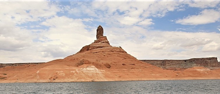 Cookie Jar ButteSummit · ~1h 9m drivePhoto: MS-R / Michael S-R, CC BY-SA 2.0 (via Wikimedia Commons)
 Padres ButteSummit · ~1h 10m drivePhoto: mark byzewski, CC BY 2.0 (via Wikimedia Commons)
 Dominguez ButteSummit · ~1h 10m drivePhoto: mark byzewski, CC BY 2.0 (via Wikimedia Commons)
 Gregory ButteSummit · ~1h 15m drivePhoto: © Pierre André, CC BY-SA 4.0 (via Wikimedia Commons)
- The CathedralSummit · ~1h 18m drivePhoto: George A. Grant, Public domain (via Wikimedia Commons)
 Mormon TempleSummit · ~1h 19m drivePhoto: George A. Grant, Public domain (via Wikimedia Commons)
 Sinking ShipSummit · ~1h 20m drivePhoto: Christopher Michel, CC BY 2.0 (via Wikimedia Commons)
Also worth it near here
- The Maze TrailHiking · ~3 min drivePhoto: Shaan Hurley, CC BY 2.0 (via Flickr)
- Stateline CampgroundCamping · ~5 min drive
- Swoop WallRock climbing · ~13 min drivePhoto: DarTar, CC BY-SA 4.0 (via Wikimedia Commons)
 Wrather ArchNatural arch · ~22 min drivePhoto: BLM Photo, Public domain (via Wikimedia Commons)
Best time to visit Coyote Buttes
Best months: May and September. Best months have typical highs of 55–85 °F, lows of 30 °F or warmer (32 °F where the station doesn't record snow), at most one snowy day and no more than 12 wet days.
Jan
45° / 15°
5 wet
Feb
49° / 19°
5 wet
Mar
58° / 24°
5 wet
Apr
65° / 29°
5 wet
May
74° / 36°
5 wet
Jun
86° / 43°
3 wet
Jul
91° / 52°
6 wet
Aug
88° / 51°
8 wet
Sep
81° / 42°
6 wet
Oct
68° / 31°
4 wet
Nov
55° / 21°
3 wet
Dec
44° / 15°
4 wet
Typical high / low (°F) and days with rain or snow, 1991–2020. Measured at Kodachrome Basin Park, UT, 37.7 mi away at 5,805 ft. The station sits about 500 ft lower than this place, so expect it a little cooler here. This station doesn't record snowfall. Source: NOAA NCEI U.S. Climate Normals 1991–2020.
