Marty's Tie
 Photo: kallahar, CC BY 3.0 (via Wikimedia Commons)
- 0.4 mi
- round trip
- 703 ft
- climb
- 4,156 ft
- high point
- Out and back
- route
- May–Oct
- best months
Is Marty's Tie open right now?
Closure in the area
There's a closure order in Siskiyou Mountains Ranger District. It doesn't name Marty's Tie, so check the source for the area it covers.
Ashland Municipal Watershed Camping and Fire Prohibition
Agency closure covering Siskiyou Mountains Ranger District · Order 06-10-20-23-52 · USFS · Siskiyou Mountains Ranger District
As of · Source: USFS · Siskiyou Mountains Ranger District. Agencies don't list every closure — check before you go.
Marty's Tie is a short, easy out-and-back hike in the Siskiyou Mountains Ranger District of the Rogue River-Siskiyou National Forests in southern Oregon. The trail is about 0.4 miles long, and the round trip climbs about 700 feet from a low point of roughly 3,835 feet to a high of about 4,156 feet. The steepest stretch comes near the start, with a grade of about 28 percent at about 0.3 miles in. Summer is the most comfortable time to go. Typical averages from a nearby weather station at Howard Prairie Dam show July and August highs around 79°F with only two or three wet days a month, while winter brings highs in the mid-30s and regular snow days. The trail is open to both horses and bikes, so it works for riders and pack animals as well as hikers. The trip takes about half an hour, and the route links up with Marty's and Lower Marty's, both within a third of a mile. For an overnight stay, Mt Ashland campground is about 5 miles away.
Local outfitters
- Momentum River Expeditions3 mi away
- Ashland Family YMCA3 mi away
Not on Roamze yet. Their page has how to reach them.
- Marty'sHikingPhoto: kallahar, CC BY 3.0 (via Wikimedia Commons)0.1 mi
- Lower Marty'sHiking0.3 mi
- Lamb MineHiking0.3 mi
 Mt. Ashland's Dream BoulderRock climbingPhoto: james shaw, CC BY-SA 3.0 (via Wikimedia Commons)4.4 mi
- Poison Oak WallRock climbing4.7 mi
- Mt AshlandCamping5.1 mi
- Emigrant CreekCanoeing6.4 mi
- Walker CreekCanoeing6.6 mi
Source: Roamze catalog (indexable pages within 10 miles, PostGIS distance)
- Marty'sHiking · Next doorPhoto: kallahar, CC BY 3.0 (via Wikimedia Commons)
 WonderHiking · ~4 min drivePhoto: kallahar, CC BY 3.0 (via Wikimedia Commons)
- CatwalkHiking · Next door
 GyreHiking · ~1 min drivePhoto: U.S. Forest Service- Pacific Northwest Region, Public domain (via Wikimedia Commons)
 Fell on KneeHiking · ~5 min drivePhoto: kallahar, CC BY 3.0 (via Wikimedia Commons)
- Bull GapHiking · ~4 min drive
- Lewis Loops: GimbleHiking · ~2 min drivePhoto: kallahar, CC BY 3.0 (via Wikimedia Commons)
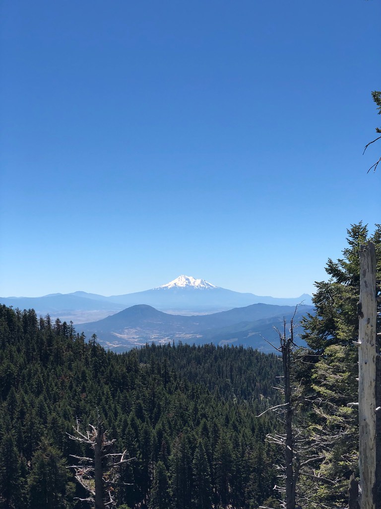 SummitHiking · ~8 min drivePhoto: zappowbang, CC BY-SA 2.0 (via Flickr)
- Horn GapHiking · ~8 min drive
- White Rabbit (Ped and Uphill Bike)Hiking · ~2 min drivePhoto: kallahar, CC BY 3.0 (via Wikimedia Commons)
Also worth it near here
 Upper Missing LinkMountain biking · ~3 min drivePhoto: james shaw, CC BY-SA 3.0 (via Wikimedia Commons)
- Glenyan RV Park & CampgroundCamping · ~6 min drive
 Bull Gap-NordicCross-country skiing · ~7 min drivePhoto: james shaw, CC BY-SA 3.0 (via Wikimedia Commons)
- Mt. Ashland's Dream BoulderRock climbing · ~8 min drivePhoto: james shaw, CC BY-SA 3.0 (via Wikimedia Commons)
Best time to visit Marty's Tie
Best months: May–October. Best months have typical highs of 55–85 °F, lows of 30 °F or warmer (32 °F where the station doesn't record snow), at most one snowy day and no more than 12 wet days.
Jan
36° / 23°
15 wet · 9 snow
Feb
40° / 23°
14 wet · 8 snow
Mar
45° / 26°
16 wet · 8 snow
Apr
50° / 29°
13 wet · 4 snow
May
60° / 36°
11 wet · 1 snow
Jun
68° / 40°
5 wet
Jul
79° / 47°
3 wet
Aug
79° / 46°
2 wet
Sep
72° / 40°
4 wet
Oct
58° / 33°
8 wet · 1 snow
Nov
42° / 28°
13 wet · 5 snow
Dec
35° / 23°
15 wet · 9 snow
Typical high / low (°F) and days with rain or snow, 1991–2020. Measured at Howard Prairie Dam, OR, 17.1 mi away at 4,567 ft. Source: NOAA NCEI U.S. Climate Normals 1991–2020.
Closures we've recorded since August 2026
Stage 2 Public Use Fire Restrictions (Forest-wide)
Rogue River-Siskiyou National Forests · Order dated September 4, 2026; seen Sep 3, 2026 → lifted Oct 28, 2026 · Forest Service
Stage 3 Public Use Fire Restrictions (Forest-wide)
Rogue River-Siskiyou National Forests · Order dated July 17, 2026; seen Aug 23, 2026 → lifted Sep 3, 2026 · Forest Service
