South Sandia Peak
- 9,782 ft
- summit
- 2
- ways up
Is South Sandia Peak open right now?
Closure in the area
There's a closure order in Sandia Ranger District. It doesn't name South Sandia Peak, so check the source for the area it covers (3 listed).
Area Closure for Recreation Residence Structures and Property at 91 Casa Loma Road
Agency closure covering Sandia Ranger District · Order 03-03-05-26-14 · USFS · Sandia Ranger District
Area Closure for Recreation Residence Structures and Property at 69 Casa Loma Road
Agency closure covering Sandia Ranger District · Order 03-03-05-26-13 · USFS · Sandia Ranger District
Area Closure for Sandia Crest “Switchback” Hazard Tree and Fuel Reduction Project
Agency closure covering Sandia Ranger District · Order 03-03-05-26-02 · USFS · Sandia Ranger District
Sandia Ranger District Road & Area Closure for National Forest Road 462 Maintenance
Agency alert covering Sandia Ranger District · Order 03-03-05-26-24 · USFS · Sandia Ranger District
Mountainair and Sandia Ranger Districts Stage 1 Fire Restriction Lifted
Agency alert covering Sandia Ranger District · Order 03-03-00-26-20 · USFS · Sandia Ranger District
As of · Source: USFS · Sandia Ranger District. Agencies don't list every closure — check before you go.
South Sandia Peak is a summit in the Sandia Mountain Wilderness, part of the Sandia Ranger District of Cibola National Forest in New Mexico. The nearest town is Cedar Crest, about 3 miles away. Several trails start within a few tenths of a mile of the peak, including the South Sandia Peak Trail, the Crest to South Peak Trail and the South Crest Trail. For climbing, the Upper Fat City Drainage (also called Embudo Canyon) is about 2.4 miles away.
Conditions and forecast
Daily highs and lows, wind and the chance of precipitation at the summit and route start for the next 7 days, from the Open-Meteo model.
- Summit elevation
- 9,782 ft
Elevation from USGS 3D Elevation Program terrain data (about 10 m resolution).
- South Sandia Peak Northern ApproachEasyabout 173 ft of climbing0.7 mi round trip
- South Sandia Peak TrailEasyabout 163 ft of climbing1.1 mi round trip
Compare the routes South Sandia Peak Northern Approach South Sandia Peak Trail Climbing About 173 ft About 163 ft Round trip 0.7 mi 1.1 mi Difficulty Easy Easy Terrain Hike Hike Map © Mapbox © OpenStreetMap contributors Questions about South Sandia Peak
How tall is South Sandia Peak?
9,782 ft (2,982 m).
How many routes go to the summit of South Sandia Peak?
2: South Sandia Peak Northern Approach and South Sandia Peak Trail.
What is the shortest route up South Sandia Peak?
South Sandia Peak Northern Approach, about 0.7 mi round trip.
- Tecolote Peak8,829 ft · New Mexico1 route5.6 mi away
 Cedro Peak7,770 ft · New Mexico1 route6.4 mi awayPhoto: Skoch3, CC BY-SA 3.0 (via Wikimedia Commons)
- Capulin Peak8,934 ft · New Mexico1 route6.9 mi away
- Palomas Peak8,682 ft · New Mexico1 route8.0 mi away
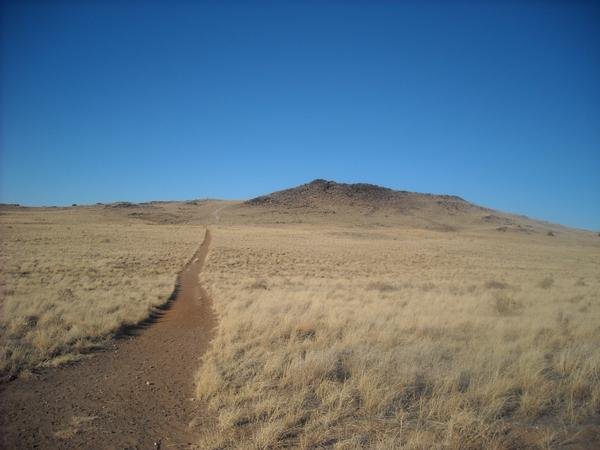 Black Volcano5,981 ft · New Mexico2 routes19 mi awayPhoto: User:michaelh2001, Public domain (via Wikimedia Commons)
- Vulcan Volcano6,032 ft · New Mexico2 routes19 mi away
- South Sandia Peak TrailHiking0.2 mi
- Crest to South Peak TrailHiking0.3 mi
- South Crest TrailHiking0.3 mi
- Oso Ridge TrailHiking0.3 mi
 Upper Fat City Drainage (a.k.a. Embudo Canyon)Rock climbingPhoto: somjuan, CC BY 2.0 (via Flickr)2.4 mi
- Trail Side Area 1Rock climbing2.8 mi
 Foothills BoulderingRock climbingPhoto: maximalideal, CC BY-SA 2.0 (via Flickr)3 mi
- Manitoba/Montgomery TrailheadRock climbing3 mi
Source: Roamze catalog (indexable pages within 10 miles, PostGIS distance)
- Cedro PeakSummit · ~11 min drivePhoto: Skoch3, CC BY-SA 3.0 (via Wikimedia Commons)
- Black VolcanoSummit · ~33 min drivePhoto: User:michaelh2001, Public domain (via Wikimedia Commons)
 Mount ChalchihuitlSummit · ~51 min drivePhoto: Unknown authorUnknown author or not provided, Public domain (via Wikimedia Commons)
 Cerro ColoradoSummit · ~1h 7m drivePhoto: Kent G. Budge, CC0 (via Wikimedia Commons)
 Cerro BonanzaSummit · ~54 min drivePhoto: John Phelan, CC BY 4.0 (via Wikimedia Commons)
 Glorieta MesaSummit · ~1h 23m drivePhoto: Patrick Alexander from Las Cruces, NM, CC0 (via Wikimedia Commons)
- Tecolote PeakSummit · ~10 min drive
- Capulin PeakSummit · ~12 min drive
- J A VolcanoSummit · ~33 min drive
- CinderSummit · ~33 min drive

