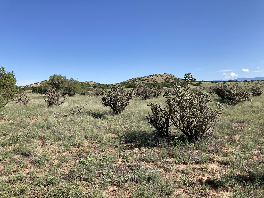
Cerro Colorado
 Photo: Kent G. Budge, CC0 (via Wikimedia Commons)
- 6,870 ft
- summit
- Apr–Jun, Aug–Oct
- best months
Cerro Colorado is a summit in New Mexico, rising to 6,870 feet about a mile from the town of Lamy. It sits among a cluster of hiking trails, making it an easy anchor for a day of exploring the surrounding area. Spring and fall are the most comfortable times to go. Typical averages from a nearby weather station at a similar elevation show May highs around 73°F and October highs around 66°F, while July and August bring the most wet days of the year. Several trails lie within a few miles, including the Arroyo de los Angeles Trail, the South Wagon Trail and the Shepherd's Trail. For climbers, the Apache Canyon (a.k.a. Grasshopper Canyon) Bouldering area is about 7.7 miles away.
Conditions and forecast
Daily highs and lows, wind and the chance of precipitation at the summit for the next 7 days, from the Open-Meteo model.
- Summit elevation
- 6,870 ft
Elevation from USGS 3D Elevation Program terrain data (about 10 m resolution).
We don't know of a mapped trail or route to the summit of Cerro Colorado. Plan the approach with local maps, a guidebook or a local guide, and check conditions before you go.
Questions about Cerro Colorado
How tall is Cerro Colorado?
6,870 ft (2,094 m).
Is there a trail to the top of Cerro Colorado?
We don't know of a mapped trail or route to the summit. Plan the approach with local maps, a guidebook or a local guide.
- Shaggy Peak8,858 ft · New Mexico1 route10 mi away
- Sun Mountain7,957 ft · New Mexico1 route13 mi away
- Atalaya Mountain9,130 ft · New Mexico1 route14 mi away
- Thompson Peak10,557 ft · New Mexico1 route15 mi away
- Lake Peak12,412 ft · New Mexico1 route23 mi away
- Penitente Peak12,261 ft · New Mexico2 routes23 mi away
 Arroyo de los Angeles TrailHikingPhoto: Paul and Jill, CC BY 2.0 (via Flickr)2.3 mi
 South Wagon TrailHikingPhoto: Paul and Jill, CC BY 2.0 (via Flickr)2.6 mi
- Shepherd's TrailHiking2.8 mi
- Eliza's Ridge TrailHiking2.9 mi
 Nathan's TraceHikingPhoto: Paul and Jill, CC BY 2.0 (via Flickr)3.1 mi
- South TrailHikingPhoto: Paul and Jill, CC BY 2.0 (via Flickr)4.2 mi
- Arroyo TrailHiking4.4 mi
- Apache Canyon (a.k.a. Grasshopper Canyon) BoulderingRock climbing7.7 mi
Source: Roamze catalog (indexable pages within 10 miles, PostGIS distance)
 Glorieta MesaSummit · ~16 min drivePhoto: Patrick Alexander from Las Cruces, NM, CC0 (via Wikimedia Commons)
 Mount ChalchihuitlSummit · ~22 min drivePhoto: Unknown authorUnknown author or not provided, Public domain (via Wikimedia Commons)
 Santa Fe BaldySummit · ~44 min drivePhoto: snowpeak, CC BY 2.0 (via Wikimedia Commons)
 Hermit PeakSummit · ~56 min drivePhoto: JerryFriedman, CC BY-SA 3.0 (via Wikimedia Commons)
 Black MesaSummit · ~58 min drivePhoto: User Em-jay-es on en.wikipedia, Public domain (via Wikimedia Commons)
 Cedro PeakSummit · ~1h 7m drivePhoto: Skoch3, CC BY-SA 3.0 (via Wikimedia Commons)
 Chicoma MountainSummit · ~1h 20m drivePhoto: JerryFriedman, CC BY-SA 3.0 (via Wikimedia Commons)
 Cerro BonanzaSummit · ~25 min drivePhoto: John Phelan, CC BY 4.0 (via Wikimedia Commons)
- Shaggy PeakSummit · ~18 min drive
- Sun MountainSummit · ~22 min drive
Best time to visit Cerro Colorado
Best months: April–June and August–October. Best months have typical highs of 55–85 °F, lows of 30 °F or warmer (32 °F where the station doesn't record snow), at most one snowy day and no more than 12 wet days.
Jan
43° / 21°
5 wet
Feb
47° / 23°
5 wet
Mar
56° / 29°
5 wet
Apr
63° / 34°
4 wet
May
73° / 44°
4 wet
Jun
84° / 54°
6 wet
Jul
86° / 57°
11 wet
Aug
83° / 56°
11 wet
Sep
77° / 50°
7 wet
Oct
66° / 39°
6 wet
Nov
52° / 28°
5 wet
Dec
42° / 21°
6 wet
Typical high / low (°F) and days with rain or snow, 1991–2020. Measured at Santa Fe Seton, NM, 9.3 mi away at 7,000 ft. This station doesn't record snowfall. Source: NOAA NCEI U.S. Climate Normals 1991–2020.

