Black Volcano
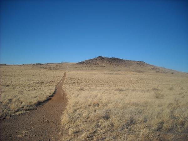 Photo: User:michaelh2001, Public domain (via Wikimedia Commons)
- 5,981 ft
- summit
- 2
- ways up
- City Land
- managed by
- Mar–May, Sep–Oct
- best months
Is Black Volcano open right now?
Alert in the area
The National Park Service lists an alert for Petroglyph National Monument.
Be City Smart: Take precautions to secure your vehicle and valuables.
Park alert covering Petroglyph National Monument · NPS · Petroglyph National Monument
As of · Source: NPS · Petroglyph National Monument. Agencies don't list every closure — check before you go.
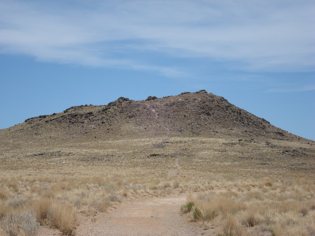
Black Volcano is a summit of 5,981 feet in Petroglyph National Monument in New Mexico, about 6 miles from the community of Paradise Hills. The peak sits on city land within the monument, and the Black Volcano Trail starts just 0.1 mile away, making it the natural way to approach the summit. Spring and fall are the most comfortable times to go. Typical averages from a nearby weather station show April and October highs around 72°F with lows in the low 40s, while July and August average highs in the low 90s. That station sits about 860 feet lower than the summit, so temperatures on top run cooler. Several other trails lie close by. The Volcan Volcano Trail Loop and the Mesa Top Multi Use Trail are each about 0.3 mile away, and the East Bond Volcano Trail is about 0.5 mile off.
Conditions and forecast
Daily highs and lows, wind and the chance of precipitation at the summit and route start for the next 7 days, from the Open-Meteo model.
- Summit elevation
- 5,981 ft
- Land manager
- City Land
Elevation from USGS 3D Elevation Program terrain data (about 10 m resolution).
- Black Volcano TrailEasyabout 33 ft of climbing0.1 mi
- Volcanos Trail LoopEasyabout 137 ft of climbing4.1 mi round trip
Compare the routes Black Volcano Trail Volcanos Trail Loop Climbing About 33 ft About 137 ft Round trip 0.1 mi 4.1 mi Difficulty Easy Easy Terrain Hike Hike Map © Mapbox © OpenStreetMap contributors Questions about Black Volcano
How tall is Black Volcano?
5,981 ft (1,823 m).
How many routes go to the summit of Black Volcano?
2: Black Volcano Trail and Volcanos Trail Loop.
What is the shortest route up Black Volcano?
Black Volcano Trail, about 0.1 mi.
- Cinder5,908 ft · New Mexico2 routes0.2 mi away
- J A Volcano5,939 ft · New Mexico2 routes0.4 mi away
- Vulcan Volcano6,032 ft · New Mexico2 routes0.6 mi away
- Bond Volcano5,880 ft · New Mexico2 routes1.8 mi away
- Butte Volcano5,877 ft · New Mexico1 route2.2 mi away
- South Sandia Peak9,782 ft · New Mexico2 routes19 mi away
 Black Volcano TrailHikingPhoto: Michael Hohimer from Atlanta, GA, U.S.A, CC BY 2.0 (via Wikimedia Commons)0.1 mi
 Volcan Volcano Trail LoopHikingPhoto: Paul J. Morris, CC BY-SA 2.0 (via Flickr)0.3 mi
- Mesa Top Multi Use TrailHikingPhoto: Michael Hohimer from Atlanta, GA, U.S.A, CC BY 2.0 (via Wikimedia Commons)0.3 mi
- Volcanos Trail LoopHikingPhoto: Michael Hohimer from Atlanta, GA, U.S.A, CC BY 2.0 (via Wikimedia Commons)0.5 mi
- East Bond Volcano TrailHikingPhoto: Paul J. Morris, CC BY-SA 2.0 (via Flickr)0.5 mi
 Bond Volcano TrailHikingPhoto: Matt Lavin, CC BY-SA 2.0 (via Flickr)0.7 mi
- South Point TrailHiking1.5 mi
- Butte Volcano TrailHiking1.8 mi
Source: Roamze catalog (indexable pages within 10 miles, PostGIS distance)
 Cedro PeakSummit · ~42 min drivePhoto: Skoch3, CC BY-SA 3.0 (via Wikimedia Commons)
 Mount ChalchihuitlSummit · ~1h 15m drivePhoto: Unknown authorUnknown author or not provided, Public domain (via Wikimedia Commons)
 Cerro BonanzaSummit · ~1h 16m drivePhoto: John Phelan, CC BY 4.0 (via Wikimedia Commons)
 Mount TaylorSummit · ~1h 22m drivePhoto: ANNAfoxlover at English Wikipedia / Later version(s) were uploaded by Casito at English Wikipedia., Public domain (via Wikimedia Commons)
 Acoma RockSummit · ~1h 24m drivePhoto: Thomas Moran, Public domain (via Wikimedia Commons)
- CinderSummit · Next door
- J A VolcanoSummit · Next door
- Vulcan VolcanoSummit · ~1 min drive
- Butte VolcanoSummit · ~4 min drive
- South Sandia PeakSummit · ~33 min drive
Best time to visit Black Volcano
Best months: March–May and September–October. Best months have typical highs of 55–85 °F, lows of 30 °F or warmer (32 °F where the station doesn't record snow), at most one snowy day and no more than 12 wet days.
Jan
50° / 24°
3 wet
Feb
56° / 28°
3 wet
Mar
65° / 34°
4 wet
Apr
72° / 41°
3 wet
May
81° / 50°
3 wet
Jun
92° / 59°
3 wet
Jul
93° / 65°
6 wet
Aug
91° / 63°
6 wet
Sep
84° / 55°
5 wet
Oct
72° / 43°
4 wet
Nov
59° / 31°
3 wet
Dec
49° / 24°
3 wet
Typical high / low (°F) and days with rain or snow, 1991–2020. Measured at Petroglyph Natl Mon, NM, 3.5 mi away at 5,121 ft. The station sits about 900 ft lower than this place, so expect it a little cooler here. This station doesn't record snowfall. Source: NOAA NCEI U.S. Climate Normals 1991–2020.
