Patrick's Ridge
- 0.4 mi
- round trip
- 548 ft
- climb
- 6,233 ft
- high point
- Out and back
- route
Is Patrick's Ridge open right now?
Closure in the area
There's a closure order in Kootenai National Forest. It doesn't name Patrick's Ridge, so check the source for the area it covers.
Kootenai Flood Event & Inaccessible Areas
Agency closure covering Kootenai National Forest · USFS · Kootenai National Forest
Updated Skillet Fire Area, Road, Trail Closure
Agency alert covering Kootenai National Forest · Order 01-10- · USFS · Kootenai National Forest
As of · Source: USFS · Kootenai National Forest. Agencies don't list every closure — check before you go.
Patrick's Ridge is a short, easy hike in the Fortine Ranger District of Montana's Kootenai National Forest, managed by the Forest Service. The route is 0.38 miles long, with a total climb of 548 feet over 0.76 miles of out-and-back trail. The trail starts at about 5,958 feet and peaks at 6,233 feet, and the steepest stretch comes right at the beginning, with a grade of 35 percent. The whole trip takes about half an hour. The climb is front-loaded, so the hardest part comes early, and the trail is short enough to fit easily into a longer day in the area. For a longer outing, the nearby Patrick Ridge hike lies about a mile away, and the Marston hike is 1.7 miles off. Camping options include South Dickey Lake, about 2.2 miles away, and North Dickey Lake, about 2.7 miles away.
Local outfitters
- Indian Springs Montana18 mi away
- North American RV Park & Yurt Village39 mi away
Not on Roamze yet. Their page has how to reach them.
- Patrick RidgeHiking1 mi
- MarstonHiking1.7 mi
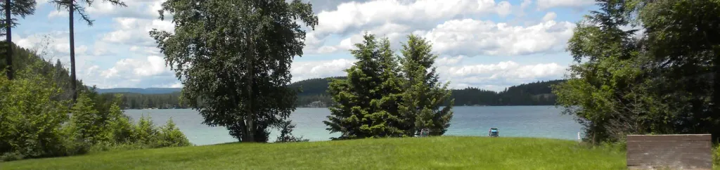 South Dickey LakeCampingPhoto: Recreation.gov (RIDB) / public domain2.2 mi
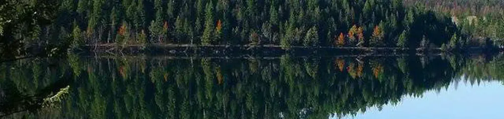 North Dickey LakeCampingPhoto: Recreation.gov (RIDB) / public domain2.7 mi
 Stillwater RiverCanoeingPhoto: Joe Mabel (on Flickr as Joe Mabel from Seattle, US), CC BY-SA 3.0 (via Wikimedia Commons)3.8 mi
- Point of RocksRock climbing5.7 mi
- Mouse HouseRock climbing7.1 mi
- Fortine CreekCanoeing7.6 mi
Source: Roamze catalog (indexable pages within 10 miles, PostGIS distance)
 Nasukoin Mtn.Hiking · ~16 min drivePhoto: Forest Service Northern Region from Missoula, MT, USA, Public domain (via Wikimedia Commons)
- Link LakeHiking · ~15 min drivePhoto: Forest Service Northern Region from Missoula, MT, USA, Public domain (via Wikimedia Commons)
- MarstonHiking · ~3 min drive
 Chain LakeHiking · ~19 min drivePhoto: Forest Service Northern Region from Missoula, MT, USA, Public domain (via Wikimedia Commons)
- Dickey Lake OverlookHiking · ~5 min drive
- Laughing WaterHiking · ~6 min drive
- DEEP CREEK X-C SKIHiking · ~9 min drive
- Hagadore LakeHiking · ~5 min drive
- Deep CreekHiking · ~9 min drive
- WilliamsHiking · ~11 min drive
Also worth it near here
- South Dickey LakeCamping · ~4 min drive
- Marston/dickeyMountain biking · ~4 min drive
- North Dickey Boat RampBoat launch · ~5 min drive
- Stillwater RiverCanoeing · ~7 min drivePhoto: Joe Mabel (on Flickr as Joe Mabel from Seattle, US), CC BY-SA 3.0 (via Wikimedia Commons)
- Fish LakeLake fishing · ~7 min drive
Map and trail data © OpenStreetMap contributors
