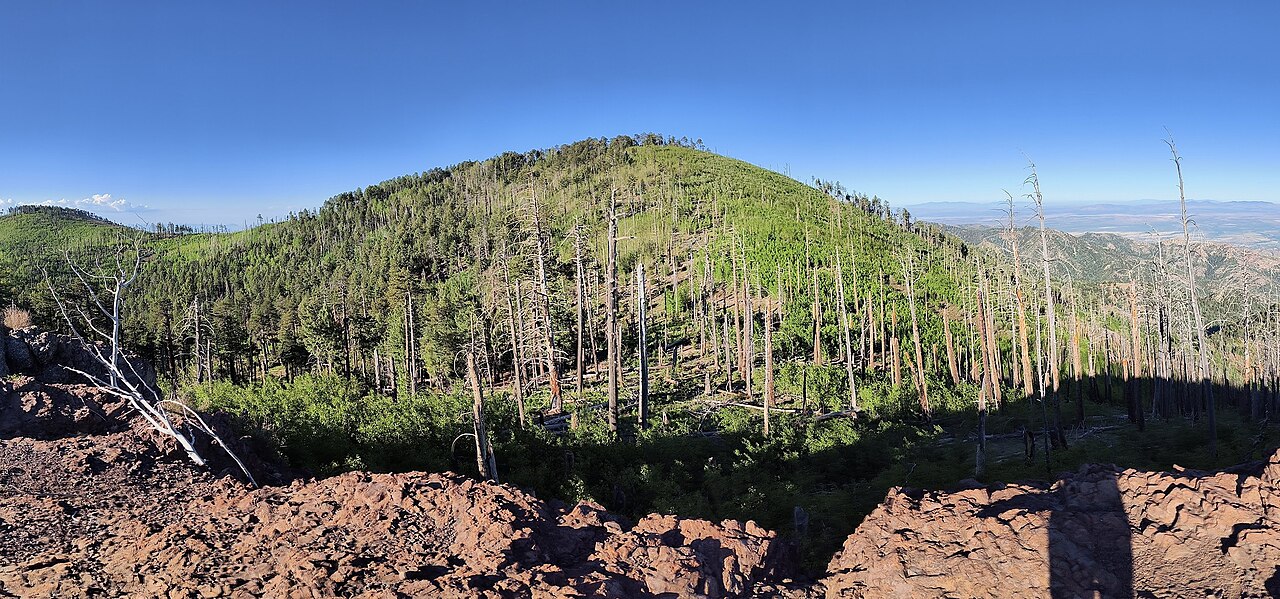
Rattlesnake
- 5.3 mi
- round trip
- 894 ft
- climb
- 7,428 ft
- high point
- Out and back
- route
Is Rattlesnake open right now?
Alert in the area
The Forest Service lists 3 alerts for Coronado National Forest.
Border Barrier Construction Closure
Agency alert covering Coronado National Forest · Order 03-05-00-26-011 · USFS · Coronado National Forest
No Fire Restrictions
Agency alert covering Coronado National Forest · USFS · Coronado National Forest
Barfoot Snake Closure Order 03-05-01-24-004
Agency alert covering Coronado National Forest · USFS · Coronado National Forest
As of · Source: USFS · Coronado National Forest. Agencies don't list every closure — check before you go.
Rattlesnake is a 5.3-mile out-and-back hike in Arizona's Coronado National Forest, within the Douglas Ranger District. The trail rises from a low point of 6,497 feet to a high of 7,428 feet, a gain of about 900 feet, and is rated moderate. The trail is on natural surface, and it allows horses but not bicycles. It is not an accessible route. The Forest Service manages the surrounding land, and the trail is open year-round. Pine Canyon Trail #357 lies about half a mile away, and Cathedral Rocks Trail is about a mile off. Rustler Park campground is roughly 2 miles from the trail, and Sycamore campground is about 4 miles away.
- Pine Canyon Trail #357Hiking0.6 mi
- Cathedral Rocks TrailHiking1 mi
- Fitch CorralHiking1.5 mi
- BootleggerMountain biking1.7 mi
- Rustler ParkCamping2.2 mi
- SycamoreCamping4.2 mi
- Herb MartyrCamping5.7 mi
- Sunny FlatCamping8.5 mi
Source: Roamze catalog (indexable pages within 10 miles, PostGIS distance)
 Barfoot Lookout TrailHiking · ~3 min drivePhoto: treegrow, CC BY 2.0 (via Flickr)
 Mushroom RockHiking · ~9 min drivePhoto: Caddymob at English Wikipedia, CC BY 3.0 (via Wikimedia Commons)
- Bootlegger Trail #257Hiking · ~4 min drive
- SaulsburyHiking · ~7 min drive
 Long Park Trail #42DHiking · ~5 min drivePhoto: Jon Roanhaus, CC BY-SA 4.0 (via Wikimedia Commons)
 Sara Deming TrailHiking · ~9 min drivePhoto: w_lemay, CC BY-SA 2.0 (via Flickr)
- Hoovey CanyonHiking · ~5 min drive
- Big Balanced RockHiking · ~9 min drivePhoto: Caddymob at English Wikipedia, CC BY 3.0 (via Wikimedia Commons)
- Pine Canyon Trail #357Hiking · Next door
- Rock Creek Trail #259Hiking · ~7 min drive