Bootlegger Trail #257
- 5.3 mi
- round trip
- 1,014 ft
- climb
- 8,748 ft
- high point
- Out and back
- route
Caution today
Agency alerts are in effect for this area; weather is good · USFS, OpenWeather · checked 11 h ago
Is Bootlegger Trail #257 open right now?
Alert in the area
The Forest Service lists 3 alerts for Coronado National Forest.
Border Barrier Construction Closure
Agency alert covering Coronado National Forest · Order 03-05-00-26-011 · USFS · Coronado National Forest
No Fire Restrictions
Agency alert covering Coronado National Forest · USFS · Coronado National Forest
Barfoot Snake Closure Order 03-05-01-24-004
Agency alert covering Coronado National Forest · USFS · Coronado National Forest
As of · Source: USFS · Coronado National Forest. Agencies don't list every closure — check before you go.
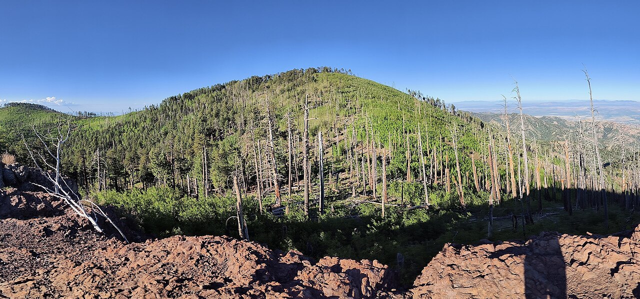
Bootlegger Trail #257 is an easy out-and-back hike in the Douglas Ranger District of Coronado National Forest in Arizona, managed by the Forest Service. The trail is about 5.3 miles long, with a one-way climb of 1,014 feet from a low point of about 7,400 feet to a high of about 8,750 feet. Bikes are not allowed on this trail, so plan on walking the whole way. The route is rated easy, and the climb is spread across the full length of the hike rather than concentrated in one stretch. Rustler Park campground sits just 0.3 miles away, and the Telephone Line Trail and Bootlegger mountain biking route are both within a mile. Barfoot Lookout Trail is about 1.1 miles off.
Keep exploring — more trails worth the drive
 Photo: treegrow, CC BY 2.0 (via Flickr)
Barfoot Lookout Trail
~2 min drive
1.56-mile out-and-back trail in Arizona with 768 ft elevation gain and loss.
 Photo: Jon Roanhaus, CC BY-SA 4.0 (via Wikimedia Commons)
Crest Trail #270D
~7 min drive
2.26-mile out-and-back trail in Arizona with 1,176 ft elevation gain
HIKE
Basin
~4 min drive
8.79-mile out-and-back trail in Arizona with 454 ft gain.
HIKE
Saulsbury
~7 min drive
10.06-mile out-and-back trail in Arizona with 2,175 ft elevation gain.
Photo: Jon Roanhaus, CC BY-SA 4.0 (via Wikimedia Commons)Long Park Trail #42D
~3 min drive
1.24-mile out-and-back trail in Arizona with 839 ft gain and 9,084 ft max elevation.
HIKE
Telephone Line Trail
~1 min drive
1.5-mile out-and-back hike in Arizona with 841 ft elevation gain
HIKE
Green House
~5 min drive
6.46-mile out-and-back trail in Arizona with 638 ft gain and 2,708 ft loss.
HIKE
Fly
~3 min drive
1.52-mile out-and-back trail in Arizona with 524 ft elevation gain.
HIKE
Rattlesnake
~4 min drive
5.28-mile out-and-back trail in Arizona with 894 ft gain.
HIKE
Turkey Pen
~6 min drive
6.27-mile out-and-back trail in Arizona with 380 ft gain.

Map and trail data © OpenStreetMap contributors
