Fitch Corral
- 1.9 mi
- round trip
- 1,072 ft
- climb
- 6,973 ft
- high point
- Out and back
- route
- Mar–May, Aug–Nov
- best months
Is Fitch Corral open right now?
Alert in the area
The Forest Service lists 3 alerts for Coronado National Forest.
Border Barrier Construction Closure
Agency alert covering Coronado National Forest · Order 03-05-00-26-011 · USFS · Coronado National Forest
No Fire Restrictions
Agency alert covering Coronado National Forest · USFS · Coronado National Forest
Barfoot Snake Closure Order 03-05-01-24-004
Agency alert covering Coronado National Forest · USFS · Coronado National Forest
As of · Source: USFS · Coronado National Forest. Agencies don't list every closure — check before you go.
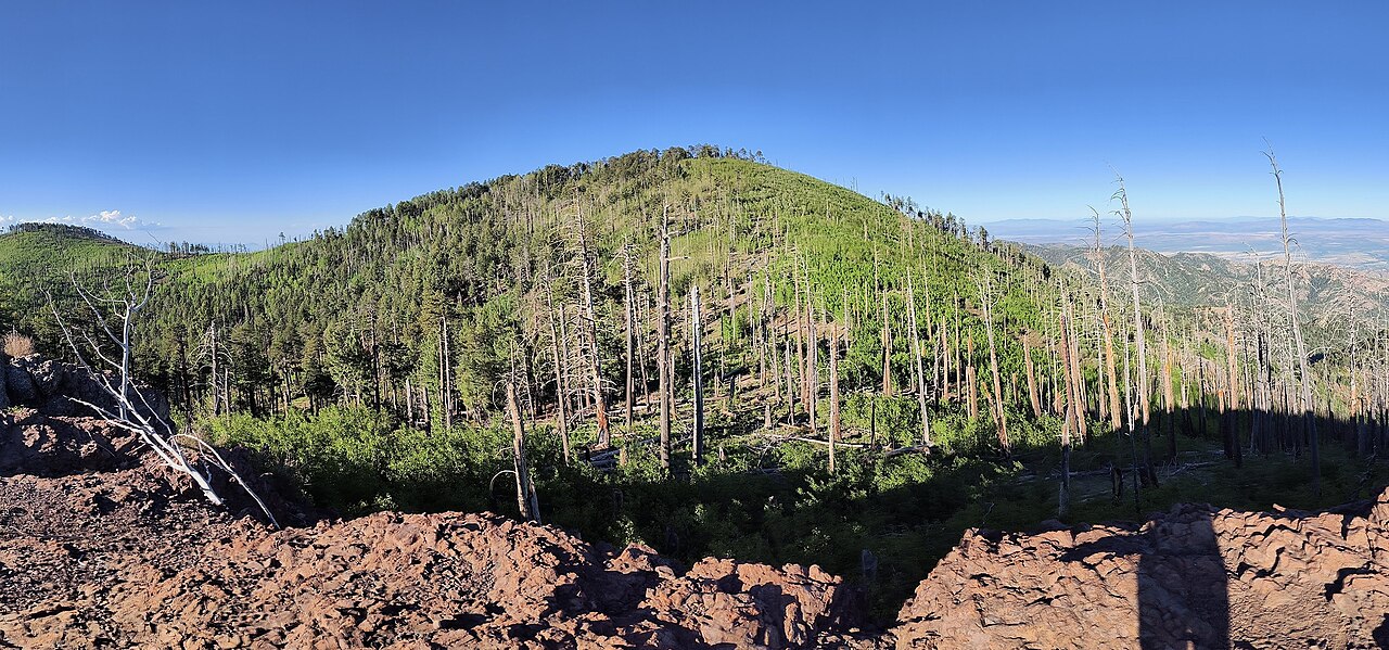
Fitch Corral is a 1.9-mile out-and-back hike in the Chiricahua Wilderness, within the Douglas Ranger District of Coronado National Forest in Arizona. The trail rises from about 6,449 feet to 6,973 feet, with a total gain of 1,072 feet over the round trip. It is a moderate route, and the Forest Service manages the land. The climb is steepest at about 0.11 miles from the trailhead, with a grade of 22 percent. The trail is natural surfaced, and bikes are allowed. It is not accessible. Spring and fall are the most comfortable times to go. Typical averages from a nearby weather station at Paradise run to highs around 72°F in April and 74°F in October, with that station sitting well below the trail's high point, so temperatures up high run cooler. The hike takes about an hour. Turkey Pen is about 0.9 miles away, and Pine Canyon Trail #357 is about 1.7 miles off. Sycamore and Rustler Park campgrounds are each about 3.4 miles away.
Best time to go · Mar–May, Aug–Nov
Best time to visit Fitch Corral
Best months: March–May and August–November. Best months have typical highs of 55–85 °F, lows of 30 °F or warmer (32 °F where the station doesn't record snow), at most one snowy day and no more than 12 wet days.
Jan
54° / 24°
Feb
58° / 28°
Mar
65° / 33°
Apr
72° / 39°
May
81° / 46°
Jun
90° / 55°
Jul
87° / 61°
Aug
84° / 58°
Sep
80° / 53°
Oct
74° / 42°
Nov
63° / 32°
Dec
54° / 26°
Typical high / low (°F) and days with rain or snow, 1991–2020. Measured at Paradise, AZ, 7.2 mi away at 5,460 ft. The station sits about 1,500 ft lower than this place, so expect it a little cooler here. This station doesn't record snowfall. Source: NOAA NCEI U.S. Climate Normals 1991–2020.
Keep exploring — more trails worth the drive
 Photo: treegrow, CC BY 2.0 (via Flickr)
Barfoot Lookout Trail
~6 min drive
1.56-mile out-and-back trail in Arizona with 768 ft elevation gain and loss.
 Photo: Jon Roanhaus, CC BY-SA 4.0 (via Wikimedia Commons)
Crest Trail #270D
~9 min drive
2.26-mile out-and-back trail in Arizona with 1,176 ft elevation gain
HIKE
Turkey Pen
~1 min drive
6.27-mile out-and-back trail in Arizona with 380 ft gain.
HIKE
Saulsbury
~5 min drive
10.06-mile out-and-back trail in Arizona with 2,175 ft elevation gain.
Photo: Jon Roanhaus, CC BY-SA 4.0 (via Wikimedia Commons)Long Park Trail #42D
~6 min drive
1.24-mile out-and-back trail in Arizona with 839 ft gain and 9,084 ft max elevation.
 Photo: w_lemay, CC BY-SA 2.0 (via Flickr)
Sara Deming Trail
~10 min drive
1.53-mile out-and-back trail in Arizona with 6,567 ft elevation gain
HIKE
Rock Creek Trail #259
~4 min drive
15.12-mile out-and-back trail in Arizona with 3,108 ft elevation gain.
 Photo: w_lemay, CC BY-SA 2.0 (via Flickr)
Heart of Rocks Loop
~10 min drive
0.70-mile loop in Arizona with 159 ft gain and 161 ft loss.
HIKE
Rattlesnake
~3 min drive
5.28-mile out-and-back trail in Arizona with 894 ft gain.
HIKE
Hoovey Canyon
~5 min drive
7.44-mile out-and-back trail in Arizona with 1,273 ft gain.