Chiricahua Peak
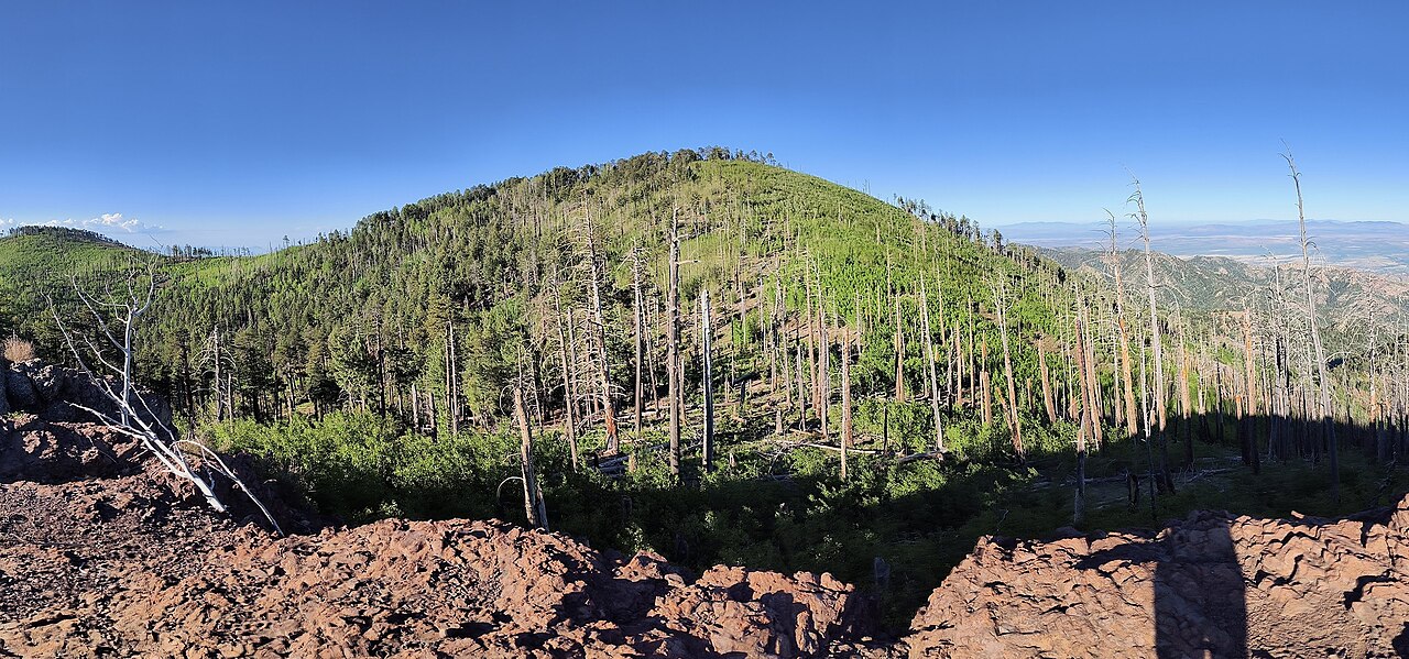 Photo: BubbaJuice, CC0 (via Wikimedia Commons)
- 9,771 ft
- summit
- Forest Service
- managed by
Is Chiricahua Peak open right now?
Alert in the area
The Forest Service lists 3 alerts for Coronado National Forest.
Border Barrier Construction Closure
Agency alert covering Coronado National Forest · Order 03-05-00-26-011 · USFS · Coronado National Forest
No Fire Restrictions
Agency alert covering Coronado National Forest · USFS · Coronado National Forest
Barfoot Snake Closure Order 03-05-01-24-004
Agency alert covering Coronado National Forest · USFS · Coronado National Forest
As of · Source: USFS · Coronado National Forest. Agencies don't list every closure — check before you go.
Chiricahua Peak is a summit of about 9,771 feet in Cochise County, Arizona, set within the Chiricahua Wilderness on the Douglas Ranger District of Coronado National Forest. The nearest town is Rodeo, New Mexico, about 15.5 miles away, and the Forest Service manages the land. Trails reach the summit area closely: Crest Trail #270C lies about 0.3 mile away, with Ojo Agua Fria and Crest Trail #270D both around 0.4 mile off. For an overnight base, Sycamore campground sits about 2.7 miles from the peak.
Conditions and forecast
Daily highs and lows, wind and the chance of precipitation at the summit for the next 7 days, from the Open-Meteo model.
- Summit elevation
- 9,771 ft
- Land manager
- Forest Service
Elevation from USGS 3D Elevation Program terrain data (about 10 m resolution).
We don't know of a mapped trail or route to the summit of Chiricahua Peak. Plan the approach with local maps, a guidebook or a local guide, and check conditions before you go.
Questions about Chiricahua Peak
How tall is Chiricahua Peak?
9,771 ft (2,978 m).
Is there a trail to the top of Chiricahua Peak?
We don't know of a mapped trail or route to the summit. Plan the approach with local maps, a guidebook or a local guide.
- Crest Trail #270CHiking0.3 mi
- Ojo Agua FriaHiking0.4 mi
 Crest Trail #270DHikingPhoto: Jon Roanhaus, CC BY-SA 4.0 (via Wikimedia Commons)0.4 mi
- AnitaMountain biking0.5 mi
- SycamoreCamping2.7 mi
- Herb MartyrCamping3.8 mi
- Rustler ParkCamping4.1 mi
- Sunny FlatCamping7.3 mi
Source: Roamze catalog (indexable pages within 10 miles, PostGIS distance)
 Silver PeakSummit · ~12 min drivePhoto: T. Dyess, Public domain (via Wikimedia Commons)
- Paint RockSummit · ~2 min drive
- Snowshed PeakSummit · ~3 min drive
- Raspberry PeakSummit · ~3 min drive
- Flys PeakSummit · ~3 min drive
- Sage PeakSummit · ~8 min drive
- Jones PeakSummit · ~8 min drive
- Buena Vista PeakSummit · ~8 min drive
- Massai PointSummit · ~19 min drive
- Sugarloaf MountainSummit · ~20 min drive

