Loading…

Free — you'll pick up right here.
Watch this trail
Sign up to watch it — saving subscribes you to gate, closure and report changes.
Arizona
8.8 mi
Distance
454 ft
Gain
3h 10m
Time
We won't guess. Here is exactly what we do and don't know.
What we do know
Inside Coronado National Forest
2 managing-area boundaries mapped — agency alerts for them feed this page automatically.
Boundary data
What's missing
No access route mapped
We don't yet know which road reaches this trailhead, so we can't tell you if it's gated.
Nobody's filed a report here yet — be the first.
Why you'll love it
Basin
AI-suggested draft · review before you go
No permit or access details on file for this trail — check with the local land manager before you go.
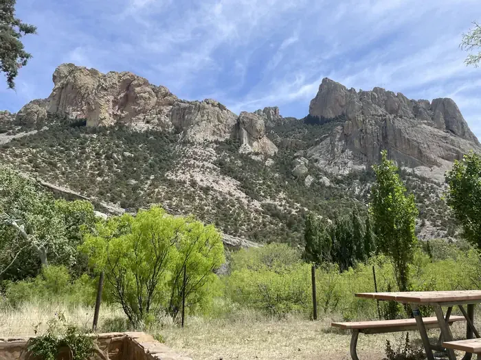
Basin Trail is an 8.8-mile out-and-back hike located in Arizona with 454 feet of elevation gain. The trail offers a moderate experience suitable for hikers seeking a manageable day trip without extreme elevation changes. The out-and-back format allows hikers to turn around at any point, making it adaptable to different fitness levels and time constraints. With nearly 9 miles of total distance, the trail provides a substantial workout while remaining accessible to a wide range of outdoor enthusiasts. The relatively modest elevation gain of 454 feet is spread across the route, creating a gradual ascent rather than steep climbs. This trail is ideal for those looking to explore Arizona's landscape while maintaining a steady, sustainable hiking pace. Whether you're a local seeking a familiar route or a visitor exploring the region, Basin Trail delivers a straightforward hiking experience without unnecessary technical difficulty.
Ash Spring
~3 min drive
2.0 mi · Easy
Herb Martyr
~3 min drive
5.6 mi · Moderate
South Fork Trail #243
~6 min drive
A strenuous 27.56-mile out-and-back trail in Arizona for experienced hikers.
Mushroom Rock
~13 min drive
Easy out-and-back hike to a distinctive rock formation in Arizona.
Bootlegger Trail #257
~4 min drive
5.3 mi · Easy
Rattlesnake
~8 min drive
5.3 mi · Moderate
Green House
~7 min drive
6.5 mi · Hard
Big Balanced Rock
~13 min drive
Short out-and-back hike to a striking balanced rock formation.
Centella
~5 min drive
2.7 mi · Easy
Pinery-Horsefall
~9 min drive
5.4 mi · Moderate