Square Top
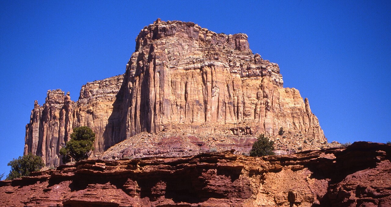 Photo: Bureau of Land Management - Utah, Public domain (via Wikimedia Commons)
- 7,397 ft
- summit
- Bureau of Land Management
- managed by
- May–Oct
- best months
Square Top is a summit of 7,397 feet in Utah, on Bureau of Land Management land within the Price Field Office. The nearest town is Emery, about 22 miles away. Summer is the most comfortable time to visit. Typical averages from a nearby weather station show July highs around 80°F with lows near 53°F, while winter highs stay in the low 30s. Several trails lie close by. The Justensen Flat-Kimball West Trail is about 2 miles away, and the Upper Eagle Canyon Trail and Hebe Canyon Trail are each within about 5 miles. Climbers can find Reds Canyon roughly 6 miles off.
Conditions and forecast
Daily highs and lows, wind and the chance of precipitation at the summit for the next 7 days, from the Open-Meteo model.
- Summit elevation
- 7,397 ft
- Land manager
- Bureau of Land Management
Elevation from USGS 3D Elevation Program terrain data (about 10 m resolution).
We don't know of a mapped trail or route to the summit of Square Top. Plan the approach with local maps, a guidebook or a local guide, and check conditions before you go.
Questions about Square Top
How tall is Square Top?
7,397 ft (2,255 m).
Is there a trail to the top of Square Top?
We don't know of a mapped trail or route to the summit. Plan the approach with local maps, a guidebook or a local guide.
 Cathedral Mountain6,910 ft · Utah1 route32 mi awayPhoto: Kevin Neubauer, CC BY 2.0 (via Wikimedia Commons)
- Hilgard Mountain11,534 ft · Utah1 route36 mi away
- Johnson Mesa5,687 ft · Utah2 routes39 mi away
- Whiskey Knoll11,539 ft · Utah1 route46 mi away
- South Mountain10,391 ft · Utah1 route47 mi away
- South Tent Mountain11,289 ft · Utah1 route49 mi away
- Justensen Flat-Kimball West TrailHiking2.3 mi
- Upper Eagle Canyon TrailHiking4.4 mi
- Hebe Canyon TrailHiking4.7 mi
- Reds CanyonRock climbing5.7 mi
 SwaseylandRock climbingPhoto: hakkun, CC BY-SA 3.0 (via Wikimedia Commons)5.8 mi
- Swasey Cabin TrailHiking5.9 mi
- Moore-Moore Int. TrailHiking6.2 mi
- Upper Muddy CreekRock climbing8.3 mi
Source: Roamze catalog (indexable pages within 10 miles, PostGIS distance)
 Temple MountainSummit · ~22 min drivePhoto: Bureau of Land Management - Utah, Public domain (via Wikimedia Commons)
 Wild Horse ButteSummit · ~28 min drivePhoto: Ken Lund, CC BY-SA 2.0 (via Wikimedia Commons)
 Mollys CastleSummit · ~31 min drivePhoto: CGP Grey, CC BY 2.0 (via Wikimedia Commons)
 Window Blind PeakSummit · ~39 min drivePhoto: Bureau of Land Management - Utah, Public domain (via Wikimedia Commons)
 Bottleneck PeakSummit · ~39 min drivePhoto: U.S. Department of the Interior, CC BY-SA 2.0 (via Wikimedia Commons)
 Factory ButteSummit · ~40 min drivePhoto: Ken Karagozian, CC BY-SA 4.0 (via Wikimedia Commons)
 Assembly Hall PeakSummit · ~41 min drivePhoto: Sandy Brown Jensen, CC BY 2.0 (via Wikimedia Commons)
 Temple of the SunSummit · ~47 min drivePhoto: Amy Washuta, CC BY 2.0 (via Wikimedia Commons)
 Temple of the MoonSummit · ~48 min drivePhoto: tsaiproject from Canada, CC BY 2.0 (via Wikimedia Commons)
 South Caineville MesaSummit · ~53 min drivePhoto: John Fowler from Placitas, NM, USA, CC BY 2.0 (via Wikimedia Commons)
Also worth it near here
- SwaseylandRock climbing · ~10 min drivePhoto: hakkun, CC BY-SA 3.0 (via Wikimedia Commons)
- Chute of Muddy LaunchBoat launch · ~15 min drive
 Dutchman ArchNatural arch · ~15 min drivePhoto: Greg Willis from Denver, CO, usa, CC BY-SA 2.0 (via Wikimedia Commons)
 Swaseys Cabin-Rods Valle TrailHiking · ~15 min drivePhoto: Greg Willis from Denver, CO, usa, CC BY-SA 2.0 (via Wikimedia Commons)
Best time to visit Square Top
Best months: May–October. Best months have typical highs of 55–85 °F, lows of 30 °F or warmer (32 °F where the station doesn't record snow), at most one snowy day and no more than 12 wet days.
Jan
33° / 16°
8 wet
Feb
35° / 18°
8 wet
Mar
43° / 24°
8 wet
Apr
50° / 29°
8 wet
May
61° / 37°
7 wet
Jun
73° / 45°
5 wet
Jul
80° / 53°
7 wet
Aug
77° / 51°
9 wet
Sep
69° / 43°
8 wet
Oct
55° / 33°
7 wet
Nov
41° / 22°
6 wet
Dec
32° / 15°
7 wet
Typical high / low (°F) and days with rain or snow, 1991–2020. Measured at Salina 24 E, UT, 29.7 mi away at 7,560 ft. This station doesn't record snowfall. Source: NOAA NCEI U.S. Climate Normals 1991–2020.
