Moore-Moore Int. Trail
- 1.5 mi
- round trip
- 512 ft
- climb
- 7,156 ft
- high point
- Out and back
- route
- May–Oct
- best months
Caution at last check
Weather is marginal · OpenWeather · checked 15 h ago
The Moore-Moore Int. Trail is an easy out-and-back hike of about 3 miles on Bureau of Land Management land in Utah, within the Price Field Office. The trail is short and gentle, with a total climb of about 500 feet from the start to the high point of about 7,156 feet. Summer is the most comfortable time to go. Typical averages from a nearby weather station show July highs around 80°F and lows near 53°F, while winter highs stay in the low 30s. Eagle Canyon Trail is about 1.8 miles away. Swaseyland, a climbing area, is roughly 5.5 miles off, and the Upper Eagle Canyon Trail lies about 6.3 miles away. The Eva Conover Trail is a little over 4 miles away.
Local outfitters
- Muddy Creek Mining Co.35 mi away
- Sand Creek RV Park & Campground48 mi away
Not on Roamze yet. Their page has how to reach them.
 Eagle Canyon TrailHikingPhoto: Scott Thompson, CC BY 3.0 (via Wikimedia Commons)1.8 mi
- Justensen Flat-Kimball West TrailHiking3.9 mi
- Eva Conover TrailHiking4.1 mi
- Swasey Cabin TrailHiking4.7 mi
 SwaseylandRock climbingPhoto: hakkun, CC BY-SA 3.0 (via Wikimedia Commons)5.5 mi
 Moore Cutoff RoadRock climbingPhoto: inkknife_2000 (7.5 million views +), CC BY-SA 2.0 (via Wikimedia Commons)5.8 mi
- Upper Eagle Canyon TrailHiking6.3 mi
 Head of Sinbad NorthRock climbingPhoto: Greg Willis from Denver, CO, usa, CC BY-SA 2.0 (via Wikimedia Commons)8.1 mi
Source: Roamze catalog (indexable pages within 10 miles, PostGIS distance)
- Swaseys Cabin-Rods Valle TrailHiking · ~13 min drivePhoto: Greg Willis from Denver, CO, usa, CC BY-SA 2.0 (via Wikimedia Commons)
 Coal Wash TrailHiking · ~21 min drivePhoto: inkknife_2000 (7.5 million views +), CC BY-SA 2.0 (via Wikimedia Commons)
 Little Wild Horse Canyon TrailHiking · ~34 min drivePhoto: gregw66, CC BY-SA 2.0 (via Wikimedia Commons)
- Eagle Canyon TrailHiking · ~3 min drivePhoto: Scott Thompson, CC BY 3.0 (via Wikimedia Commons)
 Fix It Pass TrailHiking · ~15 min drivePhoto: inkknife_2000 (7.5 million views +), CC BY-SA 2.0 (via Wikimedia Commons)
 Arsens Garden Loop TrailHiking · ~29 min drivePhoto: U.S. Department of the Interior, CC BY-SA 2.0 (via Wikimedia Commons)
 Waterfall TrailHiking · ~26 min drivePhoto: Greg Willis from Denver, CO, usa, CC BY-SA 2.0 (via Wikimedia Commons)
 Bell Canyon TrailHiking · ~32 min drivePhoto: Greg Willis from Denver, CO, usa, CC BY-SA 2.0 (via Wikimedia Commons)
- Red Draw TrailHiking · ~29 min drivePhoto: U.S. Department of the Interior, CC BY-SA 2.0 (via Wikimedia Commons)
- Molen Wash TrailHiking · ~18 min drive
Also worth it near here
- SwaseylandRock climbing · ~9 min drivePhoto: hakkun, CC BY-SA 3.0 (via Wikimedia Commons)
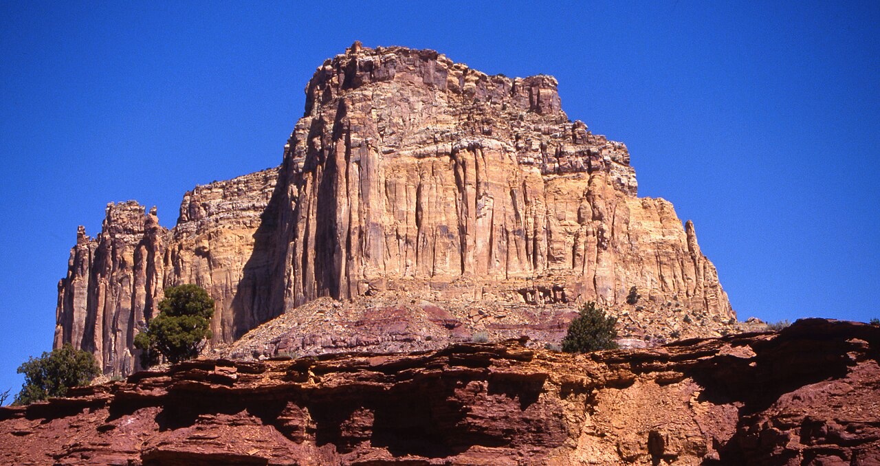 Square TopSummit · ~11 min drivePhoto: Bureau of Land Management - Utah, Public domain (via Wikimedia Commons)
 Dutchman ArchNatural arch · ~12 min drivePhoto: Greg Willis from Denver, CO, usa, CC BY-SA 2.0 (via Wikimedia Commons)
- Twin PondsLake fishing · ~18 min drive
Best time to visit Moore-Moore Int. Trail
Best months: May–October. Best months have typical highs of 55–85 °F, lows of 30 °F or warmer (32 °F where the station doesn't record snow), at most one snowy day and no more than 12 wet days.
Jan
33° / 16°
8 wet
Feb
35° / 18°
8 wet
Mar
43° / 24°
8 wet
Apr
50° / 29°
8 wet
May
61° / 37°
7 wet
Jun
73° / 45°
5 wet
Jul
80° / 53°
7 wet
Aug
77° / 51°
9 wet
Sep
69° / 43°
8 wet
Oct
55° / 33°
7 wet
Nov
41° / 22°
6 wet
Dec
32° / 15°
7 wet
Typical high / low (°F) and days with rain or snow, 1991–2020. Measured at Salina 24 E, UT, 27.3 mi away at 7,560 ft. This station doesn't record snowfall. Source: NOAA NCEI U.S. Climate Normals 1991–2020.
Map and trail data © OpenStreetMap contributors
