Potters Pond
Campground
The next 6 weekends are full on Recreation.gov
No closures listed
The Forest Service lists no closures for Manti-La Sal National Forest.
As of · Source: USFS · Manti-La Sal National Forest. Agencies don't list every closure — check before you go.
South Tent Mountain is a summit in the Ferron Ranger District of Manti-La Sal National Forest in central Utah. The closest town is Spring City, about 10 miles away. The route up is described under South Tent Mountain Summit, a hike that starts about a mile from the peak. For a longer outing, Canal Canyon is another hike close by, a little over a mile out. Several other spots are within reach. Grassy Lake Fishing Site is about 5 miles away and Potters Pond campground is about 6 miles away. Climbers can head to Joe's Valley, roughly 9 miles off.
Potters Pond
Campground
 If it rainsGranary arts, CC BY-SA 4.0 · Wikimedia Commons
Granary Arts
Museum
Places © OpenStreetMap contributors, Places © Overture Maps Foundation · Photos: Granary arts, CC BY-SA 4.0 (commons)
More in Mount PleasantDaily highs and lows, wind and the chance of precipitation at the summit and route start for the next 7 days, from the Open-Meteo model.
Elevation from USGS 3D Elevation Program terrain data (about 10 m resolution).
11,289 ft (3,441 m).
One: South Tent Mountain Summit.


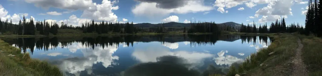 Potters PondCampingPhoto: Recreation.gov (RIDB) / public domain5.9 mi
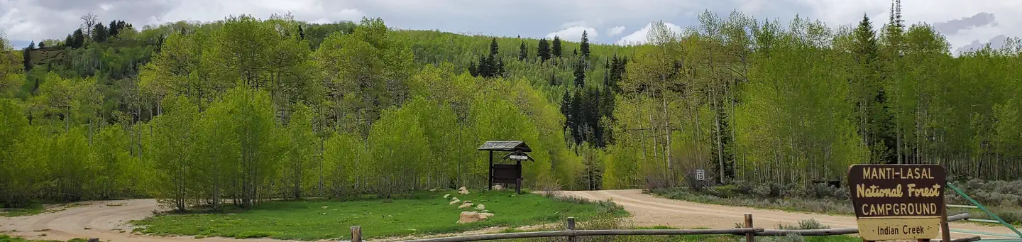 Indian CreekRiver fishing7.3 mi
Source: Roamze catalog (indexable pages within 10 miles, PostGIS distance)
 Temple HillSummit · ~29 min drivePhoto: Bobjgalindo, CC BY-SA 4.0 (via Wikimedia Commons)
 Black MountainSummit · ~47 min drivePhoto: An Errant Knight, CC BY-SA 4.0 (via Wikimedia Commons)
 West HillsSummit · ~1h 1m drivePhoto: inkknife_2000 (7.5 million views +), CC BY-SA 2.0 (via Wikimedia Commons)
 Bottleneck PeakSummit · ~1h 13m drivePhoto: U.S. Department of the Interior, CC BY-SA 2.0 (via Wikimedia Commons)
 Dry MountainSummit · ~1h 13m drivePhoto: An Errant Knight, CC BY-SA 4.0 (via Wikimedia Commons)
 Assembly Hall PeakSummit · ~1h 15m drivePhoto: Sandy Brown Jensen, CC BY 2.0 (via Wikimedia Commons)
 Window Blind PeakSummit · ~1h 16m drivePhoto: Bureau of Land Management - Utah, Public domain (via Wikimedia Commons)
 Warm Springs MountainSummit · ~1h 21m drivePhoto: An Errant Knight, CC BY-SA 4.0 (via Wikimedia Commons)
 Little MountainSummit · ~1h 22m drivePhoto: An Errant Knight, CC BY-SA 4.0 (via Wikimedia Commons)
 Spanish Fork PeakSummit · ~1h 24m drivePhoto: An Errant Knight, CC BY-SA 4.0 (via Wikimedia Commons)
