Window Blind Peak
 Photo: Bureau of Land Management - Utah, Public domain (via Wikimedia Commons)
- 7,028 ft
- summit
- Bureau of Land Management
- managed by
- Apr–Jun, Sep–Oct
- best months
Window Blind Peak is a summit of 7,028 feet in the Mexican Mountain Wilderness, on land managed by the Bureau of Land Management's Price Field Office in Utah. The nearest town is Castle Dale, about 23 miles away. Spring and fall are the most comfortable times to visit. Typical averages from a nearby weather station in Castle Dale show May highs around 75°F and October highs around 68°F, while July averages about 91°F and winter lows drop to around 10°F. That station sits roughly 1,400 feet below the peak, so temperatures on the summit run cooler. San Rafael Swinging Bridge Campground and Equestrian Campground are both within about 2.5 miles, and the San Rafael Swell - North climbing area is about 2.7 miles away. The Oil Well Flat Trail is about 3.5 miles off.
Conditions and forecast
Daily highs and lows, wind and the chance of precipitation at the summit for the next 7 days, from the Open-Meteo model.
- Summit elevation
- 7,028 ft
- Land manager
- Bureau of Land Management
Elevation from USGS 3D Elevation Program terrain data (about 10 m resolution).
We don't know of a mapped trail or route to the summit of Window Blind Peak. Plan the approach with local maps, a guidebook or a local guide, and check conditions before you go.
Questions about Window Blind Peak
How tall is Window Blind Peak?
7,028 ft (2,142 m).
Is there a trail to the top of Window Blind Peak?
We don't know of a mapped trail or route to the summit. Plan the approach with local maps, a guidebook or a local guide.
- Three Golden Stairs5,007 ft · Utah1 route36 mi away
- South Tent Mountain11,289 ft · Utah1 route45 mi away
- North Tent Mountain11,230 ft · Utah1 route46 mi away
- South Mountain10,391 ft · Utah1 route47 mi away
- Hilgard Mountain11,534 ft · Utah1 route54 mi away
 Cathedral Mountain6,910 ft · Utah1 route54 mi awayPhoto: Kevin Neubauer, CC BY 2.0 (via Wikimedia Commons)
- San Rafael Swinging Bridge CampgroundCamping2.4 mi
- Equestrian CampgroundCamping2.5 mi
 Dylan WallRock climbingPhoto: Famartin, CC BY-SA 4.0 (via Wikimedia Commons)2.7 mi
 San Rafael Swell - NorthRock climbingPhoto: Famartin, CC BY-SA 4.0 (via Wikimedia Commons)2.7 mi
 Eagle CanyonRock climbingPhoto: Famartin, CC BY-SA 4.0 (via Wikimedia Commons)3.3 mi
- Oil Well Flat TrailHiking3.5 mi
 Little Grand Canyon TrailHikingPhoto: Greg Willis from Denver, CO, usa, CC BY-SA 2.0 (via Wikimedia Commons)3.5 mi
 San Rafael RiverCanoeingPhoto: G. Thomas at English Wikipedia, Public domain (via Wikimedia Commons)9.2 mi
Source: Roamze catalog (indexable pages within 10 miles, PostGIS distance)
 Assembly Hall PeakSummit · ~3 min drivePhoto: Sandy Brown Jensen, CC BY 2.0 (via Wikimedia Commons)
 Bottleneck PeakSummit · ~3 min drivePhoto: U.S. Department of the Interior, CC BY-SA 2.0 (via Wikimedia Commons)
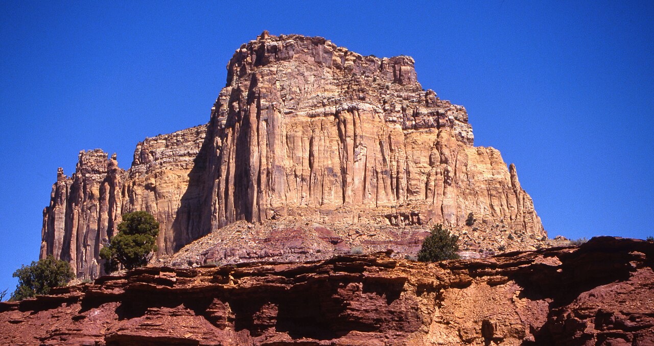 Square TopSummit · ~39 min drivePhoto: Bureau of Land Management - Utah, Public domain (via Wikimedia Commons)
 Temple MountainSummit · ~42 min drivePhoto: Bureau of Land Management - Utah, Public domain (via Wikimedia Commons)
 Mollys CastleSummit · ~55 min drivePhoto: CGP Grey, CC BY 2.0 (via Wikimedia Commons)
 Wild Horse ButteSummit · ~55 min drivePhoto: Ken Lund, CC BY-SA 2.0 (via Wikimedia Commons)
 Factory ButteSummit · ~1h 16m drivePhoto: Ken Karagozian, CC BY-SA 4.0 (via Wikimedia Commons)
 Black MountainSummit · ~1h 17m drivePhoto: An Errant Knight, CC BY-SA 4.0 (via Wikimedia Commons)
 North Caineville MesaSummit · ~1h 21m drivePhoto: DXR, CC BY-SA 3.0 (via Wikimedia Commons)
- Three Golden StairsSummit · ~1h 2m drive
Best time to visit Window Blind Peak
Best months: April–June and September–October. Best months have typical highs of 55–85 °F, lows of 30 °F or warmer (32 °F where the station doesn't record snow), at most one snowy day and no more than 12 wet days.
Jan
40° / 10°
5 wet · 2 snow
Feb
47° / 16°
4 wet · 2 snow
Mar
58° / 25°
4 wet · 1 snow
Apr
66° / 31°
4 wet
May
75° / 40°
5 wet
Jun
85° / 47°
4 wet
Jul
91° / 54°
5 wet
Aug
89° / 52°
7 wet
Sep
81° / 43°
6 wet
Oct
68° / 32°
5 wet
Nov
53° / 20°
4 wet · 1 snow
Dec
41° / 11°
4 wet · 2 snow
Typical high / low (°F) and days with rain or snow, 1991–2020. Measured at Castle Dale, UT, 22.2 mi away at 5,629 ft. The station sits about 1,400 ft lower than this place, so expect it a little cooler here. Source: NOAA NCEI U.S. Climate Normals 1991–2020.
