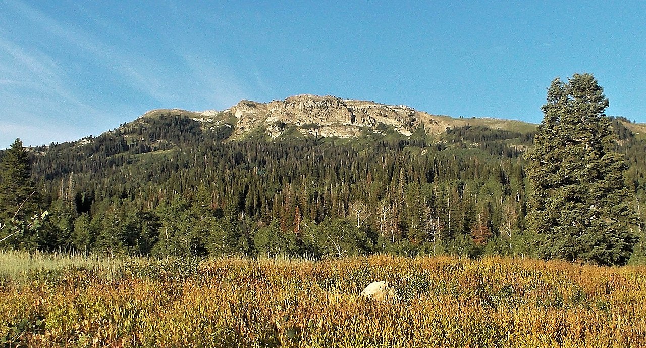
Mount Ogden
 Photo: GreenGlass1972 at en.wikipedia, Public domain (via Wikimedia Commons)
- 9,566 ft
- summit
- Forest Service
- managed by
Is Mount Ogden open right now?
No closures listed
The Forest Service lists no closures for Uinta-Wasatch-Cache National Forest.
As of · Source: USFS · Uinta-Wasatch-Cache National Forest. Agencies don't list every closure — check before you go.
Mount Ogden is a summit in Weber County, Utah, rising to about 9,566 feet in the Ogden Ranger District of the Uinta-Wasatch-Cache National Forest. The Forest Service manages the land, and the nearest town is South Ogden, about 4.4 miles away. The Great Western Trail - Utah passes about 0.2 miles from the summit, with Malans Basin mountain biking and the Snowbasin climbing area also within half a mile. For an overnight base, Maples Campground sits about 2.1 miles away.
Conditions and forecast
Daily highs and lows, wind and the chance of precipitation at the summit for the next 7 days, from the Open-Meteo model.
- Summit elevation
- 9,566 ft
- Land manager
- Forest Service
Elevation from USGS 3D Elevation Program terrain data (about 10 m resolution).
We don't know of a mapped trail or route to the summit of Mount Ogden. Plan the approach with local maps, a guidebook or a local guide, and check conditions before you go.
Questions about Mount Ogden
How tall is Mount Ogden?
9,566 ft (2,916 m).
Is there a trail to the top of Mount Ogden?
We don't know of a mapped trail or route to the summit. Plan the approach with local maps, a guidebook or a local guide.
- Allen Peak9,467 ft · Utah1 route0.3 mi away
- De Moisy Peak9,363 ft · Utah1 route0.9 mi away
- Malans Peak6,944 ft · Utah1 route1.9 mi away
 Lewis Peak8,033 ft · Utah1 route5.8 mi awayPhoto: Chris Light, CC BY-SA 4.0 (via Wikimedia Commons)
- Thurston Peak9,706 ft · Utah1 route8.3 mi away
 Ben Lomond9,702 ft · Utah1 route12 mi awayPhoto: Joe Tordiff, CC BY-SA 2.0 (via Wikimedia Commons)
- Great Western Trail - UtahHiking0.2 mi
- Malans BasinMountain biking0.3 mi
- SnowbasinRock climbing0.4 mi
- Maples CampgroundCamping2.1 mi
- The PlatformRock climbing2.5 mi
 Ogden RiverCanoeingPhoto: GreenGlass1972, Public domain (via Wikimedia Commons)3.4 mi
- Anderson CoveCamping6.1 mi
 Weber RiverCanoeingPhoto: User:Sexygreatgrama, CC BY-SA 3.0 (via Wikimedia Commons)7.3 mi
Source: Roamze catalog (indexable pages within 10 miles, PostGIS distance)
- Lewis PeakSummit · ~10 min drivePhoto: Chris Light, CC BY-SA 4.0 (via Wikimedia Commons)
- Ben LomondSummit · ~21 min drivePhoto: Joe Tordiff, CC BY-SA 2.0 (via Wikimedia Commons)
 Willard PeakSummit · ~23 min drivePhoto: Intermountain Forest Service, USDA Region 4 Photography, Public domain (via Wikimedia Commons)
 Bountiful PeakSummit · ~28 min drivePhoto: Andrey Zharkikh, CC BY 2.0 (via Wikimedia Commons)
 Elephant HeadSummit · ~41 min drivePhoto: Chris Light, CC BY-SA 4.0 (via Wikimedia Commons)
 Frary PeakSummit · ~41 min drivePhoto: The Utahraptor (talk), CC BY 3.0 (via Wikimedia Commons)
 Grandview PeakSummit · ~43 min drivePhoto: Kvforester, CC BY-SA 4.0 (via Wikimedia Commons)
 Ensign PeakSummit · ~48 min drivePhoto: Beneathtimp, CC0 (via Wikimedia Commons)
 Mount Van CottSummit · ~50 min drivePhoto: Template:Author federal, Public domain (via Wikimedia Commons)
 Red ButteSummit · ~51 min drivePhoto: Milonica, CC BY-SA 3.0 (via Wikimedia Commons)
