Bountiful Peak
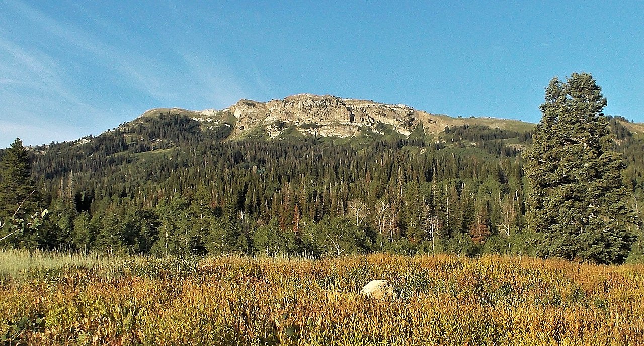 Photo: Andrey Zharkikh, CC BY 2.0 (via Wikimedia Commons)
- 9,256 ft
- summit
- 2
- ways up
- Forest Service
- managed by
Is Bountiful Peak open right now?
No closures listed
The Forest Service lists no closures for Uinta-Wasatch-Cache National Forest.
As of · Source: USFS · Uinta-Wasatch-Cache National Forest. Agencies don't list every closure — check before you go.
Bountiful Peak is a summit of 9,256 feet in the Salt Lake Ranger District of the Uinta-Wasatch-Cache National Forest in Utah, about 4.3 miles from the town of Centerville. The Forest Service manages the land. The Bountiful Peak Trail starts just 0.1 mile away and is the natural way to reach the summit. The Bountiful Peak Campground sits about 1.3 miles off, and the Great Western Trail is about 1.5 miles away, so the peak fits into a day of hiking in the surrounding area.
Conditions and forecast
Daily highs and lows, wind and the chance of precipitation at the summit and route start for the next 7 days, from the Open-Meteo model.
- Summit elevation
- 9,256 ft
- Land manager
- Forest Service
Elevation from USGS 3D Elevation Program terrain data (about 10 m resolution).
- Bountiful Peak TrailHardabout 3,735 ft of climbing13.2 mi round trip
- Skyline DriveHardabout 2,042 ft of climbing15.4 mi round trip
Compare the routes Bountiful Peak Trail Skyline Drive Climbing About 3,735 ft About 2,042 ft Round trip 13.2 mi 15.4 mi Difficulty Hard Hard Terrain Hike Hike Map © Mapbox © OpenStreetMap contributors Questions about Bountiful Peak
How tall is Bountiful Peak?
9,256 ft (2,821 m).
How many routes go to the summit of Bountiful Peak?
2: Bountiful Peak Trail and Skyline Drive.
What is the shortest route up Bountiful Peak?
Bountiful Peak Trail, about 13.2 mi round trip.
- Cave Peak6,806 ft · Utah2 routes8.0 mi away
- Thurston Peak9,706 ft · Utah1 route8.3 mi away
- Rudys Flat7,166 ft · Utah3 routes8.6 mi away
- Lookout Peak8,952 ft · Utah1 route10 mi away
- Twin Peaks6,290 ft · Utah3 routes12 mi away
 Ensign Peak5,417 ft · Utah2 routes12 mi awayPhoto: Beneathtimp, CC0 (via Wikimedia Commons)
- Bountiful Peak TrailHiking0.1 mi
- Farmington Flat RoadHiking1.3 mi
- G2 Connector TrailHiking1.3 mi
- Bountiful Peak CgCamping1.3 mi
- Great Western TrailHiking1.5 mi
- Farmington CragRock climbing3 mi
- FarmingtonRock climbing3.4 mi
- BountifulRock climbing3.7 mi
Source: Roamze catalog (indexable pages within 10 miles, PostGIS distance)
 Grandview PeakSummit · ~15 min drivePhoto: Kvforester, CC BY-SA 4.0 (via Wikimedia Commons)
- Ensign PeakSummit · ~21 min drivePhoto: Beneathtimp, CC0 (via Wikimedia Commons)
 Mount Van CottSummit · ~22 min drivePhoto: Template:Author federal, Public domain (via Wikimedia Commons)
 Red ButteSummit · ~22 min drivePhoto: Milonica, CC BY-SA 3.0 (via Wikimedia Commons)
 Mount WireSummit · ~23 min drivePhoto: Milonica at English Wikipedia, CC BY-SA 3.0 (via Wikimedia Commons)
 Mount OgdenSummit · ~28 min drivePhoto: GreenGlass1972 at en.wikipedia, Public domain (via Wikimedia Commons)
 Grandeur PeakSummit · ~31 min drivePhoto: summitcheese, CC BY-SA 2.0 (via Wikimedia Commons)
 Mount AireSummit · ~31 min drivePhoto: Ken Lund, CC BY-SA 2.0 (via Wikimedia Commons)
 Frary PeakSummit · ~36 min drivePhoto: The Utahraptor (talk), CC BY 3.0 (via Wikimedia Commons)
 Mount OlympusSummit · ~37 min drivePhoto: Cory Maylett (talk · contribs), CC BY-SA 3.0 (via Wikimedia Commons)
Also worth it near here
- Bonneville Shoreline NorthMountain biking · ~5 min drive
- SunsetCamping · ~5 min drive
 Farmington CanyonRock climbing · ~7 min drivePhoto: Marion Jensen, CC BY 3.0 (via Wikimedia Commons)
 Robert N. Hasenyager Great Salt Lake Nature Center TrailHiking · ~9 min drivePhoto: gary_leavens, CC BY-SA 2.0 (via Wikimedia Commons)
