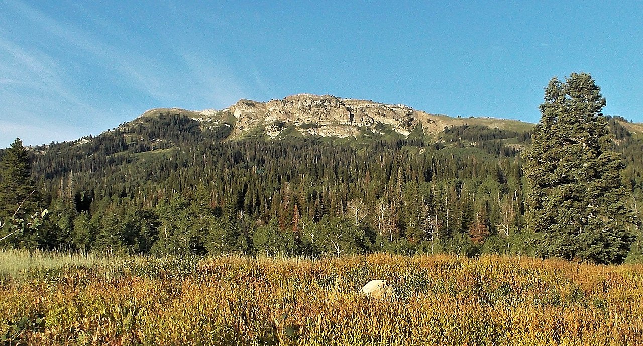
Grandview Peak
 Photo: Kvforester, CC BY-SA 4.0 (via Wikimedia Commons)
- 9,404 ft
- summit
Is Grandview Peak open right now?
No closures listed
The Forest Service lists no closures for Uinta-Wasatch-Cache National Forest.
As of · Source: USFS · Uinta-Wasatch-Cache National Forest. Agencies don't list every closure — check before you go.
Grandview Peak is a summit of about 9,404 feet in Salt Lake County, Utah, within the Salt Lake Ranger District of the Uinta-Wasatch-Cache National Forest. The nearest town is Emigration Canyon, about 4.4 miles away. Three hikes start about 1.5 miles away: Grandview Route, Meadows Trail and Upper City Creek. Freeze Creek, a climbing area, is about 3.8 miles off.
Conditions and forecast
Daily highs and lows, wind and the chance of precipitation at the summit for the next 7 days, from the Open-Meteo model.
- Summit elevation
- 9,404 ft
Elevation from USGS 3D Elevation Program terrain data (about 10 m resolution).
We don't know of a mapped trail or route to the summit of Grandview Peak. Plan the approach with local maps, a guidebook or a local guide, and check conditions before you go.
Questions about Grandview Peak
How tall is Grandview Peak?
9,404 ft (2,866 m).
Is there a trail to the top of Grandview Peak?
We don't know of a mapped trail or route to the summit. Plan the approach with local maps, a guidebook or a local guide.
- Lookout Peak8,952 ft · Utah1 route2.2 mi away
- Rudys Flat7,166 ft · Utah3 routes3.2 mi away
- Cave Peak6,806 ft · Utah2 routes4.3 mi away
 Red Butte6,613 ft · Utah1 route6.0 mi awayPhoto: Milonica, CC BY-SA 3.0 (via Wikimedia Commons)
 Mount Van Cott6,348 ft · Utah2 routes6.0 mi awayPhoto: Template:Author federal, Public domain (via Wikimedia Commons)
- Twin Peaks6,290 ft · Utah3 routes6.1 mi away
- Grandview RouteHiking1.5 mi
- Meadows TrailHiking1.5 mi
- UPPER CITY CREEKHiking1.5 mi
- Freeze CreekRock climbing3.8 mi
- Freezer ButtressRock climbing3.8 mi
- BoulderingRock climbing4.7 mi
- East Canyon CreekCanoeing7.2 mi
- Bountiful Peak CgCamping9.3 mi
Source: Roamze catalog (indexable pages within 10 miles, PostGIS distance)
- Red ButteSummit · ~10 min drivePhoto: Milonica, CC BY-SA 3.0 (via Wikimedia Commons)
- Mount Van CottSummit · ~10 min drivePhoto: Template:Author federal, Public domain (via Wikimedia Commons)
 Mount WireSummit · ~10 min drivePhoto: Milonica at English Wikipedia, CC BY-SA 3.0 (via Wikimedia Commons)
 Ensign PeakSummit · ~14 min drivePhoto: Beneathtimp, CC0 (via Wikimedia Commons)
 Bountiful PeakSummit · ~15 min drivePhoto: Andrey Zharkikh, CC BY 2.0 (via Wikimedia Commons)
 Mount AireSummit · ~16 min drivePhoto: Ken Lund, CC BY-SA 2.0 (via Wikimedia Commons)
 Grandeur PeakSummit · ~17 min drivePhoto: summitcheese, CC BY-SA 2.0 (via Wikimedia Commons)
 Gobblers KnobSummit · ~22 min drivePhoto: Derrellwilliams, CC BY-SA 4.0 (via Wikimedia Commons)
 Mount OlympusSummit · ~23 min drivePhoto: Cory Maylett (talk · contribs), CC BY-SA 3.0 (via Wikimedia Commons)
 Mount RaymondSummit · ~23 min drivePhoto: Derrellwilliams, CC BY-SA 4.0 (via Wikimedia Commons)

