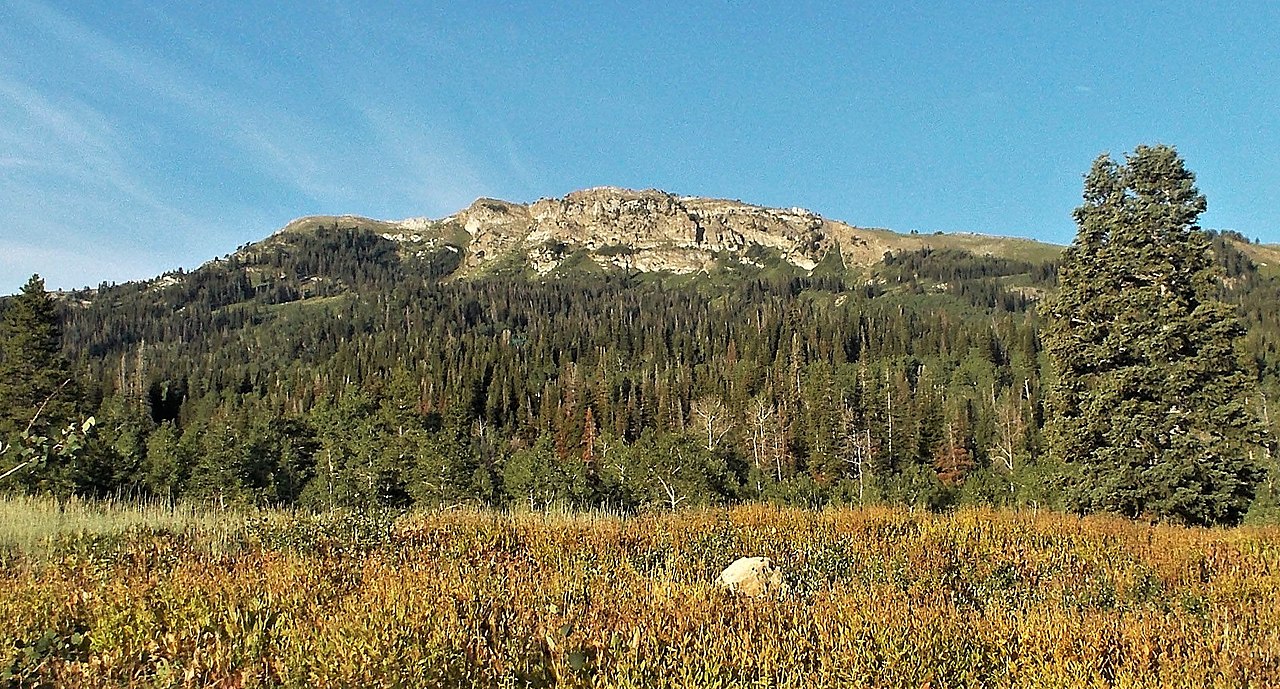
Ensign Peak
 Photo: Beneathtimp, CC0 (via Wikimedia Commons)
- 5,417 ft
- summit
- 2
- ways up
- City Land
- managed by
- May–Jun, Sep–Oct
- best months
Ensign Peak is a summit of 5,417 feet in Ensign Peak Nature Park, a city-managed park about 2.4 miles from Salt Lake City, Utah. The peak sits within the park's own land, and several trails start within a short distance of it. Late spring and early fall are the most comfortable times to go. Typical averages from a nearby weather station show May highs around 69°F and September highs around 78°F, while July climbs to about 89°F and winter brings frequent snow days. The South Ensign Peak Trail, West Ensign Peak Trail and Ensign Peak Trail all lie about 0.2 miles away, and Hell Canyon Trail is about 0.3 miles off. City Creek Canyon, a climbing area, is roughly 0.9 miles away.
Conditions and forecast
Daily highs and lows, wind and the chance of precipitation at the summit and route start for the next 7 days, from the Open-Meteo model.
- Summit elevation
- 5,417 ft
- Land manager
- City Land
Elevation from USGS 3D Elevation Program terrain data (about 10 m resolution).
- Ensign Peak TrailEasyabout 304 ft of climbing0.9 mi round trip
- West Ensign Peak TrailEasyabout 373 ft of climbing0.7 mi
Compare the routes Ensign Peak Trail West Ensign Peak Trail Climbing About 304 ft About 373 ft Round trip 0.9 mi 0.7 mi Difficulty Easy Easy Terrain Hike Hike Map © Mapbox © OpenStreetMap contributors Questions about Ensign Peak
How tall is Ensign Peak?
5,417 ft (1,651 m).
How many routes go to the summit of Ensign Peak?
2: Ensign Peak Trail and West Ensign Peak Trail.
What is the shortest route up Ensign Peak?
West Ensign Peak Trail, about 0.7 mi.
- Twin Peaks6,290 ft · Utah3 routes2.6 mi away
 Mount Van Cott6,348 ft · Utah2 routes3.7 mi awayPhoto: Template:Author federal, Public domain (via Wikimedia Commons)
 Red Butte6,613 ft · Utah1 route4.7 mi awayPhoto: Milonica, CC BY-SA 3.0 (via Wikimedia Commons)
- Cave Peak6,806 ft · Utah2 routes4.8 mi away
 Mount Wire7,139 ft · Utah3 routes5.1 mi awayPhoto: Milonica at English Wikipedia, CC BY-SA 3.0 (via Wikimedia Commons)
- Rudys Flat7,166 ft · Utah3 routes5.2 mi away
- South Ensign Peak TrailHiking0.2 mi
- West Ensign Peak TrailHiking0.2 mi
- Ensign Peak TrailHiking0.2 mi
- Hell Canyon TrailHiking0.3 mi
- City Creek CanyonRock climbing0.9 mi
- Shoreline CragRock climbing1 mi
- The RattleHornRock climbing1.4 mi
 Jordan RiverCanoeingPhoto: Andrey Zharkikh from Salt Lake City, USA, CC BY 2.0 (via Wikimedia Commons)8.8 mi
Source: Roamze catalog (indexable pages within 10 miles, PostGIS distance)
- Mount Van CottSummit · ~6 min drivePhoto: Template:Author federal, Public domain (via Wikimedia Commons)
- Red ButteSummit · ~8 min drivePhoto: Milonica, CC BY-SA 3.0 (via Wikimedia Commons)
- Mount WireSummit · ~9 min drivePhoto: Milonica at English Wikipedia, CC BY-SA 3.0 (via Wikimedia Commons)
 Grandview PeakSummit · ~14 min drivePhoto: Kvforester, CC BY-SA 4.0 (via Wikimedia Commons)
 Grandeur PeakSummit · ~16 min drivePhoto: summitcheese, CC BY-SA 2.0 (via Wikimedia Commons)
 Mount OlympusSummit · ~20 min drivePhoto: Cory Maylett (talk · contribs), CC BY-SA 3.0 (via Wikimedia Commons)
 Mount AireSummit · ~20 min drivePhoto: Ken Lund, CC BY-SA 2.0 (via Wikimedia Commons)
 Bountiful PeakSummit · ~21 min drivePhoto: Andrey Zharkikh, CC BY 2.0 (via Wikimedia Commons)
 Mount RaymondSummit · ~23 min drivePhoto: Derrellwilliams, CC BY-SA 4.0 (via Wikimedia Commons)
 Gobblers KnobSummit · ~24 min drivePhoto: Derrellwilliams, CC BY-SA 4.0 (via Wikimedia Commons)
Best time to visit Ensign Peak
Best months: May–June and September–October. Best months have typical highs of 55–85 °F, lows of 30 °F or warmer (32 °F where the station doesn't record snow), at most one snowy day and no more than 12 wet days.
Jan
38° / 19°
11 wet · 8 snow
Feb
43° / 22°
10 wet · 6 snow
Mar
52° / 29°
10 wet · 5 snow
Apr
59° / 34°
10 wet · 3 snow
May
69° / 41°
9 wet · 1 snow
Jun
80° / 49°
6 wet
Jul
89° / 57°
4 wet
Aug
87° / 56°
5 wet
Sep
78° / 47°
6 wet
Oct
63° / 36°
8 wet · 1 snow
Nov
48° / 27°
9 wet · 4 snow
Dec
37° / 20°
11 wet · 8 snow
Typical high / low (°F) and days with rain or snow, 1991–2020. Measured at City Creek Wtp, UT, 3.4 mi away at 5,340 ft. Source: NOAA NCEI U.S. Climate Normals 1991–2020.

