The Notch Trail
- 8.1 mi
- round trip
- 691 ft
- climb
- 7,837 ft
- high point
- Out and back
- route
- Apr–Jun, Aug–Oct
- best months
Is The Notch Trail open right now?
Alert in the area
The Forest Service lists an alert for Monticello Ranger District.
Hazardous Road Conditions – Moab Monticello Ranger Districts 11.4.2026
Agency alert covering Monticello Ranger District · USFS · Monticello Ranger District
As of · Source: USFS · Monticello Ranger District. Agencies don't list every closure — check before you go.
The Notch Trail is a hard hike of about 8 miles in the Dark Canyon Wilderness of Utah's Manti-La Sal National Forest, within the Monticello Ranger District. It is a natural-surface trail, and the route is out and back, with the high point at 7,837 feet and the low point at 7,176 feet. The trail is managed by the Forest Service and is open year-round. Horses are allowed, but bikes are not. The most comfortable months for a visit are typically May and September, when typical averages from a nearby weather station run from highs of about 71°F to 77°F and lows in the low 40s and around 50°F. That station sits roughly 1,300 feet lower than the trail's high point, so temperatures on the trail run cooler. The Dark Canyon East Trail lies just 0.2 miles away. Posey is about 1.3 miles off, Drift Canyon Overlook about 3 miles, and Hammond Canyon about 4 miles.
Local outfitters
- Coral Sands RV Park34 mi away
Not on Roamze yet. Their page has how to reach them.
- Dark Canyon East TrailHiking0.2 mi
- PoseyHiking1.3 mi
- Drift Canyon OverlookHiking3 mi
- HORSE PASTURE CANYONHiking3.3 mi
- Hammond CanyonHiking4.1 mi
- KIGALIA CANYON TRAILHiking4.3 mi
 Cream Pots (Sz)HikingPhoto: Ken Lund from Reno, Nevada, USA, CC BY-SA 2.0 (via Wikimedia Commons)4.4 mi
- Brushy KnollHiking4.5 mi
Source: Roamze catalog (indexable pages within 10 miles, PostGIS distance)
- Cream Pots (Sz)Hiking · ~8 min drivePhoto: Ken Lund from Reno, Nevada, USA, CC BY-SA 2.0 (via Wikimedia Commons)
 Dark CanyonHiking · ~11 min drivePhoto: Ken Lund from Reno, Nevada, USA, CC BY-SA 2.0 (via Wikimedia Commons)
- Dark Canyon East TrailHiking · Next door
- Woodenshoe RoadHiking · ~14 min drive
- Rig Canyon Trail - 5161Hiking · ~12 min drivePhoto: Ken Lund from Reno, Nevada, USA, CC BY-SA 2.0 (via Wikimedia Commons)
- Horse Pasture CanyonHiking · ~6 min drive
- Drift Canyon OverlookHiking · ~5 min drive
- Posey Canyon TrailHiking · ~8 min drive
- Peavine CanyonHiking · ~8 min drive
- HORSE PASTURE CANYONHiking · ~6 min drive
Also worth it near here
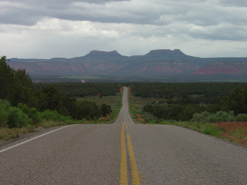 Bears EarsSummit · ~16 min drivePhoto: U.S. Geological Surey, Public domain (via Wikimedia Commons)
 Lyman Canyon OverlookMountain biking · ~17 min drivePhoto: brewbooks from near Seattle, USA, CC BY-SA 2.0 (via Wikimedia Commons)
 Arch CanyonRock climbing · ~17 min drivePhoto: BLMUtah, Public domain (via Wikimedia Commons)
- NizhoniCamping · ~22 min drive
Best time to visit The Notch Trail
Best months: April–June and August–October. Best months have typical highs of 55–85 °F, lows of 30 °F or warmer (32 °F where the station doesn't record snow), at most one snowy day and no more than 12 wet days.
Jan
39° / 20°
6 wet · 4 snow
Feb
43° / 24°
6 wet · 3 snow
Mar
53° / 30°
5 wet · 2 snow
Apr
60° / 35°
5 wet · 1 snow
May
71° / 44°
5 wet
Jun
83° / 54°
3 wet
Jul
89° / 60°
7 wet
Aug
85° / 58°
8 wet
Sep
77° / 51°
6 wet
Oct
63° / 39°
5 wet
Nov
50° / 29°
4 wet · 2 snow
Dec
39° / 20°
6 wet · 4 snow
Typical high / low (°F) and days with rain or snow, 1991–2020. Measured at Natural Bridges Nm, UT, 14.7 mi away at 6,508 ft. The station sits about 1,300 ft lower than this place, so expect it a little cooler here. Source: NOAA NCEI U.S. Climate Normals 1991–2020.
