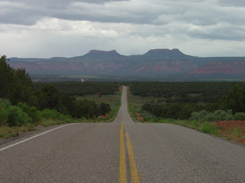
Drift Canyon Overlook
- 1.2 mi
- round trip
- 141 ft
- climb
- 8,723 ft
- high point
- Out and back
- route
- May–Oct
- best months
Is Drift Canyon Overlook open right now?
Alert in the area
The Forest Service lists an alert for Monticello Ranger District.
Hazardous Road Conditions – Monticello Ranger District 11.4.2026
Agency alert covering Monticello Ranger District · USFS · Monticello Ranger District
As of · Source: USFS · Monticello Ranger District. Agencies don't list every closure — check before you go.
Drift Canyon Overlook is an easy out-and-back hike in Utah's Manti-La Sal National Forest, within the Monticello Ranger District. The trail is short, about 1.2 miles long with a climb of 141 feet, so it works well as a quick stop or a warm-up before a longer outing in the area. The trail is natural-surfaced and open to bikes. The Forest Service manages the surrounding land, and the route is open year-round. For comfortable weather, late spring and early fall are the sweet spots. Typical averages from a nearby weather station at Monticello show May highs around 67°F and September highs around 74°F, while winter highs there stay in the upper 30s. Horse Pasture Canyon lies about 0.9 miles away, and Redd Pasture (446) is roughly 1.9 miles off. The Notch Trail and Dark Canyon East Trail are both about 3 miles away.
Local outfitters
- Coral Sands RV Park37 mi away
Not on Roamze yet. Their page has how to reach them.
Best time to go · May–Oct
Best time to visit Drift Canyon Overlook
Best months: May–October. Best months have typical highs of 55–85 °F, lows of 30 °F or warmer (32 °F where the station doesn't record snow), at most one snowy day and no more than 12 wet days.
Jan
37° / 17°
Feb
41° / 20°
Mar
50° / 26°
Apr
58° / 31°
May
67° / 39°
Jun
79° / 48°
Jul
84° / 55°
Aug
81° / 54°
Sep
74° / 46°
Oct
62° / 36°
Nov
48° / 26°
Dec
38° / 17°
Typical high / low (°F) and days with rain or snow, 1991–2020. Measured at Monticello #2, UT, 24.3 mi away at 7,086 ft. The station sits about 1,600 ft lower than this place, so expect it a little cooler here. This station doesn't record snowfall. Source: NOAA NCEI U.S. Climate Normals 1991–2020.
Keep exploring — more trails worth the drive
 Photo: Ken Lund from Reno, Nevada, USA, CC BY-SA 2.0 (via Wikimedia Commons)
Dark Canyon
~8 min drive
26.83-mile out-and-back trail in Utah with 642 ft elevation gain.
Photo: Ken Lund from Reno, Nevada, USA, CC BY-SA 2.0 (via Wikimedia Commons)Rig Canyon Trail - 5161
~9 min drive
5.96-mile out-and-back hike in Utah with 1,512 ft gain and 8,135 ft max elevation.
HIKE
HORSE PASTURE CANYON
~2 min drive
1.02-mile out-and-back trail in Utah with 981 ft elevation gain and loss.
HIKE
Horse Pasture Canyon
~2 min drive
7.98-mile out-and-back trail in Utah with 1,414 ft of elevation gain.
 Photo: Ken Lund from Reno, Nevada, USA, CC BY-SA 2.0 (via Wikimedia Commons)
Cream Pots (Sz)
~12 min drive
3.51-mile out-and-back trail in Utah with 230 ft elevation gain.
HIKE
Redd Pasture (446)
~3 min drive
2.56-mile out-and-back trail in Utah with 124 ft elevation gain.
HIKE
The Notch Trail
~5 min drive
8.08-mile out-and-back trail in Utah with 440 ft of elevation gain.
HIKE
Gooseberry Trail
~7 min drive
7.38-mile out-and-back hike in Utah with 1,912 ft elevation gain
HIKE
Dark Canyon East Trail
~5 min drive
0.6-mile out-and-back hike in Utah with 373 ft gain and 8,321 ft max elevation
HIKE
Brushy Knoll
~9 min drive
9.0-mile out-and-back trail in Utah with 1,889 ft elevation gain.