Woodenshoe Road
- 41.4 mi
- round trip
- 4,774 ft
- climb
- 8,501 ft
- high point
- Out and back
- route
- May–Oct
- best months
Is Woodenshoe Road open right now?
Alert in the area
The Forest Service lists an alert for Monticello Ranger District.
Hazardous Road Conditions – Moab Monticello Ranger Districts 11.4.2026
Agency alert covering Monticello Ranger District · USFS · Monticello Ranger District
As of · Source: USFS · Monticello Ranger District. Agencies don't list every closure — check before you go.
Woodenshoe Road is a long, steep out-and-back hike in the Monticello Ranger District of Manti-La Sal National Forest in southeastern Utah. The route starts at about 5,100 feet and climbs to a high point of 8,500 feet, with a total elevation gain of about 4,800 feet over a distance of roughly 83 miles. The Forest Service manages the land, and the trail is an expert-level route. Summer is the most comfortable time to go. Typical averages from a nearby weather station in Monticello show July highs around 84°F with lows near 55°F, while temperatures at the high point run cooler than that station. Winter is cold, with January highs near 37°F and lows around 17°F. The closest trails are Arch Canyon Overlook Trail, about 1.5 miles away, and Peavine Canyon, about 1.6 miles away. Lyman Canyon Overlook is about 1.7 miles off, and the Bears Ears Loop mountain biking route is about 2.5 miles away.
Local outfitters
- Coral Sands RV Park30 mi away
- Sacred Monument Tours48 mi away
Not on Roamze yet. Their page has how to reach them.
- Arch Canyon Overlook TrailHiking1.5 mi
- Peavine CanyonHiking1.6 mi
- Lyman Canyon OverlookHiking1.7 mi
- East Texas RimHiking2 mi
 Bears Ears LoopMountain bikingPhoto: brewbooks from near Seattle, USA, CC BY-SA 2.0 (via Wikimedia Commons)2.5 mi
- Short Point TrailHiking2.5 mi
- West Rim Texas CanyonMountain biking2.7 mi
- Kigalia Canyon TrailHiking2.8 mi
Source: Roamze catalog (indexable pages within 10 miles, PostGIS distance)
 Texas TrailHiking · ~7 min drivePhoto: Ken Lund from Reno, Nevada, USA, CC BY-SA 2.0 (via Wikimedia Commons)
- Salvation Knoll Trail (475)Hiking · ~8 min drivePhoto: Ken Lund from Reno, Nevada, USA, CC BY-SA 2.0 (via Wikimedia Commons)
 Cream Pots (Sz)Hiking · ~14 min drivePhoto: Ken Lund from Reno, Nevada, USA, CC BY-SA 2.0 (via Wikimedia Commons)
- West Rim Texas CanyonHiking · ~8 min drivePhoto: Ken Lund from Reno, Nevada, USA, CC BY-SA 2.0 (via Wikimedia Commons)
 Amphitheater TrailHiking · ~13 min drivePhoto: Klaus Eltrop, CC BY-SA 3.0 (via Wikimedia Commons)
 Sipapu TrailHiking · ~16 min drivePhoto: Klaus Eltrop, CC BY-SA 3.0 (via Wikimedia Commons)
- Peavine CanyonHiking · ~3 min drive
 Kane Gulch TrailHiking · ~17 min drivePhoto: Greg Willis, CC BY-SA 3.0 (via Wikimedia Commons)
- Arch Canyon Overlook TrailHiking · ~3 min drive
- East Texas RimHiking · ~3 min drive
Also worth it near here
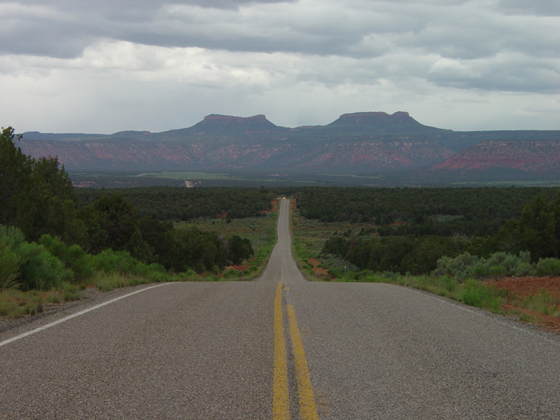 Bears EarsSummit · ~3 min drivePhoto: U.S. Geological Surey, Public domain (via Wikimedia Commons)
 Lyman Canyon OverlookMountain biking · ~4 min drivePhoto: brewbooks from near Seattle, USA, CC BY-SA 2.0 (via Wikimedia Commons)
- Grand Gulch overflow campgroundCamping · ~10 min drive
 Arch CanyonRock climbing · ~11 min drivePhoto: BLMUtah, Public domain (via Wikimedia Commons)
Best time to visit Woodenshoe Road
Best months: May–October. Best months have typical highs of 55–85 °F, lows of 30 °F or warmer (32 °F where the station doesn't record snow), at most one snowy day and no more than 12 wet days.
Jan
37° / 17°
Feb
41° / 20°
Mar
50° / 26°
Apr
58° / 31°
May
67° / 39°
Jun
79° / 48°
Jul
84° / 55°
Aug
81° / 54°
Sep
74° / 46°
Oct
62° / 36°
Nov
48° / 26°
Dec
38° / 17°
Typical high / low (°F) and days with rain or snow, 1991–2020. Measured at Monticello #2, UT, 31.3 mi away at 7,086 ft. The station sits about 1,400 ft lower than this place, so expect it a little cooler here. This station doesn't record snowfall. Source: NOAA NCEI U.S. Climate Normals 1991–2020.
Map and trail data © OpenStreetMap contributors
