Nizhoni
Campground
The next 8 weekends are full on Recreation.gov
No closures listed
The Forest Service lists no closures for Manti-La Sal National Forest.
As of · Source: USFS · Manti-La Sal National Forest. Agencies don't list every closure — check before you go.
Posey is a 4-mile out-and-back hike in the Monticello Ranger District of Manti-La Sal National Forest in Utah, managed by the Forest Service. The trail gains about 1,140 feet from its low point of 7,359 feet to the high of 8,512 feet. Summer is the most comfortable time to go. Typical averages from a nearby weather station in Monticello show July highs around 84°F with lows near 55°F, while winter highs sit in the upper 30s. The trail is natural-surfaced and allows horses, which makes it a good option for riders. Bikes are not permitted. The Notch Trail and Dark Canyon East Trail both lie within about a mile and a half, and Posey Canyon Trail is roughly 4 miles away. Climbers can find the Blanding area about 10 miles off.
Nizhoni
Campground
Edge of the Cedars Museum
Museum
Places © OpenStreetMap contributors
More in MonticelloNot on Roamze yet. Their page has how to reach them.
Best months: May–October. Best months have typical highs of 55–85 °F, lows of 30 °F or warmer (32 °F where the station doesn't record snow), at most one snowy day and no more than 12 wet days.
Jan
37° / 17°
Feb
41° / 20°
Mar
50° / 26°
Apr
58° / 31°
May
67° / 39°
Jun
79° / 48°
Jul
84° / 55°
Aug
81° / 54°
Sep
74° / 46°
Oct
62° / 36°
Nov
48° / 26°
Dec
38° / 17°
Typical high / low (°F) and days with rain or snow, 1991–2020. Measured at Monticello #2, UT, 23.9 mi away at 7,086 ft. The station sits about 1,400 ft lower than this place, so expect it a little cooler here. This station doesn't record snowfall. Source: NOAA NCEI U.S. Climate Normals 1991–2020.
 Photo: Ken Lund from Reno, Nevada, USA, CC BY-SA 2.0 (via Wikimedia Commons)
Cream Pots (Sz)
~5 min drive
3.51-mile out-and-back trail in Utah with 230 ft elevation gain.
 Photo: Ken Lund from Reno, Nevada, USA, CC BY-SA 2.0 (via Wikimedia Commons)
Texas Trail
~15 min drive
4.39-mile out-and-back hike in Utah with 484 ft gain
HIKE
Dark Canyon East Trail
~2 min drive
0.6-mile out-and-back hike in Utah with 373 ft gain and 8,321 ft max elevation
HIKE
Woodenshoe Road
~13 min drive
41.36-mile out-and-back trail in Utah with 1,116 ft elevation gain.
 Photo: Ken Lund from Reno, Nevada, USA, CC BY-SA 2.0 (via Wikimedia Commons)
Rig Canyon Trail - 5161
~14 min drive
5.96-mile out-and-back hike in Utah with 1,512 ft gain and 8,135 ft max elevation.
Photo: Ken Lund from Reno, Nevada, USA, CC BY-SA 2.0 (via Wikimedia Commons)Dark Canyon
~14 min drive
26.83-mile out-and-back trail in Utah with 642 ft elevation gain.
HIKE
Posey Canyon
~7 min drive
0.79-mile out-and-back trail in Utah with 57 feet of elevation gain.
HIKE
Posey Canyon Trail
~7 min drive
6.06-mile out-and-back hike in Utah with 835 ft gain/loss.
HIKE
The Notch Trail
~2 min drive
8.08-mile out-and-back trail in Utah with 440 ft of elevation gain.
HIKE
Hammond Canyon
~7 min drive
Hammond Canyon is a 1.00-mile out-and-back trail in Utah with 40 feet of elevation gain.
Also worth it near here
SEE
Queens Arch
~9 min drive
 Photo: BLMUtah, Public domain (via Wikimedia Commons)
Arch Canyon
~16 min drive
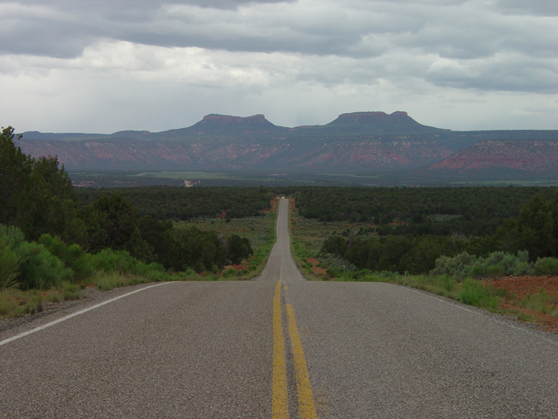 Photo: U.S. Geological Surey, Public domain (via Wikimedia Commons)
Bears Ears
~16 min drive
 Photo: brewbooks from near Seattle, USA, CC BY-SA 2.0 (via Wikimedia Commons)
Lyman Canyon Overlook
~16 min drive
