Dark Canyon
 Photo: Ken Lund from Reno, Nevada, USA, CC BY-SA 2.0 (via Wikimedia Commons)
- 26.8 mi
- round trip
- 1,280 ft
- climb
- 6,875 ft
- high point
- Out and back
- route
- Apr–Jun, Aug–Oct
- best months
Caution today
Agency alerts are in effect for this area; weather is marginal · USFS, OpenWeather · checked just now
Is Dark Canyon open right now?
No closures listed
The Forest Service lists no closures for Manti-La Sal National Forest.
As of · Source: USFS · Manti-La Sal National Forest. Agencies don't list every closure — check before you go.
Dark Canyon is a hard out-and-back hike in Utah's Dark Canyon Wilderness, part of the Monticello Ranger District of Manti-La Sal National Forest. The trail runs about 26.8 miles, climbing roughly 1,280 feet from a low point of about 5,718 feet to a high of about 6,875 feet. The Forest Service manages the land. The trail is natural-surface and allows horses but not bikes, so plan for a ride with a pack animal if you're heading out on foot and hoof. Spring and fall are the most comfortable seasons to go. Typical averages from a nearby weather station show May highs around 71°F and September highs around 77°F, while July averages about 89°F and winter highs sit near 39°F with a few snowy days each month. Several other routes lie within a few miles. Rig Canyon Trail - 5161 is less than a mile away, and Rig Canyon, Big Spring Spur and Horse Pasture Canyon are all within about 4 miles.
Local outfitters
- Coral Sands RV Park39 mi away
Not on Roamze yet. Their page has how to reach them.
Best time to go · Apr–Jun, Aug–Oct
Best time to visit Dark Canyon
Best months: April–June and August–October. Best months have typical highs of 55–85 °F, lows of 30 °F or warmer (32 °F where the station doesn't record snow), at most one snowy day and no more than 12 wet days.
Jan
39° / 20°
6 wet · 4 snow
Feb
43° / 24°
6 wet · 3 snow
Mar
53° / 30°
5 wet · 2 snow
Apr
60° / 35°
5 wet · 1 snow
May
71° / 44°
5 wet
Jun
83° / 54°
3 wet
Jul
89° / 60°
7 wet
Aug
85° / 58°
8 wet
Sep
77° / 51°
6 wet
Oct
63° / 39°
5 wet
Nov
50° / 29°
4 wet · 2 snow
Dec
39° / 20°
6 wet · 4 snow
Typical high / low (°F) and days with rain or snow, 1991–2020. Measured at Natural Bridges Nm, UT, 14.4 mi away at 6,508 ft. Source: NOAA NCEI U.S. Climate Normals 1991–2020.
Keep exploring — more trails worth the drive
Photo: Ken Lund from Reno, Nevada, USA, CC BY-SA 2.0 (via Wikimedia Commons)Rig Canyon Trail - 5161
~2 min drive
5.96-mile out-and-back hike in Utah with 1,512 ft gain and 8,135 ft max elevation.
 Photo: Ken Lund from Reno, Nevada, USA, CC BY-SA 2.0 (via Wikimedia Commons)
Woodenshoe Trail
~13 min drive
28.87-mile out-and-back trail in Utah managed by the Forest Service.
HIKE
RIG CANYON
~6 min drive
1.58-mile out-and-back in Utah with 576 ft gain/loss and 8,142 ft max elevation.
HIKE
Woodenshoe Road
~18 min drive
41.36-mile out-and-back trail in Utah with 1,116 ft elevation gain.
 Photo: Ken Lund from Reno, Nevada, USA, CC BY-SA 2.0 (via Wikimedia Commons)
Cream Pots (Sz)
~19 min drive
3.51-mile out-and-back trail in Utah with 230 ft elevation gain.
HIKE
Horse Pasture Canyon
~6 min drive
7.98-mile out-and-back trail in Utah with 1,414 ft of elevation gain.
HIKE
Big Spring Spur
~6 min drive
1.78-mile out-and-back trail in Utah with 137 ft of elevation gain.
HIKE
Gooseberry Trail
~13 min drive
7.38-mile out-and-back hike in Utah with 1,912 ft elevation gain
HIKE
Trail Canyon
~8 min drive
9.28-mile out-and-back trail in Utah with 461 ft elevation gain.
HIKE
HORSE PASTURE CANYON
~7 min drive
1.02-mile out-and-back trail in Utah with 981 ft elevation gain and loss.
Also worth it near here
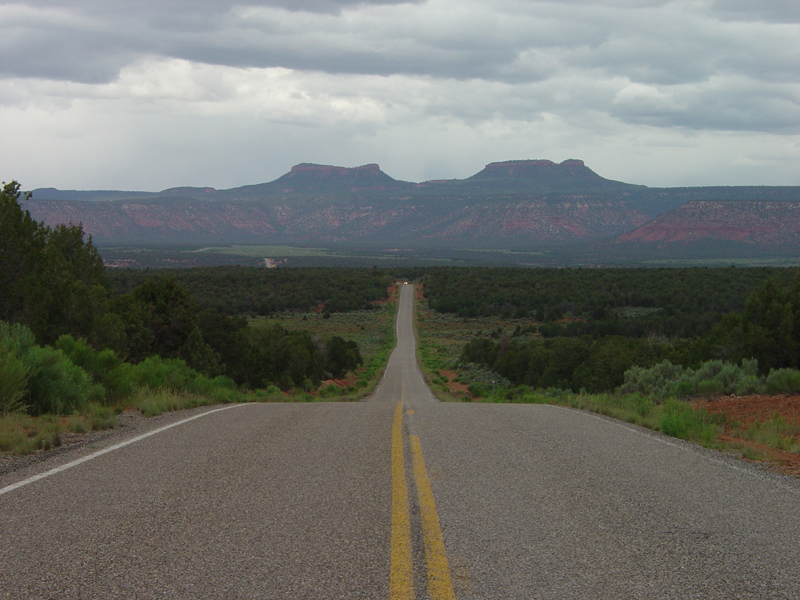 Photo: U.S. Geological Surey, Public domain (via Wikimedia Commons)
Bears Ears
~20 min drive
 Photo: brewbooks from near Seattle, USA, CC BY-SA 2.0 (via Wikimedia Commons)
Bears Ears Loop
~21 min drive
 Photo: Daniel Schwen, CC BY-SA 4.0 (via Wikimedia Commons)
Sipapu Bridge
~25 min drive
BED
Site 2
~25 min drive
