BLM Primitive Campsite near Butler Wash Trail
Campground
Campground · 10 mi from the trail
 Photo: Ken Lund from Reno, Nevada, USA, CC BY-SA 2.0 (via Wikimedia Commons)
No closures listed
The Forest Service lists no closures for Manti-La Sal National Forest.
As of · Source: USFS · Manti-La Sal National Forest. Agencies don't list every closure — check before you go.
Cream Pots (Sz) is a moderate out-and-back hike in the Monticello Ranger District of Manti-La Sal National Forest in Utah, managed by the Forest Service. The trail is about 3.5 miles long, with a one-way climb of roughly 767 feet from a low point of about 6,048 feet to a high of about 6,824 feet. The route is on natural surface, and horses are allowed. Bikes are not. That makes it a good fit for riders on horseback or for hikers who want to move at a slower pace. Spring and fall are the most comfortable times to go. Typical averages from a nearby weather station show May highs around 71°F and September highs around 77°F, while July averages about 89°F and winter brings highs near 39°F with a few snowy days each month. Several other trails sit within a few miles, including Posey, Posey Canyon Trail and Posey Canyon. The Blanding climbing area is about 7 miles away.
BLM Primitive Campsite near Butler Wash Trail
Campground
Places © OpenStreetMap contributors
More in MonticelloNot on Roamze yet. Their page has how to reach them.
Best months: April–June and August–October. Best months have typical highs of 55–85 °F, lows of 30 °F or warmer (32 °F where the station doesn't record snow), at most one snowy day and no more than 12 wet days.
Jan
39° / 20°
6 wet · 4 snow
Feb
43° / 24°
6 wet · 3 snow
Mar
53° / 30°
5 wet · 2 snow
Apr
60° / 35°
5 wet · 1 snow
May
71° / 44°
5 wet
Jun
83° / 54°
3 wet
Jul
89° / 60°
7 wet
Aug
85° / 58°
8 wet
Sep
77° / 51°
6 wet
Oct
63° / 39°
5 wet
Nov
50° / 29°
4 wet · 2 snow
Dec
39° / 20°
6 wet · 4 snow
Typical high / low (°F) and days with rain or snow, 1991–2020. Measured at Natural Bridges Nm, UT, 15.4 mi away at 6,508 ft. Source: NOAA NCEI U.S. Climate Normals 1991–2020.
 Photo: Ken Lund from Reno, Nevada, USA, CC BY-SA 2.0 (via Wikimedia Commons)
Texas Trail
~13 min drive
4.39-mile out-and-back hike in Utah with 484 ft gain
Photo: Ken Lund from Reno, Nevada, USA, CC BY-SA 2.0 (via Wikimedia Commons)Salvation Knoll Trail (475)
~16 min drive
1.19-mile out-and-back hike to Salvation Knoll in Utah with 123 ft of elevation gain.
HIKE
Posey
~5 min drive
4.00-mile out-and-back trail in Utah with 208 ft of elevation gain.
HIKE
Woodenshoe Road
~14 min drive
41.36-mile out-and-back trail in Utah with 1,116 ft elevation gain.
Photo: Ken Lund from Reno, Nevada, USA, CC BY-SA 2.0 (via Wikimedia Commons)West Rim Texas Canyon
~14 min drive
14.79-mile out-and-back trail in Utah with 2,411 ft elevation gain.
HIKE
Posey Canyon
~7 min drive
0.79-mile out-and-back trail in Utah with 57 feet of elevation gain.
HIKE
Posey Canyon Trail
~6 min drive
6.06-mile out-and-back hike in Utah with 835 ft gain/loss.
HIKE
The Notch Trail
~8 min drive
8.08-mile out-and-back trail in Utah with 440 ft of elevation gain.
HIKE
Whiskers Trail 472
~7 min drive
4.08-mile out-and-back trail in Utah with 639 ft elevation gain/loss
HIKE
WHISKERS TRAIL (472)
~7 min drive
5.34-mile out-and-back trail in Utah with 900 ft elevation gain and loss.
Also worth it near here
SEE
Keystone Arch
~10 min drive
 Photo: BLMUtah, Public domain (via Wikimedia Commons)
Arch Canyon
~12 min drive
 Photo: brewbooks from near Seattle, USA, CC BY-SA 2.0 (via Wikimedia Commons)
Lyman Canyon Overlook
~15 min drive
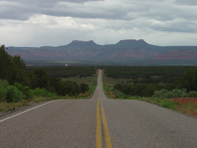 Photo: U.S. Geological Surey, Public domain (via Wikimedia Commons)
Bears Ears
~15 min drive
