Roundy Trail
- 2.9 mi
- round trip
- 1,411 ft
- climb
- 7,780 ft
- high point
- Out and back
- route
- Apr–Oct
- best months
Is Roundy Trail open right now?
Alert in the area
The Forest Service lists 3 alerts for Dixie National Forest.
Duck Creek OHV Trail Closure
Agency alert covering Dixie National Forest · Order 0407-26-11 · USFS · Dixie National Forest
Pine Valley Ranger District Area and Trail and Road Closure
Agency alert covering Dixie National Forest · Order 0407-26-01 · USFS · Dixie National Forest
Cedar City Temporary Road Closure Webster Flat Road (Order 0407-25-02)
Agency alert covering Dixie National Forest · Order 0407-25-02 · USFS · Dixie National Forest
As of · Source: USFS · Dixie National Forest. Agencies don't list every closure — check before you go.
Roundy Trail is a 2.9-mile out-and-back hike in the Escalante Ranger District of Dixie National Forest in southern Utah. The trail rises from about 6,360 feet to a high point of 7,780 feet, a climb of 1,411 feet one way, and is rated moderate. The trail is natural-surface and not accessible. Horses are allowed, but bikes are not. The Forest Service lists the open season as May 1 through October 31. For comfortable weather, aim for late spring or early fall. Typical averages from a nearby weather station in Boulder, Utah, run to highs around 68°F in May and 74°F in September, with July the warmest month at about 84°F. That station sits roughly 1,100 feet lower than the trail's high point, so temperatures on the summit run cooler. The Box Trail and Pine Creek both lie about 0.6 miles away. Posey Lake Campground is about 6.7 miles off, and the Petrified Loop is about 4.7 miles away.
Local outfitters
- Escalante Outfitters6 mi away
- Canyons of Escalante RV Park6 mi away
Not on Roamze yet. Their page has how to reach them.
- The Box TrailHiking0.6 mi
- Pine CreekHiking0.6 mi
- Eagle View TrailHiking4 mi
- Petrified LoopHiking4.7 mi
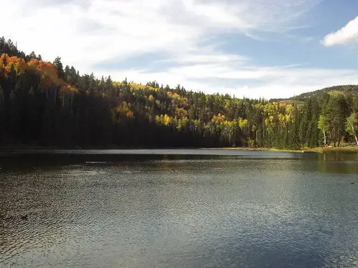 Posey Lake CampgroundCampingPhoto: Recreation.gov (RIDB) / public domain6.7 mi
- Escalante Ranger DistrictLake fishing7.7 mi
- Blue Spruce CampgroundCamping8.1 mi
- Cowpuncher Guard StationCamping10 mi
Source: Roamze catalog (indexable pages within 10 miles, PostGIS distance)
 Upper Death HollowHiking · ~14 min drivePhoto: Jason J. Corneveaux, CC BY-SA 3.0 (via Wikimedia Commons)
- Death HollowHiking · ~14 min drivePhoto: Jason J. Corneveaux, CC BY-SA 3.0 (via Wikimedia Commons)
 Escalante OverlookHiking · ~17 min drivePhoto: inkknife_2000 (7.5 million views +), CC BY-SA 2.0 (via Wikimedia Commons)
 Great Western Trail - Mcgath SectionHiking · ~18 min drivePhoto: Jason J. Corneveaux, CC BY-SA 3.0 (via Wikimedia Commons)
- Rogers Peak TrailHiking · ~15 min drivePhoto: Jason J. Corneveaux, CC BY-SA 3.0 (via Wikimedia Commons)
 Boulder Mail TrailHiking · ~16 min drivePhoto: Greg Willis from Denver, CO, usa, CC BY-SA 2.0 (via Wikimedia Commons)
 Upper Calf Creek Fall TrailHiking · ~17 min drivePhoto: Greg Willis from Denver, CO, usa, CC BY-SA 2.0 (via Wikimedia Commons)
 Escalante River TrailHiking · ~20 min drivePhoto: Frans-Banja Mulder, CC BY 3.0 (via Wikimedia Commons)
- Mamie CreekHiking · ~12 min drive
- Pine CreekHiking · Next door
Best time to visit Roundy Trail
Best months: April–October. Best months have typical highs of 55–85 °F, lows of 30 °F or warmer (32 °F where the station doesn't record snow), at most one snowy day and no more than 12 wet days.
Jan
39° / 21°
6 wet · 4 snow
Feb
44° / 24°
6 wet · 4 snow
Mar
53° / 31°
5 wet · 2 snow
Apr
60° / 36°
4 wet · 1 snow
May
68° / 45°
5 wet
Jun
79° / 54°
4 wet
Jul
84° / 61°
8 wet
Aug
81° / 60°
10 wet
Sep
74° / 52°
7 wet
Oct
62° / 40°
5 wet
Nov
49° / 30°
4 wet · 1 snow
Dec
39° / 21°
5 wet · 4 snow
Typical high / low (°F) and days with rain or snow, 1991–2020. Measured at Boulder, UT, 12.1 mi away at 6,650 ft. The station sits about 1,100 ft lower than this place, so expect it a little cooler here. Source: NOAA NCEI U.S. Climate Normals 1991–2020.

