Great Western Trail - Mcgath Section
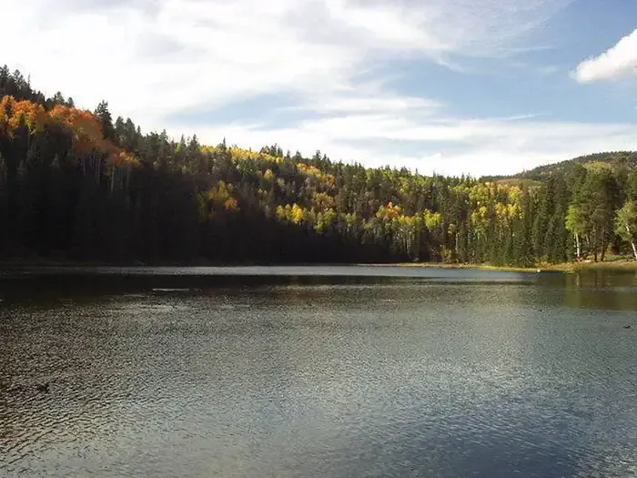
 Photo: Jason J. Corneveaux, CC BY-SA 3.0 (via Wikimedia Commons)
- 7.5 mi
- round trip
- 2,518 ft
- climb
- 9,911 ft
- high point
- Out and back
- route
Is Great Western Trail - Mcgath Section open right now?
Alert in the area
The Forest Service lists 3 alerts for Dixie National Forest.
Duck Creek OHV Trail Closure
Agency alert covering Dixie National Forest · Order 0407-26-11 · USFS · Dixie National Forest
Pine Valley Ranger District Area and Trail and Road Closure
Agency alert covering Dixie National Forest · Order 0407-26-01 · USFS · Dixie National Forest
Cedar City Temporary Road Closure Webster Flat Road (Order 0407-25-02)
Agency alert covering Dixie National Forest · Order 0407-25-02 · USFS · Dixie National Forest
As of · Source: USFS · Dixie National Forest. Agencies don't list every closure — check before you go.
The Mcgath Section of the Great Western Trail is a 15-mile out-and-back hike in Utah's Escalante Ranger District of Dixie National Forest. The route rises from a low point of about 8,100 feet to a high of about 9,900 feet, with an elevation gain of about 2,500 feet. The Forest Service manages the land, and the trail is rated expert. The trail is long and steep, and the climb takes up the full length of the route. Sweetwater Road lies just 0.1 mile away, and Rogers Peak Trail is about 2 miles off. The Great Western Trail itself runs roughly 2.4 miles from this section, and Blue Spruce Campground is about 4.7 miles away for those looking to camp overnight.
Local outfitters
- Escalante Outfitters16 mi away
- Canyons of Escalante RV Park16 mi away
Not on Roamze yet. Their page has how to reach them.
- Sweetwater RoadHiking0.1 mi
- Rogers Peak TrailHikingPhoto: Jason J. Corneveaux, CC BY-SA 3.0 (via Wikimedia Commons)2.1 mi
- Great Western TrailHiking2.4 mi
- Burr Top TrailHiking2.4 mi
- Blue Spruce CampgroundCamping4.7 mi
- Cowpuncher Guard StationCamping4.8 mi
 Posey Lake CampgroundCampingPhoto: Recreation.gov (RIDB) / public domain7.6 mi
- Chriss LakeLake fishing9.4 mi
Source: Roamze catalog (indexable pages within 10 miles, PostGIS distance)
 Upper Death HollowHiking · ~5 min drivePhoto: Jason J. Corneveaux, CC BY-SA 3.0 (via Wikimedia Commons)
 Boulder Mail TrailHiking · ~17 min drivePhoto: Greg Willis from Denver, CO, usa, CC BY-SA 2.0 (via Wikimedia Commons)
 Deer Creek Lake TrailHiking · ~18 min drivePhoto: Frans-Banja Mulder, CC BY 3.0 (via Wikimedia Commons)
- Great Western Trail - Pine Creek SectionHiking · ~8 min drive
- Rogers Peak TrailHiking · ~4 min drivePhoto: Jason J. Corneveaux, CC BY-SA 3.0 (via Wikimedia Commons)
- Long Neck TrailHiking · ~18 min drivePhoto: Frans-Banja Mulder, CC BY 3.0 (via Wikimedia Commons)
- Deer Creek TrailHiking · ~18 min drivePhoto: Frans-Banja Mulder, CC BY 3.0 (via Wikimedia Commons)
- Trail Point TrailHiking · ~12 min drive
- Death HollowHiking · ~5 min drivePhoto: Jason J. Corneveaux, CC BY-SA 3.0 (via Wikimedia Commons)
- Sweetwater RoadHiking · Next door
Map and trail data © OpenStreetMap contributors
