Queens Arch
- 7,502 ft
- elevation
- Forest Service
- managed by
- Apr–Jun, Aug–Oct
- best months
Caution today
Agency alerts are in effect for this area; weather is marginal · USFS, OpenWeather · checked 10 h ago
Is Queens Arch open right now?
Alert in the area
The Forest Service lists an alert for Monticello Ranger District.
Hazardous Road Conditions – Moab Monticello Ranger Districts 11.4.2026
Agency alert covering Monticello Ranger District · USFS · Monticello Ranger District
As of · Source: USFS · Monticello Ranger District. Agencies don't list every closure — check before you go.
Queens Arch is a natural arch in the Dark Canyon Wilderness, part of the Monticello Ranger District of Manti-La Sal National Forest in Utah. The Forest Service manages the land, and the nearest town is Blanding, about 20 miles away. The arch sits at roughly 7,500 feet. For comfortable weather, aim for late spring or early fall. Typical averages from a nearby weather station show May highs around 71°F and September highs around 77°F, while July averages climb to about 89°F and winter highs sit near 39°F. Several hikes lie within a few miles. Horse Pasture Canyon and Brushy Knoll are each about 2.5 miles away, and Peavine Canyon is about 2.9 miles off. Dark Canyon is about 3 miles away.
- Elevation
- 7,502 ft
- Land manager
- Forest Service
Elevation from USGS 3D Elevation Program terrain data (about 10 m resolution).
- Horse Pasture CanyonHiking2.5 mi
- Brushy KnollHiking2.5 mi
- Peavine CanyonHiking2.9 mi
 Dark CanyonHikingPhoto: Ken Lund from Reno, Nevada, USA, CC BY-SA 2.0 (via Wikimedia Commons)3 mi
- Rig Canyon Trail - 5161HikingPhoto: Ken Lund from Reno, Nevada, USA, CC BY-SA 2.0 (via Wikimedia Commons)3 mi
- Drift Canyon OverlookHiking3.6 mi
- The Notch TrailHiking4.2 mi
- Dark Canyon East TrailHiking4.3 mi
Source: Roamze catalog (indexable pages within 10 miles, PostGIS distance)
 Sipapu BridgeNatural arch · ~23 min drivePhoto: Daniel Schwen, CC BY-SA 4.0 (via Wikimedia Commons)
 Kachina BridgeNatural arch · ~26 min drivePhoto: brewbooks from near Seattle, USA, CC BY-SA 2.0 (via Wikimedia Commons)
 Owachomo BridgeNatural arch · ~27 min drivePhoto: W. Bulach, CC BY-SA 4.0 (via Wikimedia Commons)
 Druid ArchNatural arch · ~39 min drivePhoto: J. Benjamin Wildeboer (talk · contribs), Ben W on flickr, CC BY-SA 2.0 (via Wikimedia Commons)
 Paul Bunyans PottyNatural arch · ~44 min drivePhoto: CanyonlandsNPS, Public domain (via Wikimedia Commons)
 Beehive ArchNatural arch · ~49 min drivePhoto: CanyonlandsNPS, Public domain (via Wikimedia Commons)
- Keystone ArchNatural arch · ~15 min drive
- Aesops ArchNatural arch · ~19 min drive
- Cathedral ArchNatural arch · ~19 min drive
- The ShoeNatural arch · ~26 min drive
Also worth it near here
- Rig Canyon Trail - 5161Hiking · ~5 min drivePhoto: Ken Lund from Reno, Nevada, USA, CC BY-SA 2.0 (via Wikimedia Commons)
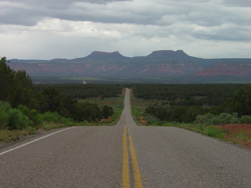 Bears EarsSummit · ~16 min drivePhoto: U.S. Geological Surey, Public domain (via Wikimedia Commons)
 Bears Ears LoopMountain biking · ~17 min drivePhoto: brewbooks from near Seattle, USA, CC BY-SA 2.0 (via Wikimedia Commons)
 Arch CanyonRock climbing · ~21 min drivePhoto: BLMUtah, Public domain (via Wikimedia Commons)
Best time to visit Queens Arch
Best months: April–June and August–October. Best months have typical highs of 55–85 °F, lows of 30 °F or warmer (32 °F where the station doesn't record snow), at most one snowy day and no more than 12 wet days.
Jan
39° / 20°
6 wet · 4 snow
Feb
43° / 24°
6 wet · 3 snow
Mar
53° / 30°
5 wet · 2 snow
Apr
60° / 35°
5 wet · 1 snow
May
71° / 44°
5 wet
Jun
83° / 54°
3 wet
Jul
89° / 60°
7 wet
Aug
85° / 58°
8 wet
Sep
77° / 51°
6 wet
Oct
63° / 39°
5 wet
Nov
50° / 29°
4 wet · 2 snow
Dec
39° / 20°
6 wet · 4 snow
Typical high / low (°F) and days with rain or snow, 1991–2020. Measured at Natural Bridges Nm, UT, 12.8 mi away at 6,508 ft. The station sits about 1,000 ft lower than this place, so expect it a little cooler here. Source: NOAA NCEI U.S. Climate Normals 1991–2020.
