Mount Hebo
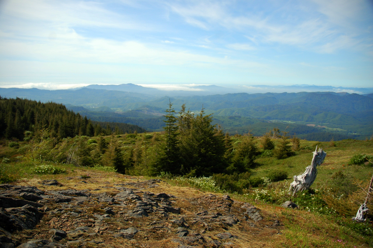 Photo: Ennetws, Public domain (via Wikimedia Commons)
- 3,181 ft
- summit
- 1
- way up
- May–Oct
- best months
Is Mount Hebo open right now?
Closure in the area
There's a closure order in Hebo Ranger District. It doesn't name Mount Hebo, so check the source for the area it covers (2 listed).
Cascade Head Road (FSR 1861) Motor Vehicle Traffic Closure
Agency closure covering Hebo Ranger District · Order 06-12-01-26-03 · USFS · Hebo Ranger District
Homestead Trailhead Closure
Agency closure covering Siuslaw National Forest · Order 06-12-10-26-11 · USFS · Siuslaw National Forest
Sutton Lake Boat Ramp Closure
Agency alert covering Siuslaw National Forest · Order 06-12-10-26-07 · USFS · Siuslaw National Forest
Forest Service Road 1633 Road Closure
Agency alert covering Hebo Ranger District · Order 06-12-01-26-01 · USFS · Hebo Ranger District
As of · Source: USFS · Hebo Ranger District. Agencies don't list every closure — check before you go.
Mount Hebo is a summit of 3,181 feet in the Hebo Ranger District of Oregon's Siuslaw National Forest, about 6 miles from the town of Beaver. It sits in the forest's western reaches, and its elevation makes it a natural anchor for a day of exploring the surrounding trails, lakes and paddling waters. Summer is the most comfortable time to visit. Typical averages from a nearby weather station show July and August highs around 71 to 72°F with only about three wet days a month, while winter months bring highs in the low 40s and rain on most days. South Lake Dispersed Camp lies just 1.3 miles away, and Hebo Lake Campground is about 3.5 miles off. The Hebo Lake Loop and the Pioneer Indian hike are both within about 3.5 miles.
Conditions and forecast
Daily highs and lows, wind and the chance of precipitation at the summit and pioneer indian (hebo lake) trailhead for the next 7 days, from the Open-Meteo model.
- Summit elevation
- 3,181 ft
Elevation from USGS 3D Elevation Program terrain data (about 10 m resolution).
Map © Mapbox © OpenStreetMap contributors Questions about Mount Hebo
How tall is Mount Hebo?
3,181 ft (970 m).
How many routes go to the summit of Mount Hebo?
One: Pioneer Indian.
Where do the routes up Mount Hebo start?
Pioneer Indian starts at Pioneer Indian (Hebo Lake) Trailhead (about 1,664 ft).
When is the best time to climb Mount Hebo?
Year-round.
- Cedar Butte2,905 ft · Oregon1 route26 mi away
 Mount Baldy414 ft · Oregon1 route29 mi awayPhoto: M.O. Stevens, Public domain (via Wikimedia Commons)
- Kings Mountain3,224 ft · Oregon1 route29 mi away
- Iowa Hill1,139 ft · Oregon2 routes35 mi away
- Angora Peak2,673 ft · Oregon1 route40 mi away
- Price Peak1,938 ft · Oregon1 route43 mi away
- South Lake Dispersed CampCamping1.3 mi
- Hebo Lake CampgroundCamping3.5 mi
- Three RiversCanoeing3.5 mi
- Pioneer IndianHiking3.5 mi
- Hebo Lake LoopHiking3.6 mi
- Niagara CreekCanoeing3.6 mi
 Niagra FallsHikingPhoto: lumachrome, CC BY-SA 2.0 (via Flickr)4.8 mi
- Castle RockCamping5.3 mi
Source: Roamze catalog (indexable pages within 10 miles, PostGIS distance)
 South Saddle MountainSummit · ~49 min drivePhoto: M.O. Stevens, CC BY-SA 3.0 (via Wikimedia Commons)
- Mount BaldySummit · ~49 min drivePhoto: M.O. Stevens, Public domain (via Wikimedia Commons)
 Bald PeakSummit · ~60 min drivePhoto: M.O. Stevens, CC BY-SA 3.0 (via Wikimedia Commons)
 Round TopSummit · ~1h 2m drivePhoto: Terrickisaiah555, CC BY-SA 3.0 (via Wikimedia Commons)
 Neahkahnie MountainSummit · ~1h 5m drivePhoto: Fcb981, CC BY-SA 3.0 (via Wikimedia Commons)
 Coffin ButteSummit · ~1h 14m drivePhoto: Bigcran, CC BY-SA 4.0 (via Wikimedia Commons)
 Cooper MountainSummit · ~1h 17m drivePhoto: M.O. Stevens, CC BY-SA 3.0 (via Wikimedia Commons)
- Cedar ButteSummit · ~44 min drive
- Kings MountainSummit · ~50 min drive
- Iowa HillSummit · ~60 min drive
Best time to visit Mount Hebo
Best months: May–October. Best months have typical highs of 55–85 °F, lows of 30 °F or warmer (32 °F where the station doesn't record snow), at most one snowy day and no more than 12 wet days.
Jan
43° / 31°
19 wet
Feb
43° / 31°
16 wet
Mar
44° / 31°
18 wet
Apr
48° / 32°
17 wet
May
56° / 39°
12 wet
Jun
61° / 43°
8 wet
Jul
71° / 50°
3 wet
Aug
72° / 51°
3 wet
Sep
67° / 48°
6 wet
Oct
56° / 41°
12 wet
Nov
47° / 34°
17 wet
Dec
42° / 30°
19 wet
Typical high / low (°F) and days with rain or snow, 1991–2020. Measured at Laurel Mtn, OR, 21.8 mi away at 3,589 ft. This station doesn't record snowfall. Source: NOAA NCEI U.S. Climate Normals 1991–2020.
