East Fork Mosby Creek
- 3.9 mi
- distance
- 2,869 ft
- high point
- Jun, Aug–Oct
- best months
East Fork Mosby Creek is a paddling route in Oregon on Bureau of Land Management land within the Nw Oregon Upper Willamette Field Office. It is a canoeing destination about 3.86 miles long, and the surrounding area holds several other paddling spots within a short drive. Summer is the most comfortable time to visit. Typical averages from the Toketee Falls weather station, about 26 miles away and roughly 800 feet lower, show July and August highs in the mid-80s with only three wet days a month. Winter is much wetter and cooler, with highs in the low 40s and rain on more than half the days in December and January. Martin Creek and Pass Creek are both paddling routes about 4 miles away, and Northeast Fork Rock Creek is about 5 miles off. For an overnight stay, Mineral Forest Camp sits about 6 miles from the creek.
Local outfitters
- Casey's Riverside RV Resort21 mi away
- River Trail Guides36 mi away
Not on Roamze yet. Their page has how to reach them.
- Martin CreekCanoeing4.3 mi
- Pass CreekCanoeing4.4 mi
- Northeast Fork Rock CreekCanoeing5.2 mi
- Canton CreekHiking6.1 mi
- Fairview CreekHiking6.2 mi
- Mineral Forest CampCamping6.2 mi
- Crawfish Lake ShelterCamping8.4 mi
- McKinley RockRock climbing8.7 mi
Source: Roamze catalog (indexable pages within 10 miles, PostGIS distance)
 Mosby CreekCanoeing · ~10 min drivePhoto: Chris Phan from Glasgow, United Kingdom, CC BY 2.0 (via Wikimedia Commons)
- Canton Creek CampgroundFloat trip · ~24 min drive
- Gravel Bin River AccessBoat launch · ~25 min drive
 Coast Fork Willamette RiverCanoeing · ~31 min drivePhoto: U.S. Federal Caucus, Public domain (via Wikimedia Commons)
- Bogus Raft LaunchBoat launch · ~26 min drive
 Row RiverCanoeing · ~31 min drivePhoto: Bruce Fingerhood from Springfield, Oregon, US, CC BY 2.0 (via Wikimedia Commons)
- Bingham Boat RampBoat launch · ~34 min drive
- Martin CreekCanoeing · ~7 min drive
- Lone Rock Drift Boat RampBoat launch · ~34 min drive
- Pass CreekCanoeing · ~8 min drive
Also worth it near here
 Bohemia MountainSummit · ~15 min drivePhoto: United States Forest Service, Public domain (via Wikimedia Commons)
- McKinley RockRock climbing · ~15 min drive
- Musick Guard Station RentalHut camping · ~16 min drive
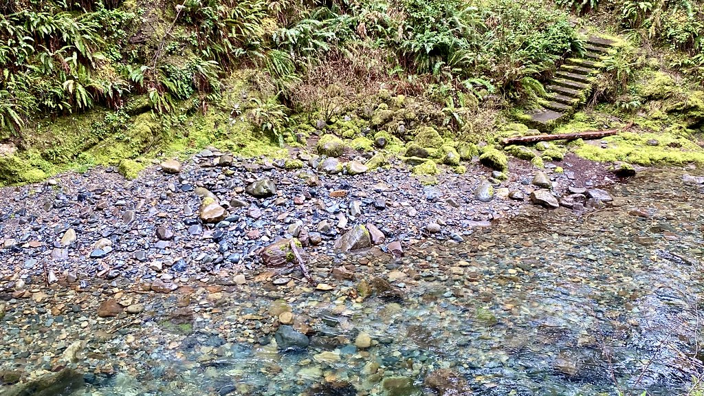 Brice CreekHiking · ~18 min drivePhoto: lamblukas, CC BY 2.0 (via Flickr)
- Smith FallsWaterfall · ~18 min drive
Best time to visit East Fork Mosby Creek
Best months: June and August–October. Best months have typical highs of 55–85 °F, lows of 30 °F or warmer (32 °F where the station doesn't record snow), at most one snowy day and no more than 12 wet days.
Jan
42° / 31°
18 wet · 3 snow
Feb
47° / 32°
16 wet · 2 snow
Mar
53° / 34°
18 wet · 1 snow
Apr
60° / 37°
17 wet
May
70° / 43°
13 wet
Jun
76° / 47°
8 wet
Jul
86° / 52°
3 wet
Aug
85° / 51°
3 wet
Sep
76° / 46°
6 wet
Oct
60° / 39°
11 wet
Nov
47° / 34°
17 wet · 1 snow
Dec
40° / 31°
19 wet · 2 snow
Typical high / low (°F) and days with rain or snow, 1991–2020. Measured at Toketee Falls, OR, 26.3 mi away at 2,060 ft. The station sits about 800 ft lower than this place, so expect it a little cooler here. Source: NOAA NCEI U.S. Climate Normals 1991–2020.
