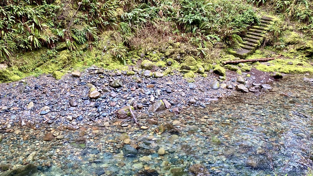
Coast Fork Willamette River
 Photo: U.S. Federal Caucus, Public domain (via Wikimedia Commons)
- 2.3 mi
- distance
- 982 ft
- high point
- Mar–Oct
- best months
Clear at last check
Weather is good · usgs_nwis, OpenWeather · checked 21 h ago
The Coast Fork Willamette River is a canoeing route in western Oregon, about 0.4 miles from the town of Gap. It is a short stretch of water close to town, making it an easy addition to a day spent outdoors in this corner of the state. Summer is the warmest time to paddle. Typical averages from a nearby weather station at Cottage Grove Dam put July and August highs around 81 to 82°F with lows near 50°F, while winter highs stay in the upper 40s. For more time on the water, Silk Creek and the Row River are both about 6 miles away. Harralson Campground, also about 4 miles off, offers a place to stay, and the Row River Trail-Asphalt hike is a similar distance.
Local outfitters
- A. Helfrich Outfitter22 mi away
- River Trail Guides22 mi away
Not on Roamze yet. Their page has how to reach them.
- Row River Trail-AsphaltHiking4.1 mi
- Harralson CampgroundCamping4.1 mi
- Silk CreekCanoeing6.1 mi
 Row RiverCanoeingPhoto: Bruce Fingerhood from Springfield, Oregon, US, CC BY 2.0 (via Wikimedia Commons)6.5 mi
 Pass CreekCanoeingPhoto: Finetooth, CC BY-SA 4.0 (via Wikimedia Commons)7.3 mi
- South Fork Siuslaw RiverCanoeing8.6 mi
- Cox CreekCanoeing9.2 mi
Source: Roamze catalog (indexable pages within 10 miles, PostGIS distance)
- Row RiverCanoeing · ~11 min drivePhoto: Bruce Fingerhood from Springfield, Oregon, US, CC BY 2.0 (via Wikimedia Commons)
- Dilley LandingBoat launch · ~30 min drive
- Pass CreekCanoeing · ~13 min drivePhoto: Finetooth, CC BY-SA 4.0 (via Wikimedia Commons)
- Middlefork Boat LaunchBoat launch · ~31 min drive
 Mosby CreekCanoeing · ~21 min drivePhoto: Chris Phan from Glasgow, United Kingdom, CC BY 2.0 (via Wikimedia Commons)
 Siuslaw RiverCanoeing · ~24 min drivePhoto: Bruce Fingerhood from Springfield, Oregon, US, CC BY 2.0 (via Wikimedia Commons)
 Coyote CreekCanoeing · ~31 min drivePhoto: Visitor7, CC BY-SA 3.0 (via Wikimedia Commons)
 Smith RiverCanoeing · ~33 min drivePhoto: Finetooth, CC BY-SA 3.0 (via Wikimedia Commons)
- Silk CreekCanoeing · ~10 min drive
- South Fork Siuslaw RiverCanoeing · ~15 min drive
Best time to visit Coast Fork Willamette River
Best months: March–October. Best months have typical highs of 55–85 °F, lows of 30 °F or warmer (32 °F where the station doesn't record snow), at most one snowy day and no more than 12 wet days.
Jan
48° / 33°
Feb
51° / 34°
Mar
56° / 35°
Apr
60° / 39°
May
67° / 43°
Jun
72° / 48°
Jul
81° / 52°
Aug
82° / 51°
Sep
77° / 48°
Oct
64° / 42°
Nov
53° / 37°
Dec
46° / 33°
Typical high / low (°F) and days with rain or snow, 1991–2020. Measured at Cottage Grove Dam, OR, 1.1 mi away at 831 ft. This station doesn't record snowfall. Source: NOAA NCEI U.S. Climate Normals 1991–2020.