Lookout Park
Campground
Campground · 4.0 mi from the trail
Closure in the area
There's a closure order in Jemez Ranger District. It doesn't name Bearhead Peak, so check the source for the area it covers.
NFSR 313 Closed Due to Washout Near NM Highway 12
Agency closure covering Jemez Ranger District · USFS · Jemez Ranger District
Road Conditions
Agency alert covering Santa Fe National Forest · USFS · Santa Fe National Forest
Gilman Tunnels closed due to rockslide
Agency alert covering Jemez Ranger District · USFS · Jemez Ranger District
As of · Source: USFS · Jemez Ranger District. Agencies don't list every closure — check before you go.
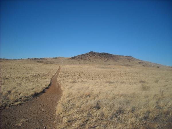
Bearhead Peak is a summit of 8,716 feet in the Jemez Ranger District of the Santa Fe National Forest in New Mexico, about 9.5 miles from the community of Cochiti Lake. Its elevation makes it one of the higher points in this part of the Jemez mountains, and the peak sits in an area with several hiking routes and climbing areas within a short drive. Summer is the most comfortable time to go. A nearby weather station at a similar elevation records typical July highs around 74°F and lows near 45°F, with June and August close behind. Winter is much colder, with typical January highs around 36°F and lows near 9°F. July and August also bring the most wet days, about 15 each month, so expect more rain in the warm season. Several trails start close by. Medio Dia is about 2.6 miles away, Bearhead Ridge is about 3.2 miles away and Peralta Canyon is about 3.5 miles away. Climbers can find the Capulin Canyon and Cochiti Mesa Area Crags about 4.7 miles off.
Lookout Park
Campground
Stone Kiva Restaurant
American restaurant
 If it rainsNewMexicophotographer1, CC BY-SA 4.0 · Wikimedia Commons
Places © OpenStreetMap contributors, Places © Overture Maps Foundation · Photos: NewMexicophotographer1, CC BY-SA 4.0 (commons)
More in Santo Domingo PuebloDaily highs and lows, wind and the chance of precipitation at the summit and route start for the next 7 days, from the Open-Meteo model.
Elevation from USGS 3D Elevation Program terrain data (about 10 m resolution).
8,716 ft (2,657 m).
One: Bearhead Peak.
Year-round.
Source: Roamze catalog (indexable pages within 10 miles, PostGIS distance)
 Chicoma MountainSummit · ~35 min drivePhoto: JerryFriedman, CC BY-SA 3.0 (via Wikimedia Commons)
 Black MesaSummit · ~43 min drivePhoto: User Em-jay-es on en.wikipedia, Public domain (via Wikimedia Commons)
 Mount ChalchihuitlSummit · ~47 min drivePhoto: Unknown authorUnknown author or not provided, Public domain (via Wikimedia Commons)
 Pueblo MesaSummit · ~53 min drivePhoto: Clyde Charles Brown, CC BY-SA 4.0 (via Wikimedia Commons)
 Cerro ColoradoSummit · ~1h 5m drivePhoto: Kent G. Budge, CC0 (via Wikimedia Commons)
 Glorieta MesaSummit · ~1h 11m drivePhoto: Patrick Alexander from Las Cruces, NM, CC0 (via Wikimedia Commons)
 Santa Fe BaldySummit · ~1h 11m drivePhoto: snowpeak, CC BY 2.0 (via Wikimedia Commons)
 Black VolcanoSummit · ~1h 15m drivePhoto: User:michaelh2001, Public domain (via Wikimedia Commons)
 Cedro PeakSummit · ~1h 20m drivePhoto: Skoch3, CC BY-SA 3.0 (via Wikimedia Commons)
 Cerro BonanzaSummit · ~42 min drivePhoto: John Phelan, CC BY 4.0 (via Wikimedia Commons)
Also worth it near here
Best months: May–June and September. Best months have typical highs of 55–85 °F, lows of 30 °F or warmer (32 °F where the station doesn't record snow), at most one snowy day and no more than 12 wet days.
Jan
36° / 9°
9 wet
Feb
38° / 12°
9 wet
Mar
44° / 20°
9 wet
Apr
52° / 25°
8 wet
May
62° / 32°
8 wet
Jun
72° / 39°
8 wet
Jul
74° / 45°
15 wet
Aug
71° / 43°
15 wet
Sep
66° / 35°
11 wet
Oct
57° / 26°
7 wet
Nov
45° / 17°
6 wet
Dec
36° / 9°
9 wet
Typical high / low (°F) and days with rain or snow, 1991–2020. Measured at Los Alamos 13 W, NM, 9.5 mi away at 8,716 ft. This station doesn't record snowfall. Source: NOAA NCEI U.S. Climate Normals 1991–2020.


