Pueblo Mesa
 Photo: Clyde Charles Brown, CC BY-SA 4.0 (via Wikimedia Commons)
- 7,438 ft
- summit
- 1
- way up
- Forest Service
- managed by
- Apr–Jun, Aug–Oct
- best months
Is Pueblo Mesa open right now?
Alert in the area
The Forest Service lists an alert for Santa Fe National Forest.
Road Conditions
Agency alert covering Santa Fe National Forest · USFS · Santa Fe National Forest
As of · Source: USFS · Santa Fe National Forest. Agencies don't list every closure — check before you go.
Pueblo Mesa is a summit of 7,438 feet in the Coyote Ranger District of the Santa Fe National Forest in northern New Mexico, about 1.2 miles from the small community of Cañones. The Forest Service manages the land. Spring and fall are the most comfortable times to visit. Typical averages from the nearby Abiquiu Dam weather station, which sits about 1,058 feet lower, show May highs around 73°F and October highs around 67°F, with July and August the warmest and wettest months. Several hikes start close by. Canada Gonzales is about half a mile away and Tsi'pin about 0.6 miles. The Cerro Pedernal Trail lies roughly 3.6 miles off, and Riana - Abiquiu Lake, a fishing spot, is about 4.5 miles away.
Conditions and forecast
Daily highs and lows, wind and the chance of precipitation at the summit and route start for the next 7 days, from the Open-Meteo model.
- Summit elevation
- 7,438 ft
- Land manager
- Forest Service
Elevation from USGS 3D Elevation Program terrain data (about 10 m resolution).
Map © Mapbox © OpenStreetMap contributors Questions about Pueblo Mesa
How tall is Pueblo Mesa?
7,438 ft (2,267 m).
How many routes go to the summit of Pueblo Mesa?
One: Tsi'pin.
When is the best time to climb Pueblo Mesa?
May 1 – December 1.
- Cerro Pedernal9,854 ft · New Mexico1 route3.6 mi away
- Mesa Gurule9,058 ft · New Mexico1 route18 mi away
- Guaje Mountain7,640 ft · New Mexico1 route19 mi away
- Cerro Grande10,201 ft · New Mexico1 route21 mi away
- Lake Fork Mesa8,644 ft · New Mexico1 route24 mi away
- Mesa del Rito8,434 ft · New Mexico1 route25 mi away
- Canada GonzalesHiking0.5 mi
- Tsi'pinHiking0.6 mi
- Piedra LumbreHiking2.5 mi
- Cerro Pedernal TrailHiking3.6 mi
- Palo QuemadorHiking4.2 mi
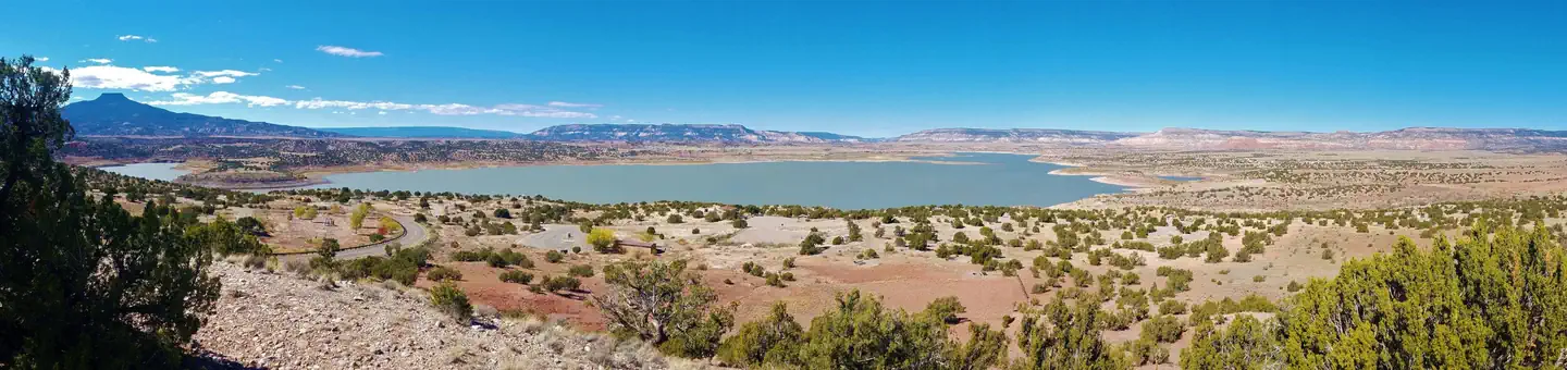 Riana - Abiquiu LakeLake fishing4.5 mi
- SecoHiking4.7 mi
- Eclipse ButtressRock climbing8.4 mi
Source: Roamze catalog (indexable pages within 10 miles, PostGIS distance)
 Chicoma MountainSummit · ~20 min drivePhoto: JerryFriedman, CC BY-SA 3.0 (via Wikimedia Commons)
 Black MesaSummit · ~43 min drivePhoto: User Em-jay-es on en.wikipedia, Public domain (via Wikimedia Commons)
 Santa Fe BaldySummit · ~1h 17m drivePhoto: snowpeak, CC BY 2.0 (via Wikimedia Commons)
 Cerro BonanzaSummit · ~1h 24m drivePhoto: John Phelan, CC BY 4.0 (via Wikimedia Commons)
- Cerro PedernalSummit · ~6 min drive
- Cerro GrandeSummit · ~35 min drive
- Sawyer MesaSummit · ~40 min drive
- Lake Fork MesaSummit · ~42 min drive
- Mesa del RitoSummit · ~43 min drive
- Burnt MesaSummit · ~43 min drive
Best time to visit Pueblo Mesa
Best months: April–June and August–October. Best months have typical highs of 55–85 °F, lows of 30 °F or warmer (32 °F where the station doesn't record snow), at most one snowy day and no more than 12 wet days.
Jan
42° / 18°
5 wet
Feb
47° / 22°
5 wet
Mar
56° / 29°
5 wet
Apr
63° / 35°
5 wet
May
73° / 44°
6 wet
Jun
84° / 53°
6 wet
Jul
88° / 58°
11 wet
Aug
85° / 57°
12 wet
Sep
79° / 50°
8 wet
Oct
67° / 37°
6 wet
Nov
54° / 27°
5 wet
Dec
43° / 19°
5 wet
Typical high / low (°F) and days with rain or snow, 1991–2020. Measured at Abiquiu Dam, NM, 5 mi away at 6,380 ft. The station sits about 1,100 ft lower than this place, so expect it a little cooler here. This station doesn't record snowfall. Source: NOAA NCEI U.S. Climate Normals 1991–2020.

