Elk Interpretive Trail
- 0.5 mi
- round trip
- 59 ft
- climb
- 7,977 ft
- high point
- Out and back
- route
- May–Jul, Sep
- best months
Elk Interpretive Trail is a short, easy hike on Edward Sargent Wildlife Management Area in northern New Mexico, managed by State Fish and Wildlife. The trail is about 0.46 miles long and sits at roughly 7,970 feet. It makes a flat, out-and-back trip, with a high point near 7,977 feet and a low of about 7,957 feet. The climb is gentle, with a steepest grade of about 3% at around 0.3 miles in. Summer is the most comfortable time to go. Typical averages from the nearby Chama weather station show July highs around 80°F and lows near 46°F. Winter is cold, with January highs around 37°F and lows near 7°F. Paddlers can find the Rio Chama about 5 miles away and Willow Creek a little farther at 5.5 miles. Across the line in Colorado, the Chama River and Archuleta Trail both lie about 8 miles off.
Local outfitters
- Pagosa Riverside Campground33 mi away
- Pagosa Pines RV Park35 mi away
Not on Roamze yet. Their page has how to reach them.
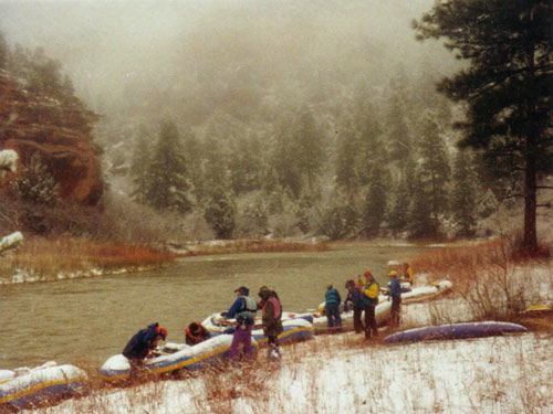 Rio ChamaCanoeingPhoto: Public domain (via Wikimedia Commons)5.1 mi
- Willow CreekCanoeing5.5 mi
- Chama RiverHiking7.8 mi
- Archuleta TrailHiking7.8 mi
- Dispersed CampingCamping8.2 mi
- Cdt - New Mexico SectionHiking8.5 mi
- Continental Divide TrailHiking8.5 mi
- Dixie Creek AccessHiking9 mi
Source: Roamze catalog (indexable pages within 10 miles, PostGIS distance)
 NotchHiking · ~30 min drivePhoto: Michael C. Rael, CC BY 2.0 (via Flickr)
 Hidden Lake TrailHiking · ~33 min drivePhoto: Michael C. Rael, CC BY 2.0 (via Flickr)
- Archuleta TrailHiking · ~13 min drive
- Cdt - New Mexico SectionHiking · ~15 min drive
 Duck LakeHiking · ~30 min drivePhoto: Michael C. Rael, CC BY 2.0 (via Flickr)
 No Name LakeHiking · ~33 min drivePhoto: Michael C. Rael, CC BY 2.0 (via Flickr)
- Blue Creek Winter TrailHiking · ~32 min drive
- Dixie Creek AccessHiking · ~15 min drive
- Chama RiverHiking · ~13 min drive
- RED LAKE CUTOFFHiking · ~25 min drive
Best time to visit Elk Interpretive Trail
Best months: May–July and September. Best months have typical highs of 55–85 °F, lows of 30 °F or warmer (32 °F where the station doesn't record snow), at most one snowy day and no more than 12 wet days.
Jan
37° / 7°
8 wet
Feb
41° / 11°
8 wet
Mar
48° / 18°
7 wet
Apr
56° / 24°
7 wet
May
65° / 32°
7 wet
Jun
77° / 38°
6 wet
Jul
80° / 46°
11 wet
Aug
78° / 46°
13 wet
Sep
72° / 38°
9 wet
Oct
61° / 27°
7 wet
Nov
48° / 17°
6 wet
Dec
38° / 8°
7 wet
Typical high / low (°F) and days with rain or snow, 1991–2020. Measured at Chama, NM, 0.3 mi away at 7,850 ft. This station doesn't record snowfall. Source: NOAA NCEI U.S. Climate Normals 1991–2020.

Map and trail data © OpenStreetMap contributors
