Dispersed Camping in Rio Grande National Forest
- May–Jul, Sep
- best months
Is Dispersed Camping in Rio Grande National Forest open right now?
Closure in the area
There's a closure order in Rio Grande National Forest. It doesn't name Dispersed Camping in Rio Grande National Forest, so check the source for the area it covers.
Closures and dangerous conditions on roads, bridges, and trails from flooding
Agency closure covering Rio Grande National Forest · USFS · Rio Grande National Forest
As of · Source: USFS · Rio Grande National Forest. Agencies don't list every closure — check before you go.
- At 8,799 ftHigh camp: expect cold nights, even in summer
- Conejos Peak Ranger DistrictRio Grande National Forest
Dispersed camping in Rio Grande National Forest's Conejos Peak Ranger District is a network of informal camp sites scattered across the forest. These sites have no services or facilities, so they are suited to visitors who want to camp off the beaten path with little in the way of amenities. The Forest Service manages the land. Summer is the most comfortable time to visit. Typical averages from the nearby Chama, NM weather station show July highs around 80°F with lows near 46°F, though the station sits roughly 950 feet below the camping areas, so temperatures at the sites run cooler. The Archuleta Trail and the Chama River hiking route are each about 0.4 miles away, and the West Fork Rio Chama is about 1.8 miles off. Trujillo Meadows Campground, about 5.7 miles away, is a nearby option for a more developed camping experience.
Local outfitters
- Little Creel RV Park12 mi away
- Wolf Creek Run Resort29 mi away
Not on Roamze yet. Their page has how to reach them.
- Archuleta TrailHiking0.4 mi
- Chama RiverHiking0.4 mi
- West Fork Rio ChamaHiking1.8 mi
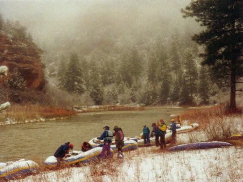 Rio ChamaCanoeingPhoto: Public domain (via Wikimedia Commons)3.2 mi
- HUGHES TRAILHiking3.3 mi
- Trujillo Meadows Boating SiteLake fishing5.3 mi
- Trujillo Meadows CampgroundCamping5.7 mi
- Elk CreekCanoeing8.2 mi
Source: Roamze catalog (indexable pages within 10 miles, PostGIS distance)
- MogoteCamping · ~30 min drive
- Lake Fork(rio Grande Natl ForeCamping · ~32 min drive
- Blanco River Group CampgroundCamping · ~34 min drive
 Blanco RiverCamping · ~40 min drivePhoto: Dicklyon, CC BY-SA 4.0 (via Wikimedia Commons)
- Aspen Glade (Rio Grande National Forest, CO)Camping · ~27 min drive
- Dispersed Camping near Dixie Creek Access (Carson National Forest)Camping · ~14 min drive
- Rio Chama RV ParkCamping · ~15 min drive
- Spectacle Lake CampgroundCamping · ~19 min drive
- Twin RiversCamping · ~19 min drive
- Conejos CampgroundCamping · ~19 min drive
Also worth it near here
Best time to visit Dispersed Camping in Rio Grande National Forest
Best months: May–July and September. Best months have typical highs of 55–85 °F, lows of 30 °F or warmer (32 °F where the station doesn't record snow), at most one snowy day and no more than 12 wet days.
Jan
37° / 7°
8 wet
Feb
41° / 11°
8 wet
Mar
48° / 18°
7 wet
Apr
56° / 24°
7 wet
May
65° / 32°
7 wet
Jun
77° / 38°
6 wet
Jul
80° / 46°
11 wet
Aug
78° / 46°
13 wet
Sep
72° / 38°
9 wet
Oct
61° / 27°
7 wet
Nov
48° / 17°
6 wet
Dec
38° / 8°
7 wet
Typical high / low (°F) and days with rain or snow, 1991–2020. Measured at Chama, NM, 8.4 mi away at 7,850 ft. The station sits about 900 ft lower than this place, so expect it a little cooler here. This station doesn't record snowfall. Source: NOAA NCEI U.S. Climate Normals 1991–2020.


Map and trail data © OpenStreetMap contributors
